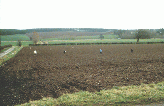
Fieldwalking the cropmark landscape on the Sherwood Sandstone of Nottinghamshire
Daryl Garton, 2009. https://doi.org/10.5284/1000007. How to cite using this DOI
Data copyright © Trent and Peak Archaeology, English Heritage unless otherwise stated
This work is licensed under the ADS Terms of Use and Access.
Primary contact
Daryl
Garton
12 Collington St
Beeston
Nottingham
NG9 1FJ
UK
Tel: 0115 07870136086
Resource identifiers
- ADS Collection: 934
- DOI:https://doi.org/10.5284/1000007
- How to cite using this DOI
Introduction

Cropmarks on the Sherwood Sandstone of Notts, discovered and published by Derrick Riley, are analyzed in combination with artefacts recovered through a programme of fieldwalking. A coherent landscape of fields, mostly laid out in a pattern resembling brickwork, is seen to be integrated with small enclosures, presumed farmsteads, situated at approximately 1km apart where the cropmarks are best represented. Fieldwalking covered 491 hectares in 97 areas, including 76 of the enclosures plus a sample of related fields. It was undertaken in transects of 10m width, plotting all artefacts individually. The distributions of Romano-British artefacts are assessed in relation to the morphology of the cropmarks. Most numerous are potsherds ranging from diffuse scatters to well-defined clusters, mostly from the sites of the enclosures. Other finds include metalwork (coins, lead-weights/spindle-whorls, fragmentary brooches), quernstones and a single bead. Fire-cracked pebbles seem to coincide with some enclosures.
In addition, the distribution of lithics and medieval potsherds recovered in the same fieldwalking exercise, was examined and commented upon.
This archive holds the full datasets produced by this project, and is a companion to the reports published in 2007 and 2008.
Garton, D., with Nailor, V. 2007. 'Flintwork and medieval pottery from fieldwalking over cropmarks on the Sherwood Sandstone of north Nottinghamshire' Transactions of the Thoroton Society Nottinghamshire, 111, 15-32.
Also see - Jacobi, R., Garton, D. and Brown, J. 2001. 'Field-walking and the Later Upper Palaeolithic of Nottinghamshire', Transactions of the Thoroton Society Nottinghamshire, 105, 17-22.
Garton, D, with Leary, R.S., Cowgill, J., Firman, R. Wright. L. 2008. 'The Romano-British landscape of the Sherwood Sandstone of Nottinghamshire: fieldwalking the brickwork-plan field-systems', Transactions of the Thoroton Society Nottinghamshire 112, 15-110.


