
Archaeological Excavation at St. Mary's Gate / Warser Gate, Nottingham
Birmingham Archaeology, 2017. https://doi.org/10.5284/1045782. How to cite using this DOI
Data copyright © University of Birmingham unless otherwise stated
This work is licensed under the ADS Terms of Use and Access.

Primary contact
Historic England
1 Waterhouse Square
138-142 Holborn
London
EC1N 2ST
UK
Tel: 01793 414700
Fax: 01793 414707
Resource identifiers
- ADS Collection: 2891
- DOI:https://doi.org/10.5284/1045782
- How to cite using this DOI


Introduction
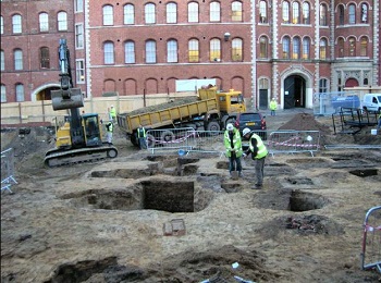
In October 2005 Birmingham Archaeology were commissioned by John Samuels Archaeological Consultants on behalf of Natrass Giles, to excavate two evaluation trenches on land occupying an area to the west of St. Mary’s Gate and to the south of Warser Gate, central Nottingham (NGR SK 57593980). The site lies within the northern extent of the former late Saxon Borough, with the potential for medieval deposits including possible caves. Since buildings (which were due to be demolished) still remained on the site, an area of hard standing, in the northeastern corner of the development area was evaluated.
The evaluation trenches identified a well, backfilled in the 17th century which contained residual medieval ceramics. This feature survived within an island of natural sandstone, surrounded by post-medieval building foundations and cellars, which had largely truncated evidence for Saxon or medieval occupation. Given the potential for the survival of archaeological deposits below the building which was due to be demolished (and not available for evaluation), the area was subject to a watching brief after demolition. As the watching brief progressed extensive deposits dating to the medieval period were uncovered. This resulted in a revised strategy for excavation and salvage recording from November 2005 to May 2006.
The excavation revealed a network of caves cut into the natural sandstone across most of the site. Some of the caves were recorded at levels of between 3.5 and 4m below the modern ground level. As the only backfill comprised post-medieval building rubble a date for the caves was unclear, however one cave in the southwestern corner of the site contained medieval pottery, animal bone and tile.
The medieval features were mostly located within the western and central-southern parts of the site. These comprised of a complex of inter-cutting pits with several deep, vertically sided, sub-rectangular and sub-circular pits cut into the natural bedrock. Of particular note were two grain-drying ovens and the remains of a rectangular (possibly timber) structure within the southwestern quarter of the site.
Along the eastern and northern boundaries of the site most of the medieval deposits at street level had been truncated by post-medieval buildings, related to the former street frontages. Deep building foundations and attendant cellaring were observed to a depth in excess of 3m below ground level. The footings and cellars of post-medieval buildings were recorded in plan, with the remaining features such as wells, excavated to a safe depth.
