
Tutbury Castle, Staffordshire. A Programme of Archaeological Work 2006
Birmingham Archaeology, 2017. https://doi.org/10.5284/1046304. How to cite using this DOI
Data copyright © University of Birmingham unless otherwise stated
This work is licensed under the ADS Terms of Use and Access.

Primary contact
Historic England
1 Waterhouse Square
138-142 Holborn
London
EC1N 2ST
UK
Tel: 01793 414700
Fax: 01793 414707
Resource identifiers
- ADS Collection: 2894
- DOI:https://doi.org/10.5284/1046304
- How to cite using this DOI


Introduction
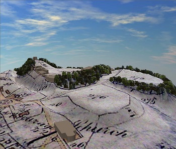
A third season of archaeological work was carried out at Tutbury Castle, Staffordshire as part of a wider research project in collaboration with the British Museum and Tutbury Castle. The survey work included a resistivity survey of the outer bailey, GPR surveys of the middle and outer baileys and completion of the topographical survey of the castle hill and its earthworks. In addition, there were several excavation foci, Area 1 begin located to the west of the chapel, Area 2 between the North and South towers, and Area 3 on the motte.
An 8m square area was opened to the west of the chapel and selectively excavated to a maximum depth of 1.06m below ground level. The excavation revealed a sequence of silty clay layers, making up what appeared to be, in its later stages, an open area. Roughly in the centre of the excavated area, built on a base of tightly packed cobbles, was a low rectangular structure constructed of two courses of coursed and dressed masonry, apparently reused, with a chamber around the upper edge. The general appearance of the structure was similar to that of a sepulchral raised slab, but the feature is tentatively interpreted here as a plinth for a monument of some kind. Other aspects of interest included a possible hearth and surrounding burnt area, and, just within the northwest corner of the excavated area, a rubble foundation, probably a plinth for a timber-framed building. Most of the features are likely to be of post-medieval date.
Two trenches were excavated in Area 2, one to the north of the South Tower (Area 2a), and one to the southwest of the North Tower (Area 2b). Area 2a was a re-opening of the trench partially excavated in this area in 2005, which had uncovered the top of a sequence of waterlogged layers (Martin-Bacon and Kincey 2006); work during the 2006 season involved the excavation of those layers. The natural subsoil was reached at a depth of approximately 2m, and at the northwest end of the trench, towards the bailey, the edge of a large feature was discovered which was tentatively identified as a ditch. This opens the way for a reinterpretation of the character of the early castle. The ditch was filled, and the adjacent berm covered with organic material including large amounts of birch bark and wood, containing a quantity of pieces of leather, both primary and secondary off cuts and shoe fragments, all of which appeared to have been deposited during the late 11thto 12th century. This whole collection of material suggested that both tanning and manufacture of leather artefacts had been carried on at the site at an early period and that the debris from these processes had been deposited within the inner ward.
The purpose of excavating in Area 2b, which lay immediately southwest of the 2005 excavation (Martin-Bacon and Kincey 2006) was to uncover more of the building revealed in the 2004 and 2005 seasons and tentatively identified as the lodging that Mary Queen of Scots was accommodated in during her incarceration here in the 1580s. More of the west wall of this building was recorded, which was progressively less well-preserved as it extended southwards, eventually disappearing before being picked up again in a test pit beyond the main trench. Towards the northern end of the building, part of a western projection was excavated, which was interpreted as a porch. The foundation stones of this former timber-framed building sat on a red clay layer containing 13th-century pottery, and although the date of the building itself is uncertain, a mid-17th-century destruction layer that sealed the walls seems to provide a terminus ante quem.
Two trenches were opened in Area 3, one on the north side of the motte (3a), immediately northeast of the 2005 trench, and one on the southeast side (3b). Area 3a contained a mass of stone which appeared to represent the conjunction of two sections of walling forming the corner of an ashlar-faced structure, apparently the perimeter wall around the top of the motte, that appears on 16th-century drawings. Much of the rubble core immediately behind these facing stones had been robbed, but in those areas that had survived intact, the top surface of the wall survived as a flat stone pavement, which seemed to represent a wall walk or allure. No significant structures or features were discovered in Area 3b.
