
Wellhead Lane, Perry Barr, Birmingham: Archaeological Excavation
Birmingham Archaeology, 2017. https://doi.org/10.5284/1046263. How to cite using this DOI
Data copyright © University of Birmingham unless otherwise stated
This work is licensed under the ADS Terms of Use and Access.

Primary contact
Historic England
1 Waterhouse Square
138-142 Holborn
London
EC1N 2ST
UK
Tel: 01793 414700
Fax: 01793 414707
Resource identifiers
- ADS Collection: 2929
- DOI:https://doi.org/10.5284/1046263
- How to cite using this DOI


Introduction
A proposed development at Wellhead Lane Sports ground in Perry Barr, Birmingham (centred on NGR SP 0727 9130) was likely to affect below ground archaeological remains. On instruction from Birmingham City Council, Birmingham Archaeology undertook an archaeological evaluation and subsequent excavation of the site between March and June 2008.
The site was considered to be of high archaeological potential as the western side of the development lay within the projected route of Icknield Street, a Roman Road which ran through Birmingham and possibly bisected the area.
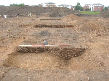
The evaluation took place in March 2008 and involved the excavation of seven 50m long trenches across the site in order to assess the archaeological potential. Two of the trenches were positioned across the projected route of the Roman Road. A further five trenches were opened up to locate any archaeological features associated with Roman occupation or evidence of later periods of domestic or industrial activity. The two trenches positioned across the western side of the site successfully highlighted a northeast-southwest aligned ditch at the putative location of Icknield Street. There was no sign of any built road surface associated with the ditch. One of the evaluation trenches unearthed a second ditch, this being orientated east-west and located close to the eastern limit of the site.
The main aims of the excavation were to establish the date and extent of the east-west aligned ditch and to investigate the possible presence of any Roman roadside features across the eastern area of the proposed development site.
The excavation successfully proved that the east-west aligned ditch, which had been recut, was dated to the post-medieval period. The original and recut ditch apparently represented the remains of a field boundary dating to the 19th century. The excavation of a shallow gully, running parallel with the main ditches and a narrow north-south aligned ditch which respected them, served to illustrate that all the surviving archaeological remains were related to 19th century field systems.
Each of the archaeological features was sealed by a layer signifying a former topsoil. The layer was overlain by a deep levelling layer comprised of modern waste, notably vast quantities of broken and almost complete glass bottles from local breweries dating to the mid 20th century. The depth of the layer increased dramatically towards the east edge of the area as the level of the site had been reduced and subsequently built up during the 20th century prior to the development of the sports facilities.
