
Land adjacent to All Saints Way, West Bromwich, Sandwell. Archaeological Evaluation
Birmingham Archaeology, 2017. https://doi.org/10.5284/1046299. How to cite using this DOI
Data copyright © University of Birmingham unless otherwise stated
This work is licensed under the ADS Terms of Use and Access.

Primary contact
Historic England
1 Waterhouse Square
138-142 Holborn
London
EC1N 2ST
UK
Tel: 01793 414700
Fax: 01793 414707
Resource identifiers
- ADS Collection: 2952
- DOI:https://doi.org/10.5284/1046299
- How to cite using this DOI


Introduction
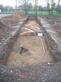
An archaeological evaluation was undertaken by Birmingham Archaeology, during February 2010, on land adjacent to All Saints Way, West Bromwich (centred on NGR SP 004 916). The work was commissioned by Halcrow Group Ltd (archaeological consultants) on behalf of Stoford Developments Limited. The evaluation was carried out after demolition of standing buildings on the site and ahead of a proposed mixed use development which has been granted reserved matters planning permission. A total of twenty-six trial-trenches were excavated across the site.
Evidence of possible 17th-18th-century activity on the site was suggested by the presence of residual finds in later contexts. It is possible that some or all of these finds are derived from material imported into the site from elsewhere. Several features possibly dating to the 18th century were present at the central part of the site associated with agricultural or perhaps isolated settlement activity on the site at this time, although it is possible that the single sherds of pottery from these features may be residual. No evidence of any structures predating the 19th century was recorded. Evidence of 18th-century buildings, the presence of which was suggested by the highly schematic 1775 Yates’s Map of Staffordshire and the windmill suggested by Wood’s 1837 Plan of West Bromwich was not located during the evaluation.
The evidence from one trench adjacent to Sandwell Road demonstrated that the foundations and lower courses of external and internal brick walls of the early 19th-century Providence Chapel survive in a reasonably good state of preservation. A tiled floor surface survived within a front porch entrance abutting the northwest front of the Chapel and evidence of other possible floors survived as spreads of mortar. The chapel would appear to have been 11m wide, which correlates with the cartographic evidence showing a structure approximately 10m wide and 17m long, with a northwest front with two external projections, which are probably entrance porches. There was also some evidence of pre-chapel activity in the form of possible pits, which may be associated with earlier temporary chapel buildings or be related to the construction of the chapel.
A brick alleyway surface between the Chapel and the probable chapel graveyard enclosure wall was recorded. The probable Chapel graveyard wall was also recorded in several trenches, together with one grave cut, containing remains of a coffin, and at least seven other probable grave cuts within the graveyard. The graveyard appears to conform exactly to the area shown on the 1890 OS map, where it is depicted as measuring 9m x 46m. It is difficult to estimate the total number of individuals interred, given the lack of documentary records and the difficulty of extrapolating the total number of individuals from the remains encountered in the evaluation trenches, but 100 is probably the minimum estimate. The graveyard could have been in use for as long as the chapel, which was built in 1810 and could have been in use until, perhaps, the early to mid-20th-century.
Other brick structures recorded during the evaluation may relate to 19th- and 20th-century buildings which appear on OS maps. These were a row of terraced houses fronting onto Sandwell Road, depicted on OS maps between 1890 and 1960, adjacent to the Providence Chapel, and what may be an industrial building shown on the 1890 OS map. The building appears to be within the same yard as a corn mill and was probably associated with it.
Features recorded at the northern part of the site were associated with houses and gardens fronting onto Hargate Lane, first depicted on the 1890 OS map and demolished after 1960. Structures associated with terraced houses fronting onto Mill Street and a large rectangular brick building, probably with an industrial function were also revealed and was first depicted on the 1904 OS map and was probably demolished between 1960 and 1977.
Brick walls and yard surfaces recorded at the eastern part of the site probably relate to the Corporation stables, shown on the 1890 OS map and on later OS maps. Brick walls, cellars and shallow pits revealed at the southern part of the site are associated with houses and rear gardens, formerly fronting onto Bratt Street, first depicted on the 1890 OS map.
Elsewhere two undated gullies at the east part of the site may be associated with drainage. Other undated features include a single square pit, an undated sub-circular pit and five postholes, some of which may be of post-medieval date.
