
Banbury Town Centre Redevelopment Project. A Programme of Archaeological Investigations
Birmingham Archaeology, 2017. https://doi.org/10.5284/1045780. How to cite using this DOI
Data copyright © University of Birmingham unless otherwise stated
This work is licensed under the ADS Terms of Use and Access.

Primary contact
Historic England
1 Waterhouse Square
138-142 Holborn
London
EC1N 2ST
UK
Tel: 01793 414700
Fax: 01793 414707
Resource identifiers
- ADS Collection: 2866
- DOI:https://doi.org/10.5284/1045780
- How to cite using this DOI


Introduction
Archaeological investigations were undertaken by Birmingham University Field Archaeology Unit (BUFAU) on areas affected by the Banbury Town Centre Redevelopment. The work was commissioned by Banbury Shopping Centre Limited and PillarCaisse and was undertaken between 1989 and 1999. It was based on an archaeological project design prepared by Ferris and Litherland (1989) that has been updated on a regular basis, and considers the work undertaken by Fasham (1973, 1983) and Rodwell (1976).
Three main zones of archaeology were identified within the development area:
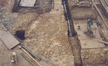
Zone 1 The Castle Precinct
The Castle originally occupied a slight knoll to the north of the market place, the site was partially built over in the 1970s by the Castle Shopping Centre, Castle Street and a car park to the north.
Zone 2 The Bridge Street/Mill Lane Urban Landscape
The Bridge Street/Mill Lane Zone comprised a triangular-shaped street block located on the eastern fringes of Banbury market.
Zone 3 The River and Canalside Waterfronts
The Canal and Riverside zone comprised a roughly triangular-shaped unit of 0.5ha of land bounded by the canal to the east, Mill Lane to the south, Castle Street to the west and the bridge over the canal to Spiceball Park to the north. The protected Scheduled Ancient Monument of Tooley's Boatyard (SAM 172) occupies the north of Zone 3.
