
The evolution of Rome's maritime facade: archaeology and geomorphology at Castelporziano
Helen Rendell, Amanda Claridge, 2010. https://doi.org/10.5284/1000127. How to cite using this DOI
Data copyright © Prof Amanda Claridge, Prof Helen Rendell unless otherwise stated
This work is licensed under the ADS Terms of Use and Access.

Primary contact
School of Humanities, Royal Holloway
University of London
Egham
Surrey
TW20 0EX
Resource identifiers
- ADS Collection: 968
- DOI:https://doi.org/10.5284/1000127
- How to cite using this DOI


Overview
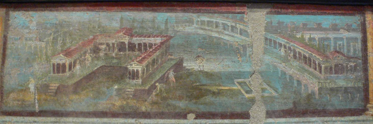
A Roman maritime villa-landscape in a wallpainting from Pompeii (Naples Museum).
Project Summary
This project investigated the evolution of the Laurentine Shore, integrating archaeological and multi-variate geographical analysis to achieve a holistic interpretation of the relationship between the built and natural environments. Working principally within the confines of the modern Castelporziano Estate whose sea front. extends 7-13 km south-east of the Tibermouth at Ostia, the project focused on the period between 100BC and AD500 and the development of the shore as a 'maritime façade' of luxury villas belonging to the Roman emperors and their court. A programme of archaeological survey and excavation in the area, started in 1983 and still ongoing, has identified some 27 'sites', represented by a line of upstanding remains and scatters of building debris overgrown by dense forest some 200-400 m inland from the modern beach. This earlier fieldwork included a particular study of a small town Vicus Augustanus, located in the midst of the villas, and the project was designed to answer the many research questions which had arisen in the course of this work:
- What is the significance of the differing locations, sizes, construction and phasing of Roman sites along the Laurentine shore?
- How does the supply of building materials, as attested by the evidence from brickstamps, compare with Ostia, what social patterning does the brickstamp evidence reveal?
- Was the Roman land/sea interface more articulated than the present one and were there any changes during the period?
- Were there any natural or artificial harbours?
- What evidence is there for changing patterns of land drainage and vegetation and for the exploitation of coastal resources, especially oysters and fish?
- To what extent did the architecture of the maritime villas exploit existing terrain, including dune ridges and interdune lagoons and swamps?
- Where was the forest in the Roman period and what did it consist of?
- Is the timing of the abandonment of settlement sites connected with the phases of dune formation?
Aims
- To understand the chronology and pace of coastal change on the Laurentine Shore
- To understand the relationship between those changes and the pattern and character of Roman settlement
Objectives
- To define a broad chronological framework for the advance of the Tyrrhenian coast south of the Tiber from c. 10000BC to AD2000
- To analyse the palaeoenvironmental changes associated with that advance
- To investigate the relationships between the geomorphology and the pattern of human settlement in the coastal zone during the Roman period (100BC-AD500)
Methods
- Development of suitable methodologies for both topographical and geophysical (magnetometer) survey in the local conditions (i.e. dense forest cover)
- Integration of the topographic modelling with multi-variate geographical analysis
- Determination of a precise height value for Roman sea level on the site
- Determination of 50 luminescence dates along the lengths of the dune ridges
- Recovery of cores from dune slacks containing plant macrofossils and other proxies.
- Creation of a GIS database
Project Archive
The project has involved not only new topographical, geophysical, geomorphological and environmental fieldwork in 2006-9 and the creation of a GIS but also the digitisation of all earlier archaeological site records (graphic, photographic and written) from 1984 to 2005. For the time being only those records relating to work carried out by the British teams have been processed and are being made available here.
The ADS archive is divided into eight sections:
Section 1 Project Context and Guide to Site Records.
This gives you a more detailed history of fieldwork in the study area and the context in which the current programme of research has developed, the methodologies employed, a year-by-year journal of the work carried out by the British teams, some team photos, a series of maps indicating the areas studied each year, and a bibliography to 2009.
Here you can find also a guide-index to the site-coding system, and explanations of the site compass and site datum (neither of which is conventional).
Section 2 Archaeological survey and excavation datasets (1984-2009).
These datasets are of four kinds: Graphics (plans, sections and other drawings), Levels (spot levels for plans and sections), Photographs (scanned 35 mm colour slides and new digital photography) and Context Recording Sheets. A searchable spreadsheet of each complete dataset is provided in the first subsection. The following five subsections contain the four datasets grouped according to the site/area they relate to: Vicus (site CPV), West of Vicus (sites B1-B3), Fish Farms (sites D5-D6), Sea Wall (site F2), and Other Sites (Villa of the Discobolus G2 and assorted small test trenches elsewhere).
Section 3 Topographical Surveys (2003-2009)
This contains progress reports by Jari Pakkanen, Peter Rose and James Andrews, and data relating to the Total Station surveys in two areas: one around the Vicus, the second around the Fish Farms, with images of the two Digital Elevation Models (DEM).
Section 4 Geophysical Surveys (2006-2009)
This contains reports and analyses by Tim Evans and the data relating to the geophysical surveys at the Vicus and the Fish Farms.
Section 5 Geomorphological Surveys (2006-2009)
Compiled by Andy Bicket. here you can find base maps, results for luminescence dating, sampling cores, sedimentology, and also the site GIS.
Section 6 Environmental Survey data (2006-2009)
Compiled by Fiona Brown, Andy Bicket and Helen Rendell. This contains the results and analyses of bulk samples from excavations at the Vicus and the Fish-farms, the radio-carbon dates obtained from cores, and the palaeo-environmental analyses.
Section 7 Archaeo-zoological data (1984-2002)
This contains the preliminary report and analytical tables of excavated data from 1984-2002 by Michael MacKinnon, University of Winnipeg. A second report covering the period 2003-2009 is in preparation.
Section 8 Artefact assemblages (1984-2009)
This contains two assemblages of particular chronological value in searchable datasets of photos and spreadsheets. Brickstamps, by Janet DeLaine and Katia Schorle, School of Archaeology University of Oxford, and Coins, by Cathy King, Heberden Coin Room, Ashmolean Museum, Oxford.
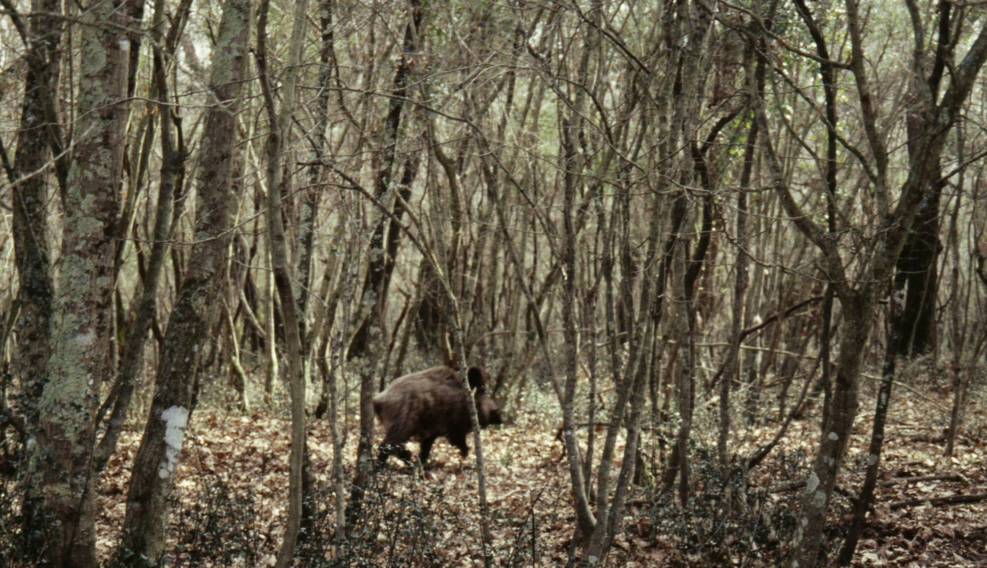
1. Wild boar in the forest at Castelporziano.
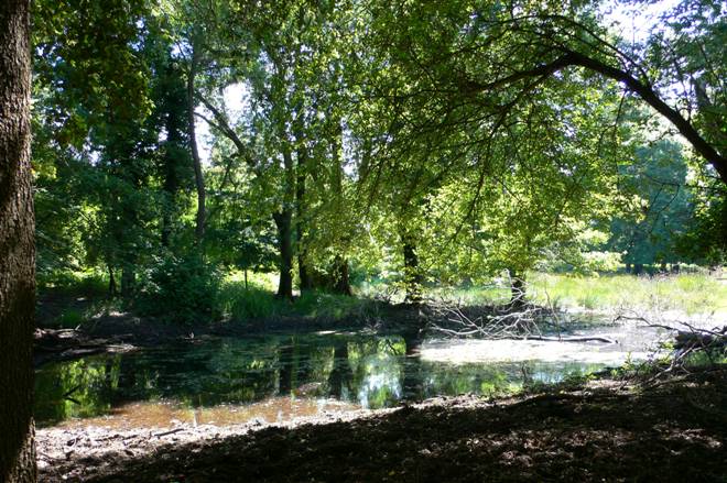
2. Coastal marshland in Castelporziano.
