Extensive Urban Survey - Cheshire

Jo Clark, Vince Devine, Mike Shaw, Malcolm Reid, 2013. https://doi.org/10.5284/1022570. How to cite using this DOI

Digital Object Identifiers

Digital Object Identifiers (DOIs) are persistent identifiers which can be used to consistently and accurately reference digital objects and/or content. The DOIs provide a way for the ADS resources to be cited in a similar fashion to traditional scholarly materials. More information on DOIs at the ADS can be found on our help page.

Citing this DOI

The updated Crossref DOI Display guidelines recommend that DOIs should be displayed in the following format:

https://doi.org/10.5284/1022570
Sample Citation for this DOI

Jo Clark, Vince Devine, Mike Shaw, Malcolm Reid (2013) Extensive Urban Survey - Cheshire [data-set]. York: Archaeology Data Service [distributor] https://doi.org/10.5284/1022570

Data copyright © Cheshire Archaeology Planning Advisory Service, English Heritage unless otherwise stated

This work is licensed under the ADS Terms of Use and Access.
Creative Commons License


English Heritage logo

Primary contact

Robert Edwards
Historic Environment Records Officer
Cheshire Archaeology Planning Advisory Service
The Forum
Chester
Cheshire

Send e-mail enquiry

Resource identifiers

Digital Object Identifiers

Digital Object Identifiers (DOIs) are persistent identifiers which can be used to consistently and accurately reference digital objects and/or content. The DOIs provide a way for the ADS resources to be cited in a similar fashion to traditional scholarly materials. More information on DOIs at the ADS can be found on our help page.

Citing this DOI

The updated Crossref DOI Display guidelines recommend that DOIs should be displayed in the following format:

https://doi.org/10.5284/1022570
Sample Citation for this DOI

Jo Clark, Vince Devine, Mike Shaw, Malcolm Reid (2013) Extensive Urban Survey - Cheshire [data-set]. York: Archaeology Data Service [distributor] https://doi.org/10.5284/1022570

Cheshire Archaeology Planning Advisory Service logo

Introduction

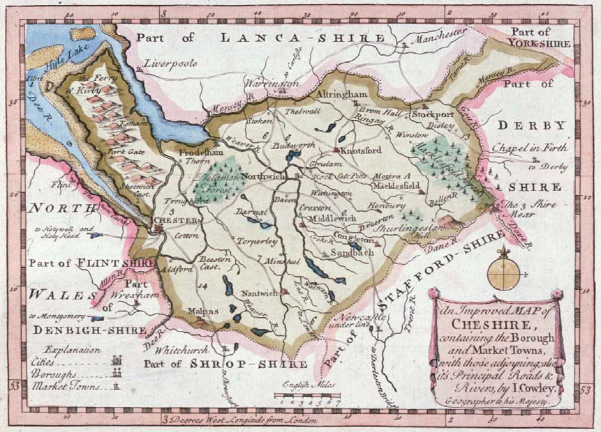
J Cowley, 1744 An Improved Map of Cheshire-Front page of Cheshire Historic Towns Survey reports

The Historic Environment Team of Cheshire County Council, in partnership with English Heritage, carried out a survey of the archaeological potential and historic development of 37 historic towns of Cheshire, Halton and Warrington.

The survey was divided into three phases - data gathering, assessment and strategy. During data gathering a wide range of sources were examined, collated and entered on to the Cheshire Historic Environment Record Database. This data was assessed and used to write a component based summary of the history and archaeology of each town.

Finally a strategy for the protection of the historic features of each town was devised, identifying, where possible, an Area of Archaeological Potential based on the assessment. The strategy reports are intended to act as Supplementary Planning Documents to the archaeological policies in the Local Development Framework. They include a defined Area of Archaeological Potential consisting of one or more Archaeological Character Zones.


ADS logo
Data Org logo
University of York logo