
Land At Bumpers Farm, Ilmer, Buckinghamshire
Cotswold Archaeology, 2015. https://doi.org/10.5284/1031210. How to cite using this DOI
Data copyright © Cotswold Archaeology unless otherwise stated
This work is licensed under the ADS Terms of Use and Access.

Primary contact
Hazel
O'Neill
Cotswold Archaeology
Building 11
Kemble Enterprise Park
Cirencester
GL7 6BQ
UK
Tel: 01285 772624
Resource identifiers
- ADS Collection: 1889
- DOI:https://doi.org/10.5284/1031210
- How to cite using this DOI
Introduction
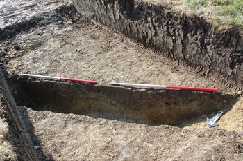
In August 2014, Cotswold Archaeology carried out an archaeological evaluation at Bumpers Farm, Ilmer, Buckinghamshire. Nineteen trenches were excavated. A previous geophysical survey detected enclosures and associated features at the south-eastern site boundary and lower-density anomalies elsewhere. The evaluation recorded a series of ditches and pits, the majority of which were concentrated within one small area towards the south-eastern site boundary. There were also limited outlying features within the north-eastern part of the site. The evaluation recovered pottery and animal bone assemblages typical of late Roman domestic refuse, suggesting that the enclosures within the south-eastern part of the site represent a late Roman farmstead. It is likely that the limited features in the north-eastern part of the site are outlying agricultural features associated with the Roman farmstead. The evaluation indicated that the pattern of land use suggested by the geophysical survey is correct, although within the areas of archaeological activity the correspondence between features and anomalies was not always entirely precise. The Roman farmstead lies on high ground within the south-eastern part of the site. The evaluation and geophysical survey suggest that this high ground was the focus of settlement, and the lower-lying areas of the site were utilised for agriculture/grazing. Some trenches featured disuse spreads sealing the archaeological features. The majority of these spreads were within the area of the Roman farmstead, although the trench to the north of the farmstead also contained a disuse spread. There was no evidence for significant activity pre- or post-dating the Roman period.
