RAF Desborough Airfield, Northampton. Geophysical Survey. (OASIS id: abherita1-216618)

AB Heritage, 2017. https://doi.org/10.5284/1042737. How to cite using this DOI

Digital Object Identifiers

Digital Object Identifiers (DOIs) are persistent identifiers which can be used to consistently and accurately reference digital objects and/or content. The DOIs provide a way for the ADS resources to be cited in a similar fashion to traditional scholarly materials. More information on DOIs at the ADS can be found on our help page.

Citing this DOI

The updated Crossref DOI Display guidelines recommend that DOIs should be displayed in the following format:

https://doi.org/10.5284/1042737
Sample Citation for this DOI

AB Heritage (2017) RAF Desborough Airfield, Northampton. Geophysical Survey. (OASIS id: abherita1-216618) [data-set]. York: Archaeology Data Service [distributor] https://doi.org/10.5284/1042737

Data copyright © AB Heritage unless otherwise stated

This work is licensed under the ADS Terms of Use and Access.
Creative Commons License


AB Heritage logo

Primary contact

AB Heritage
Jarrow Business Centre
Polling Mill Road
Jarrow
Tyne & Wear
NE32 3DT

Send e-mail enquiry

Resource identifiers

Digital Object Identifiers

Digital Object Identifiers (DOIs) are persistent identifiers which can be used to consistently and accurately reference digital objects and/or content. The DOIs provide a way for the ADS resources to be cited in a similar fashion to traditional scholarly materials. More information on DOIs at the ADS can be found on our help page.

Citing this DOI

The updated Crossref DOI Display guidelines recommend that DOIs should be displayed in the following format:

https://doi.org/10.5284/1042737
Sample Citation for this DOI

AB Heritage (2017) RAF Desborough Airfield, Northampton. Geophysical Survey. (OASIS id: abherita1-216618) [data-set]. York: Archaeology Data Service [distributor] https://doi.org/10.5284/1042737

Introduction

RAF Desborough Airfield, Northampton. Geophysical Survey. (OASIS id: abherita1-216618)

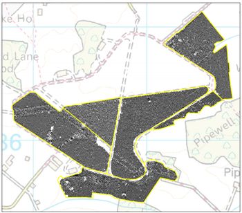
AB Heritage Ltd was commissioned to undertake a Geophysical (magnetometer) survey at the former RAF Desborough Airfield, Kettering, Northamptonshire (centred on NGR: SP 81716 86097), in support of a planning application for a proposed solar park site. The area surveyed totalled 107 hectares, covering six fields.

The aims of this geophysical survey were to:

  • Identify any geophysical anomalies of possible archaeological origin within the specified survey area;
  • Accurately locate these anomalies and present the findings in map form; and
  • Provide recommendations for any further archaeological work(s) necessary to contribute to the mitigation of the impacts of proposed development on these potential features.

The archive combines six text files of geophysical data that has been collected using a Bartington Gradiometer 601 over a proposed solar array area at RAF Desborough airfield, each file represents a field within the survey area. A geo-referenced image of the processed data from the site is also available.


ADS logo
Data Org logo
University of York logo