
Devon Historic Landscape Characterisation (HLC)
Sam Turner, 2015. https://doi.org/10.5284/1032952. How to cite using this DOI
Data copyright © Historic England, Dartmoor National Park Authority, Tamar Valley AONB, Devon County Council Historic Environment Team unless otherwise stated
This work is licensed under the ADS Terms of Use and Access.

Primary contact
Devon County Council Historic Environment Team
County Hall
Topsham Road
Exeter
Devon
EX2 4QD
Resource identifiers
- ADS Collection: 2090
- DOI:https://doi.org/10.5284/1032952
- How to cite using this DOI

Overview
The main products of the project comprise a number of GIS map layers and a report. The map layers cover all of Devon, including the Unitary Authorities of Plymouth and Torbay, but excluding the part of Devon within Exmoor National Park. (A Somerset and Exmoor National Park Historic Landscape Characterisation was completed in 2001.)
The Devon HLC covers well over 6000km2. Data relating to each individual block of a specific landscape character 'type' was recorded. The project used three principle sources to inform the character mapping:
- Ordnance Survey Landline (modern map, available as an electronic vector dataset)
- Ordnance Survey 1st edition 6inch or 25inch maps (available as a raster dataset)
- getmapping.com's vertical colour air photography (raster dataset)
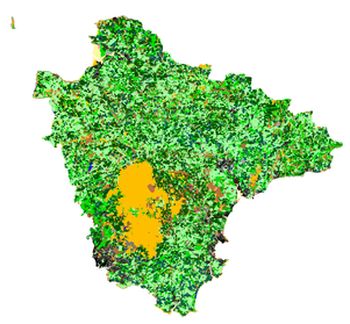
The HLC mapping was undertaken at a scale of 1:10,000 for use at 1:25,000 or smaller. The smallest individual polygons mapped were 1ha., so the project provides an extremely detailed model of Devon's historic landscape character.
In order to reflect changes in historic character through time, the project database was designed to allow a sequence of character types to be recorded for each polygon. This feature allows the user of the HLC to model modern, post-medieval, and earlier landscape character and land-use at any scale.
The final raw HLC spatial data ('rawhlc.shp') presents polygons for the whole of the county. Attached to each polygon in the shapefile is all the data relating to that polygon from the project database.
There are also a number of views of the data provided as shapefiles:
- HLC of the Modern Landscape. The shapefile 'modern_hlc.shp' presents a characterisation of the whole modern landscape of Devon. The landscape has been divided into a number of character types.
- HLC of the Post-Medieval Landscape. The shapefile 'Postmedieval_hlc.shp' presents a characterisation of the whole landscape of Devon in the late C19th based on the 1st edition OS maps. The landscape has been divided into a number of character types.
- Orchards. The shapefile 'lost_orchards.shp' showing the distribution of orchards in Devon in the late C19th (both still surviving and destroyed in the C20th) and the distribution of modern and historic (i.e. late C19th) areas of dense settlement. It shows clearly how great the loss in orchards has been: around 85% of all orchards depicted on the 1st ed OS map have been lost.
- Loss of field boundaries. The shapefile 'percent_fld_loss_settlements.shp' represents the difference in the number of fields in 1890 compared to the present day (areas of modern settlement are also included in the polygon). This correlates strongly to the degree of field boundary loss, since the commonest reason for a reduction in the number of fields between the late C19th and late C20th is the destruction of field boundaries to create bigger fields. The map clearly reveals very substantial losses in many parts of the county. These have occurred not only in areas where such changes might be most expected, e.g. regions with a strong tradition of intensive arable like the South Hams and the central Exe valley, but also in much of north Devon including areas like Hartland, and parts of the Blackdown Hills on the Devon/Somerset boundary.
