
Defence of Britain Archive
Council for British Archaeology, 2002. (updated 2006) https://doi.org/10.5284/1000327. How to cite using this DOI
Data copyright © Council for British Archaeology unless otherwise stated
This work is licensed under the ADS Terms of Use and Access.

Primary contact
Council for British Archaeology
92 Micklegate
York
YO1 6JX
England
Tel: +44 (0)1904
Fax: 671417
Resource identifiers
- ADS Collection: 324
- DOI:https://doi.org/10.5284/1000327
- How to cite using this DOI
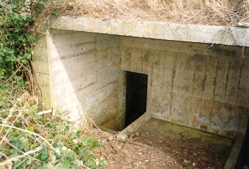
6ft x 6ft x 12ft (wide) covered concrete work, probably gun emplacement, with two sunken rooms (5ft x 5ft x 6ft (high). The site faces NW, parallel with the beach rather than directly out to sea. Overgrown with brambles.
(Source: Field Visit 1997/07/30)
| Type of site | GUN EMPLACEMENT |
|---|---|
| Location | On coast at Tenarisk Farm,, West Bexington. |
| Area |
Puncknowle, Dorset, England |
| Grid reference |
SY 5312 8673
(Scale: 1:25000
, 1993)
|
| Period | WW2 |
| Condition | Good |
| Materials | Corrugated Iron, Reinforced Concrete |
| Threats |
Type: Plant growth (Long Term) Detail: The site is very overgrown. |
| Recorder | Bragg, Stephen |
| Defence grouping |
Dorset coast defences - Defences of the Dorset coast line and immediate hinterland. |
| Photographs |
(7) - 5 exterior, 2 interior views (1 DIGITISED). |
| DOB site reference: | S0012771 |
| Event |
Construction, In the period 1940 1941 Field Visit, On 1997/07/30 |
