Land adjacent to Glebe Farm, Lutterworth: Archaeological Evaluation (OASIS ID: headland3-229714)

Headland Archaeology Ltd, 2016. https://doi.org/10.5284/1037311. How to cite using this DOI

Digital Object Identifiers

Digital Object Identifiers (DOIs) are persistent identifiers which can be used to consistently and accurately reference digital objects and/or content. The DOIs provide a way for the ADS resources to be cited in a similar fashion to traditional scholarly materials. More information on DOIs at the ADS can be found on our help page.

Citing this DOI

The updated Crossref DOI Display guidelines recommend that DOIs should be displayed in the following format:

https://doi.org/10.5284/1037311
Sample Citation for this DOI

Headland Archaeology Ltd (2016) Land adjacent to Glebe Farm, Lutterworth: Archaeological Evaluation (OASIS ID: headland3-229714) [data-set]. York: Archaeology Data Service [distributor] https://doi.org/10.5284/1037311

Data copyright © Headland Archaeology Ltd unless otherwise stated

This work is licensed under the ADS Terms of Use and Access.
Creative Commons License


Headland Archaeology Ltd logo

Primary contact

Catherine Longford
Headland Archaeology Ltd
Unit 1
Clearview Court
Twyford Road
Hereford
HR2 6JR
England

Send e-mail enquiry

Resource identifiers

Digital Object Identifiers

Digital Object Identifiers (DOIs) are persistent identifiers which can be used to consistently and accurately reference digital objects and/or content. The DOIs provide a way for the ADS resources to be cited in a similar fashion to traditional scholarly materials. More information on DOIs at the ADS can be found on our help page.

Citing this DOI

The updated Crossref DOI Display guidelines recommend that DOIs should be displayed in the following format:

https://doi.org/10.5284/1037311
Sample Citation for this DOI

Headland Archaeology Ltd (2016) Land adjacent to Glebe Farm, Lutterworth: Archaeological Evaluation (OASIS ID: headland3-229714) [data-set]. York: Archaeology Data Service [distributor] https://doi.org/10.5284/1037311

Introduction

Land adjacent to Glebe Farm, Lutterworth: Archaeological Evaluation (OASIS ID: headland3-229714)

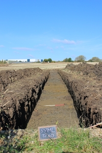
An archaeological evaluation was undertaken by Headland Archaeology (UK) Ltd during September and October 2015, at 'Land adjacent to Glebe Farm', Coventry Road, Lutterworth, where a total of 68 trenches were excavated. One Roman ditch and three undated, but potentially related, linear features were identified on higher ground in the north of the site. Deep alluvial deposits were identified adjacent to the line of an extant watercourse in the centre of the site. Areas of landfill were identified in the northern and eastern parts of the proposed development area. In the east of the site, landfill deposits measured up to 4.00m in depth. The depositional sequence suggested that truncation of the historical land surface had taken place prior to the deposition of landfill material. The potential for the site to contain further remains of archaeological significance is assessed as low.


ADS logo
Data Org logo
University of York logo