
St George's Street, Ipswich - IAS9802
Suffolk County Council Archaeological Service, 2015. https://doi.org/10.5284/1034375. How to cite using this DOI
Data copyright © Suffolk County Council Archaeological Service unless otherwise stated
This work is licensed under the ADS Terms of Use and Access.

Primary contact
Suffolk County Council Archaeological Service
Bury Resource Centre
Hollow Road
Bury St Edmunds
IP32 7AY
Resource identifiers
- ADS Collection: 1941
- DOI:https://doi.org/10.5284/1034375
- How to cite using this DOI

Introduction
Circumstances of excavation
Planning permission was granted for an office development on two areas of surface car parking on the east side of St George’s Street, to the north and south of the ex-Globe public house, for General Accident Assurance Company Ltd. Only the northern development area has been mapped here.
Site constraints
Funding was only available for sample excavation of this large site and the area excavated lay on the northern part of the site, c.7 metres back from the pavement edge, to avoid any Victorian basements fronting the street. The post excavation analysis was hampered by the lack of pottery in many of the contexts.
Site summary
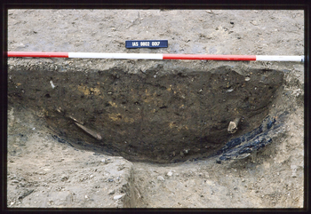
1.15m of overburden was stripped by machine and features, cutting the surface of the natural, excavated by hand.
A depression, c.20cm deep, with a deeper post-hole like depression at its western end, probably belonged to the Middle Saxon period (MS: c.700-850). It was cut by Early Medieval pit 0042 and was dated by one sherd of Ipswich ware. Only 32 sherds of Ipswich ware were recovered from the whole site indicating that it was peripheral to the MS settlement. Four pits were identified as Early Late Saxon (ELS: c.850-900); three post holes could also belong to this period but they contained only single sherds of Thetford ware. One pit was dated to the Middle Late Saxon period (MLS: c.900-1000). Tile recorded from this feature has not been identified but is likely to be either contamination from Post-Medieval feature 0008, which cuts it, or is residual Romano British.
Five pits, a ditch, a foundation trench and three post holes belonged to the Early Medieval period (EMED: c.1000-1200). The ditch ran for c.4m along the south side of the excavation. Any continuation eastwards was obscured by Late Medieval Transitional pit 0021 which cut it. The ditch was at right angles to St George’s Street and was presumably a tenement boundary. There were no contexts belonging to the Late Medieval period (LMED: c.1200-1450) and similar abandonment of this area was found in excavations across the road. There was one pit with a clay lining, however, that was identified as Late Medieval Transitional in date (LMT: c.1450-1600).
Post -Medieval features included a brick structure, of probable 19th century date, which cut the tops of two of the Early Medieval pits, and a soak-away.
Further information can be found in the Site Summary which can be accessed by selecting the 'Reports' tab on the 'Downloads' page.
