Extensive Urban Survey - The Central Marches Historic Towns Survey 1992-6

Hal Dalwood, Victoria Bryant, 2005. https://doi.org/10.5284/1000325. How to cite using this DOI

Digital Object Identifiers

Digital Object Identifiers (DOIs) are persistent identifiers which can be used to consistently and accurately reference digital objects and/or content. The DOIs provide a way for the ADS resources to be cited in a similar fashion to traditional scholarly materials. More information on DOIs at the ADS can be found on our help page.

Citing this DOI

The updated Crossref DOI Display guidelines recommend that DOIs should be displayed in the following format:

https://doi.org/10.5284/1000325
Sample Citation for this DOI

Hal Dalwood, Victoria Bryant (2005) Extensive Urban Survey - The Central Marches Historic Towns Survey 1992-6 [data-set]. York: Archaeology Data Service [distributor] https://doi.org/10.5284/1000325

Data copyright © Worcestershire County Council, English Heritage unless otherwise stated

This work is licensed under the ADS Terms of Use and Access.
Creative Commons License


English Heritage logo

Primary contact

Laura Templeton
Project Officer (illustration)
Worcestershire County Council
Woodbury
University of Worcester
Worcester
WR2 6AJ
Tel: 01905 855419

Send e-mail enquiry

Resource identifiers

Digital Object Identifiers

Digital Object Identifiers (DOIs) are persistent identifiers which can be used to consistently and accurately reference digital objects and/or content. The DOIs provide a way for the ADS resources to be cited in a similar fashion to traditional scholarly materials. More information on DOIs at the ADS can be found on our help page.

Citing this DOI

The updated Crossref DOI Display guidelines recommend that DOIs should be displayed in the following format:

https://doi.org/10.5284/1000325
Sample Citation for this DOI

Hal Dalwood, Victoria Bryant (2005) Extensive Urban Survey - The Central Marches Historic Towns Survey 1992-6 [data-set]. York: Archaeology Data Service [distributor] https://doi.org/10.5284/1000325

Worcestershire County Council logo
Shropshire Council logo
Herefordshire Council logo

Downloads

The Herefordshire CMHTS assessment reports for the medieval towns were reviewed by the County Archaeologist for the new Herefordshire county archaeological service in 2000-2001, and a report was published. This is: Ray, K. (2001), 'Medieval towns in Herefordshire: a management report' Herefordshire Archaeology Report 20. This added Brampton Bryan, Lyonshall and Much Cowarne to the list of 'towns', but noted the 'market village' nature (and relatively short duration) of most such settlements in the county. Lyonshall is remarkable both for the size of the planned settlement, and the extent of surviving earthworks, now Scheduled as an Ancient Monument. A volume on the history and archaeology of the medieval towns of the county is in preparation, to be published by Logaston Press.

Contact details:

Dr. Keith Ray, County Archaeologist
Herefordshire Archaeology, Planning Services
PO Box 144
Hereford
HR1 2YH

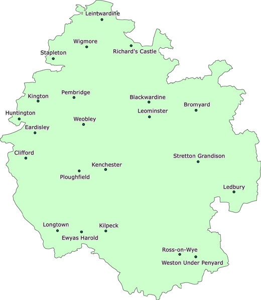
Click on the map to select the area you are interested in, or search using hierarchical menus.

Map of Herefordshire:

Herefordshire

Back to the Central Marches map

Richard's Castle Leintwardine Wigmore Stapleton Bromyard Ledbury Blackwardine Leominster Weobley Pembridge Clifford Eardisley Huntington Kington Kenchester Kilpeck Longtown Ewyas Harold Ross on Wye Weston Under Penyard Ploughfield Stretton Grandison

ADS logo
Data Org logo
University of York logo