Silchester Mapping Project 2005-10

John Creighton, Robert Fry, 2016. https://doi.org/10.5284/1038434. How to cite using this DOI

Digital Object Identifiers

Digital Object Identifiers (DOIs) are persistent identifiers which can be used to consistently and accurately reference digital objects and/or content. The DOIs provide a way for the ADS resources to be cited in a similar fashion to traditional scholarly materials. More information on DOIs at the ADS can be found on our help page.

Citing this DOI

The updated Crossref DOI Display guidelines recommend that DOIs should be displayed in the following format:

https://doi.org/10.5284/1038434
Sample Citation for this DOI

John Creighton, Robert Fry (2016) Silchester Mapping Project 2005-10 [data-set]. York: Archaeology Data Service [distributor] https://doi.org/10.5284/1038434

Data copyright © University of Reading unless otherwise stated

This work is licensed under the ADS Terms of Use and Access.
Creative Commons License


University of Reading logo

Resource identifiers

Digital Object Identifiers

Digital Object Identifiers (DOIs) are persistent identifiers which can be used to consistently and accurately reference digital objects and/or content. The DOIs provide a way for the ADS resources to be cited in a similar fashion to traditional scholarly materials. More information on DOIs at the ADS can be found on our help page.

Citing this DOI

The updated Crossref DOI Display guidelines recommend that DOIs should be displayed in the following format:

https://doi.org/10.5284/1038434
Sample Citation for this DOI

John Creighton, Robert Fry (2016) Silchester Mapping Project 2005-10 [data-set]. York: Archaeology Data Service [distributor] https://doi.org/10.5284/1038434

Overview

Silchester Mapping Project 2005-10

This archive is for supplementary material to the Silchester Mapping Project, which is published as:

John Creighton with Robert Fry (2016) Silchester: Changing Visions of a Roman Town: Integrating geophysics and archaeology: the results of the Silchester mapping project 2005-10. Britannia Monograph Series 28, London, Society for the Promotion of Roman Studies ISBN 9780907764427

The digital archive includes:

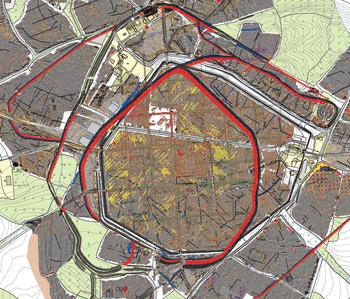
  • 30 GIS files for the area, providing information on the landscape, aerial photography, fieldwalking, past excavation locations, geophysical prospection and interpretation.
  • A digital version of the simplified fold-out plan provided in the above publication.
  • A multi-layer PDF for those who are not used or able to manipulate the GIS files, to provide an easy visual way of turning layers on and off to see how the different datasets relate to each other. The line thicknesses are fairly thick when zoomed out, but are more appropriate when zoomed in on a particular area.

ADS logo
Data Org logo
University of York logo