
Snarkhurst Wood, Hollingbourne, Kent - Integrated Site Report
Oxford Archaeology (South), 2009. (updated 2017) https://doi.org/10.5284/1044810. How to cite using this DOI
Data copyright © High Speed 1 unless otherwise stated
This work is licensed under the ADS Terms of Use and Access.

Primary contact
Stuart
Foreman
Senior Project Manager
Oxford Archaeology (South)
Janus House
Osney Mead
Oxford
OX2 0ES
UK
Tel: 01865 263800
Fax: 01865 793496
Resource identifiers
- ADS Collection: 2453
- DOI:https://doi.org/10.5284/1044810
- How to cite using this DOI

Introduction
As part of an extensive programme of archaeological investigation carried out in advance of the construction of the Channel Tunnel Rail Link (Channel Tunnel Rail Link -CTRL-), Oxford Archaeology (formerly Oxford Archaeological Unit) was commissioned to undertake a strip, map and sample excavation at South of Snarkhurst Wood in Kent. The excavation was carried out between January and February 1999, under the project management of Rail Link Engineering on behalf of Union Railways (South) Limited (a subsidiary of London and Continental Railways).
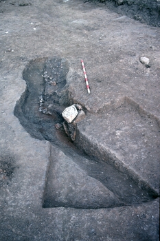
The occupation uncovered upon the site was principally of late Iron Age and Roman date. However, activity within the area since prehistoric times was suggested by the retrieval of an assemblage of redeposited worked flint ranging from the Mesolithic to early Bronze Age. Two pits may relate to middle Bronze Age occupation.
Late Iron Age and early Roman activity was identified in the form of a rural occupation area defined by enclosure ditches and a possible trackway. Associated discrete features include a circular post structure, two four-post structures, a domestic oven and a few pits and postholes. These remains are likely to represent the northern extent of a small scale, low status rural settlement. One cremation pit related to this phase was located c 200 m to the north-west of the enclosure. Few changes seem to occur in the few years following the Roman Conquest.
Some time after AD50, some of the enclosure ditches seem to have fallen into disuse to be replaced by a less complex system of ditches. Another possible enclosure may have been dug during this phase, next to the first one. Discrete features of early to middle Roman date included three four-post structures and a few pits. Roman activity seems to have ceased on the site around AD250.
Post-Roman activity was represented by a few field boundary ditches of early medieval and post-medieval date.
The fieldwork events covered by this report are:
- South of Snarkhurst Wood (ARC SNK99) - Excavation
- South of Snarkhurst Wood Watching Brief - Area 420 (ARC WB420/66+300-67+100) - Watching Brief
- Musket Lane Watching Brief - Area 420 (ARC WB420/67+100-68+10) - Watching Brief
