
Palaeochannels of the Trent Catchment
York Archaeological Trust, 2017. https://doi.org/10.5284/1043773. How to cite using this DOI
Data copyright © York Archaeological Trust unless otherwise stated
This work is licensed under the ADS Terms of Use and Access.

Primary contact
Steve
Malone
Project Manager
York Archaeological Trust
47 Aldwark
York
YO1 7BX
England
Resource identifiers
- ADS Collection: 2791
- DOI:https://doi.org/10.5284/1043773
- How to cite using this DOI

Overview
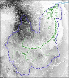
This collection contains GIS shapefiles and the associated database of all features digitised during the course of the project. The GIS files are supported by a written report which documents the methodology and defines the structure of the GIS database. This report also includes a summary of the overall findings.
