
Terrestrial mineral resource assessment: Northamptonshire
Museum of London Archaeology, Northamptonshire County Council, 2014. https://doi.org/10.5284/1025063. How to cite using this DOI
Data copyright © Museum of London Archaeology, Northamptonshire County Council unless otherwise stated
This work is licensed under the ADS Terms of Use and Access.

Primary contact
David
Bowsher
Director of Research
Museum of London Archaeology
Mortimer Wheeler House
46 Eagle Wharf Road
London
N1 7ED
UK
Tel: 020 7410 2285
Resource identifiers
- ADS Collection: 1679
- DOI:https://doi.org/10.5284/1025063
- How to cite using this DOI


Introduction
The project was undertaken by Museum of London Archaeology and Northamptonshire County Council, as part of the Terrestrial Minerals Resource Assessment (TMRA) administered by English Heritage. The aim of the project was to map past, current and future mineral extraction areas in Northamptonshire; enhance HER data within such areas that includes a statement of significance for undesignated assets; analyse heritage assets that have been lost to past minerals extraction, along with the likely impact of future extraction in relation to asset significance, type, period and character; and use the data and research agenda as a framework for analysing and reporting the results, trends of loss and enhancements to current understanding of past human activity. The project also provided an assessment of the impact of mineral extraction on the historic environment in a quantifiable and systematic manner.
The minerals resource was identified from British Geological Survey mapping; extraction shown on historic maps and the British Pits database; and current minerals permissions and a Study Area was developed based on discussion with the Northamptonshire County Minerals Planner, the Northamptonshire Historic Environment Record (HER) and the County Archaeological Advisor.
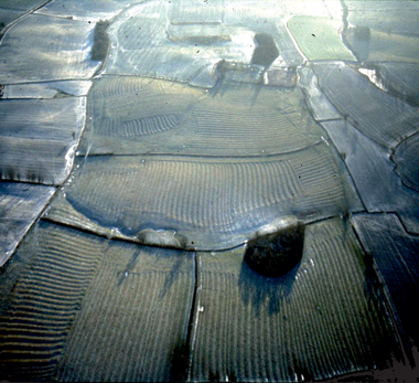
The project entailed enhancing the HER with archaeological data from the National Record of the Historic Environment (NRHE) database managed by English Heritage. Data from The Synthetic Survey of the Environmental, Archaeological and Hydrological record for the River Nene from its source to Peterborough was reviewed for any additional data that required inclusion into the project database. The data was then modified by assigning consistently a chronological period to each asset along with an asset type (e.g. industrial, domestic, defence) as well as asset significance (very high, high, medium, etc.). The enhanced and updated project database was used to generate asset density figures and distribution maps for an archaeological resource assessment, in order to identify any patterns in human activity across the mineral producing areas. Some clear patterns in the asset densities of different periods were revealed. During the prehistoric period the asset density increased through time with the highest densities in the Bronze and Iron Age. Spatially, during the prehistoric period, the highest densities are noted on the river gravels of the Nene Valley. A particularly high density of Bronze Age funerary monuments were seen in this area.
The Romano-British, late medieval, post-medieval and Modern periods all revealed high asset densities with the early medieval having a relatively low asset density. Settlement becomes increasingly important in the historic periods. Also industrial and transport assets increase in density in throughout the historic period. In particular, the resources available in the Limestone area lead to a high density of industrial sites. The importance of remains of late medieval âridge and furrowâ field systems to the landscape of Northamptonshire is reflected in the high density of agricultural assets in this period.
It should be noted that asset density to a large extent reflects current understanding based on the level of past archaeological investigation, and generally lower density areas may be currently less well understood archaeologically than high density areas.
The study has demonstrated the importance of archaeological remains within minerals producing areas and needs to be a key consideration for both minerals planners and minerals extraction companies. Early planning and consultation with heritage curators is recommended.
As part of the Terrestrial Minerals Resource Assessment a pilot study was undertaken to examine into the potential environmental effects of quarrying on above ground heritage assets. A study area around Fotheringhay in Northamptonshire was selected, in consultation with Northamptonshire County Council. Within this study area, a theoretical quarry location and haulage routes were located in order to create a broad range of potential 'issues' in relation to above ground assets, including both physical and non-physical impacts. The results of this pilot study are available as a separate report.
