Leicestershire Museums

Leicestershire County Council Museums, 2021. https://doi.org/10.5284/1106895. How to cite using this DOI

Digital Object Identifiers

Digital Object Identifiers (DOIs) are persistent identifiers which can be used to consistently and accurately reference digital objects and/or content. The DOIs provide a way for the ADS resources to be cited in a similar fashion to traditional scholarly materials. More information on DOIs at the ADS can be found on our help page.

Citing this DOI

The updated Crossref DOI Display guidelines recommend that DOIs should be displayed in the following format:

https://doi.org/10.5284/1106895
Sample Citation for this DOI

Leicestershire County Council Museums (2021) Leicestershire Museums [data-set]. York: Archaeology Data Service [distributor] https://doi.org/10.5284/1106895

This work is licensed under a Creative Commons Attribution 4.0 International License.
Creative Commons License


Leicestershire County Council Museums logo

Primary contact

Helen Sharp
Curator (Archaeology)
Leicestershire County Council Museums

Send e-mail enquiry

Resource identifiers

Digital Object Identifiers

Digital Object Identifiers (DOIs) are persistent identifiers which can be used to consistently and accurately reference digital objects and/or content. The DOIs provide a way for the ADS resources to be cited in a similar fashion to traditional scholarly materials. More information on DOIs at the ADS can be found on our help page.

Citing this DOI

The updated Crossref DOI Display guidelines recommend that DOIs should be displayed in the following format:

https://doi.org/10.5284/1106895
Sample Citation for this DOI

Leicestershire County Council Museums (2021) Leicestershire Museums [data-set]. York: Archaeology Data Service [distributor] https://doi.org/10.5284/1106895

Available archives:

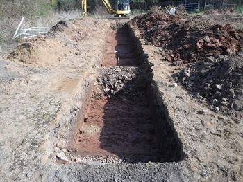
A total of 27 archives have been added to the Leicestershire Museums. These can be accessed below.

Image from Data from Geophysical Surveys at Two Sites at Newbold Verdon, Leicestershire, 2021 and 2023 Data from Geophysical Surveys at Two Sites at Newbold Verdon, Leicestershire, 2021 and 2023.

Copyright logo Released: 01 July 2024
Collection doi: 10.5284/1117197
Image from Digital Data from a Geophysical Survey of the proposed Foxton to Gartree Pipeline Route, Leicestershire 2022 Digital Data from a Geophysical Survey of the proposed Foxton to Gartree Pipeline Route, Leicestershire 2022.

Copyright logo Released: 09 July 2024
Collection doi: 10.5284/1120839
Image from Data from a Geophysical Survey at Lychgate Lane, Aston Flamville, Leicestershire 2023 Data from a Geophysical Survey at Lychgate Lane, Aston Flamville, Leicestershire 2023.

Copyright logo Released: 31 May 2024
Collection doi: 10.5284/1117204
Image from Data from a Geophysical Survey at Mercia Park Phase 2, Appleby Magna, Leicestershire, August 2023 Data from a Geophysical Survey at Mercia Park Phase 2, Appleby Magna, Leicestershire, August 2023.

Copyright logo Released: 03 May 2024
Collection doi: 10.5284/1117205
Image from Data from a Geophysical Survey at Anstey Lane, Groby, Leicestershire, May 2022 Data from a Geophysical Survey at Anstey Lane, Groby, Leicestershire, May 2022.

Copyright logo Released: 01 July 2024
Collection doi: 10.5284/1120006
Image from Images from an Excavation adjacent to Stoneacres, Great Easton, Leicestershire, June 2022 Images from an Excavation adjacent to Stoneacres, Great Easton, Leicestershire, June 2022.

Copyright logo Released: 18 December 2023
Collection doi: 10.5284/1116181
Image from Images and GIS from an Archaeological Evaluation at Welford Road, Wigston, Leicestershire, August 2022 Images and GIS from an Archaeological Evaluation at Welford Road, Wigston, Leicestershire, August 2022.

Copyright logo Released: 22 November 2023
Collection doi: 10.5284/1115939
Image from Digital Archive from Magnetometer Survey at Brand Hill House, Woodhouse Eaves, Leicestershire, January 2023 Digital Archive from Magnetometer Survey at Brand Hill House, Woodhouse Eaves, Leicestershire, January 2023.

Copyright logo Released: 14 April 2023
Collection doi: 10.5284/1105889
Image from Digital Archive from Archaeological Fieldwork at Bradgate Park Lawns, Leicestershire September 2021 Digital Archive from Archaeological Fieldwork at Bradgate Park Lawns, Leicestershire September 2021.

Copyright logo Released: 02 February 2023
Collection doi: 10.5284/1102129
Image from Images from an Archaeological Evaluation at 87 High Street, Barwell, Leicestershire, November 2021 Images from an Archaeological Evaluation at 87 High Street, Barwell, Leicestershire, November 2021.

Copyright logo Released: 06 February 2023
Collection doi: 10.5284/1103154
Image from Digital Archive from Trial Trench Evaluation at 6 West End, Long Whatton, Leicestershire, March 2022 Digital Archive from Trial Trench Evaluation at 6 West End, Long Whatton, Leicestershire, March 2022.

Copyright logo 
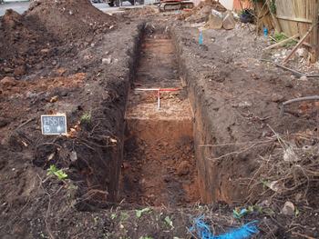
Released: 08 December 2022
Collection doi: 10.5284/1101041
Image from Digital Archive from a Geophysical Survey at New Barn Farm, Barwell, Leicestershire 2022 Digital Archive from a Geophysical Survey at New Barn Farm, Barwell, Leicestershire 2022.

Copyright logo 
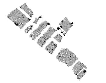
Released: 12 December 2022
Collection doi: 10.5284/1101047
Image from Digital Archive for Archaeological Investigations at Avanti Fields School, Leicester, Leicestershire, 2019-2020 Digital Archive for Archaeological Investigations at Avanti Fields School, Leicester, Leicestershire, 2019-2020.

Copyright logo 
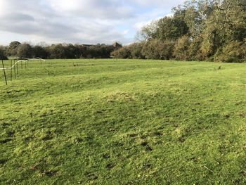
Released: 19 July 2022
Collection doi: 10.5284/1097413
Image from Images from an Archaeological Evaluation at south of London Road, Markfield, Leicestershire 2021 Images from an Archaeological Evaluation at south of London Road, Markfield, Leicestershire 2021.

Copyright logo Released: 22 March 2022
Collection doi: 10.5284/1090575
Image from Site Data from Trial Trench Evaluation at Sketchley Lane, Sketchley, Leicestershire October 2019 Site Data from Trial Trench Evaluation at Sketchley Lane, Sketchley, Leicestershire October 2019.

Copyright logo Released: 04 March 2022
Collection doi: 10.5284/1090498
Image from Site Data from an Archaeological Evaluation at Markfield Road, Ratby, Leicestershire 2021 Site Data from an Archaeological Evaluation at Markfield Road, Ratby, Leicestershire 2021.

Copyright logo Released: 10 February 2022
Collection doi: 10.5284/1090459
Image from Site Data from an Archaeological Excavation at St Bartholomew's Way, Melton Mowbray, Leicestershire 2018-19 Site Data from an Archaeological Excavation at St Bartholomew's Way, Melton Mowbray, Leicestershire 2018-19.

Copyright logo Released: 01 November 2021
Collection doi: 10.5284/1090299
Image from Images from Historic Building Recording at the Royal Hotel, Station Road, Ashby de la Zouch 2019 Images from Historic Building Recording at the Royal Hotel, Station Road, Ashby de la Zouch 2019.

Copyright logo Released: 05 October 2021
Collection doi: 10.5284/1088138
Image from Excavation, Lutterworth Road, Lutterworth, Leicestershire. Excavation (OASIS ID: oxfordar1-402794) Excavation, Lutterworth Road, Lutterworth, Leicestershire. Excavation (OASIS ID: oxfordar1-402794).

Copyright logo Released: 24 November 2020
Collection doi: 10.5284/1083488
Image from Land adjacent to A5, Lutterworth, Leicestershire: Archaeological evaluation (OASIS ID: headland3-366701) Land adjacent to A5, Lutterworth, Leicestershire: Archaeological evaluation (OASIS ID: headland3-366701).

Copyright logo Released: 14 January 2020
Collection doi: 10.5284/1058965
Image from Land at Cottage Farm, Glen Road, Oadby, Leicestershire. Archaeological Excavation (OASIS ID: cotswold2-317891) Land at Cottage Farm, Glen Road, Oadby, Leicestershire. Archaeological Excavation (OASIS ID: cotswold2-317891).

Copyright logo Released: 20 June 2018
Collection doi: 10.5284/1047633
Image from Land at Smeeton Road, Kibworth Beauchamp, Leicestershire. Archaeological Evaluation (OASIS ID: cotswold2-250636) Land at Smeeton Road, Kibworth Beauchamp, Leicestershire. Archaeological Evaluation (OASIS ID: cotswold2-250636).

Copyright logo Released: 15 June 2018
Collection doi: 10.5284/1047617
Image from Lockington Quarry (Phase 8), Lockington, Leicestershire. Archaeological Evaluation (OASIS ID: cotswold2-299226) Lockington Quarry (Phase 8), Lockington, Leicestershire. Archaeological Evaluation (OASIS ID: cotswold2-299226).

Copyright logo Released: 15 June 2018
Collection doi: 10.5284/1047615
Image from Land off Kimcote Road, Gilmorton, Leicestershire. Archaeological Evaluation and Earthworks Survey (OASIS ID: cotswold2-316370) Land off Kimcote Road, Gilmorton, Leicestershire. Archaeological Evaluation and Earthworks Survey (OASIS ID: cotswold2-316370).

Copyright logo Released: 12 June 2018
Collection doi: 10.5284/1047603
Image from Land South of Coventry Road, Lutterworth, Leicestershire (OASIS ID: oxfordar1-300987) Land South of Coventry Road, Lutterworth, Leicestershire (OASIS ID: oxfordar1-300987).

Copyright logo Released: 07 February 2018
Collection doi: 10.5284/1046311
Image from Lutterworth Swinford Road, south of Lutterworth, Leicestershire. Archaeological Evaluation (OASIS ID: oxfordar1-295740) Lutterworth Swinford Road, south of Lutterworth, Leicestershire. Archaeological Evaluation (OASIS ID: oxfordar1-295740).

Copyright logo Released: 23 October 2018
Collection doi: 10.5284/1049643
Image from Love's Lane, Dunton Bassett, Leicestershire (OASIS ID: oxfordar1-277741) Love's Lane, Dunton Bassett, Leicestershire (OASIS ID: oxfordar1-277741).

Copyright logo Released: 11 December 2017
Collection doi: 10.5284/1045787

ADS logo
Data Org logo
University of York logo