
Images from an Archaeological Evaluation of Land at Upper Stanbridge Farm, Sherston, Wiltshire 2020
Cotswold Archaeology, 2021. https://doi.org/10.5284/1085019. How to cite using this DOI
Data copyright © Cotswold Archaeology unless otherwise stated
This work is licensed under a Creative Commons Attribution 4.0 International License.

Primary contact
Cotswold Archaeology
Building 11
Kemble Enterprise Park
Cirencester
GL7 6BQ
UK
Tel: 01285 771022
Fax: 01285 771033
Resource identifiers
- ADS Collection: 4006
- DOI:https://doi.org/10.5284/1085019
- How to cite using this DOI
Introduction
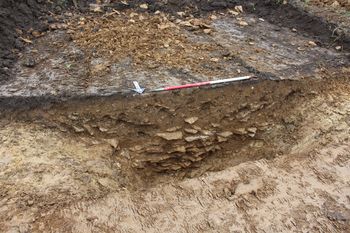
In October 2020, Cotswold Archaeology carried out an archaeological evaluation of land at Upper Stanbridge Farm, Sherston, Wiltshire. A total of 12 trenches were excavated. Two flint flakes of broad prehistoric date were recovered from the fills of two large ditches identified in the central-western part of the site. Two further large, albeit undated ditches, were also identified in this part of the site. Based on the currently available evidence it would appear likely that these ditches form parts of a pair of ditchlike features, which may form part of a substantial land boundary or similar. Evidence of medieval and/or post-medieval agricultural activity, comprising the ploughed-out remains of ridge-and-furrow cultivation, was identified in the north-western half of the site. Two sherds of pottery of late 18th to 19th-century date were recovered from the fill of a construction cut for a stone lined drain/culvert identified in the south-eastern part of the site. Two undated ditches were identified in trenches excavated within the central-northern and central-western parts of the site. The precise function of these features remains unclear but the absence of artefactual and faunal material from the fills of these features suggests that they lay at an appreciable distance from any areas of former settlement and are therefore most likely to have been associated with agricultural activities.
