
Living Between the Monuments: The prehistory of the Dishforth to Barton A1 Motorway Improvements Digital Monograph, 2021
Northern Archaeological Associates, 2021. https://doi.org/10.5284/1090390. How to cite using this DOI
Data copyright © Northern Archaeological Associates unless otherwise stated
This work is licensed under a Creative Commons Attribution 4.0 International License.

Primary contact
Northern Archaeological Associates
Marwood House
Harmire Enterprise Park
Barnard Castle
Co. Durham
DL12 8BN
Tel: 01833 690 800
Resource identifiers
- ADS Collection: 4156
- DOI:https://doi.org/10.5284/1090390
- How to cite using this DOI
Downloads
Monograph | Figures
|
Title: Figures metadata Filename: A1L2B_Prehist_Figures_metadata.csv (29 kB) |
CSV |
Info
Download |
|
Files

|
Title: Front cover Filename: Prehist_cover_front.jpg (1 MB) |
JPG |
Info
Download |

|
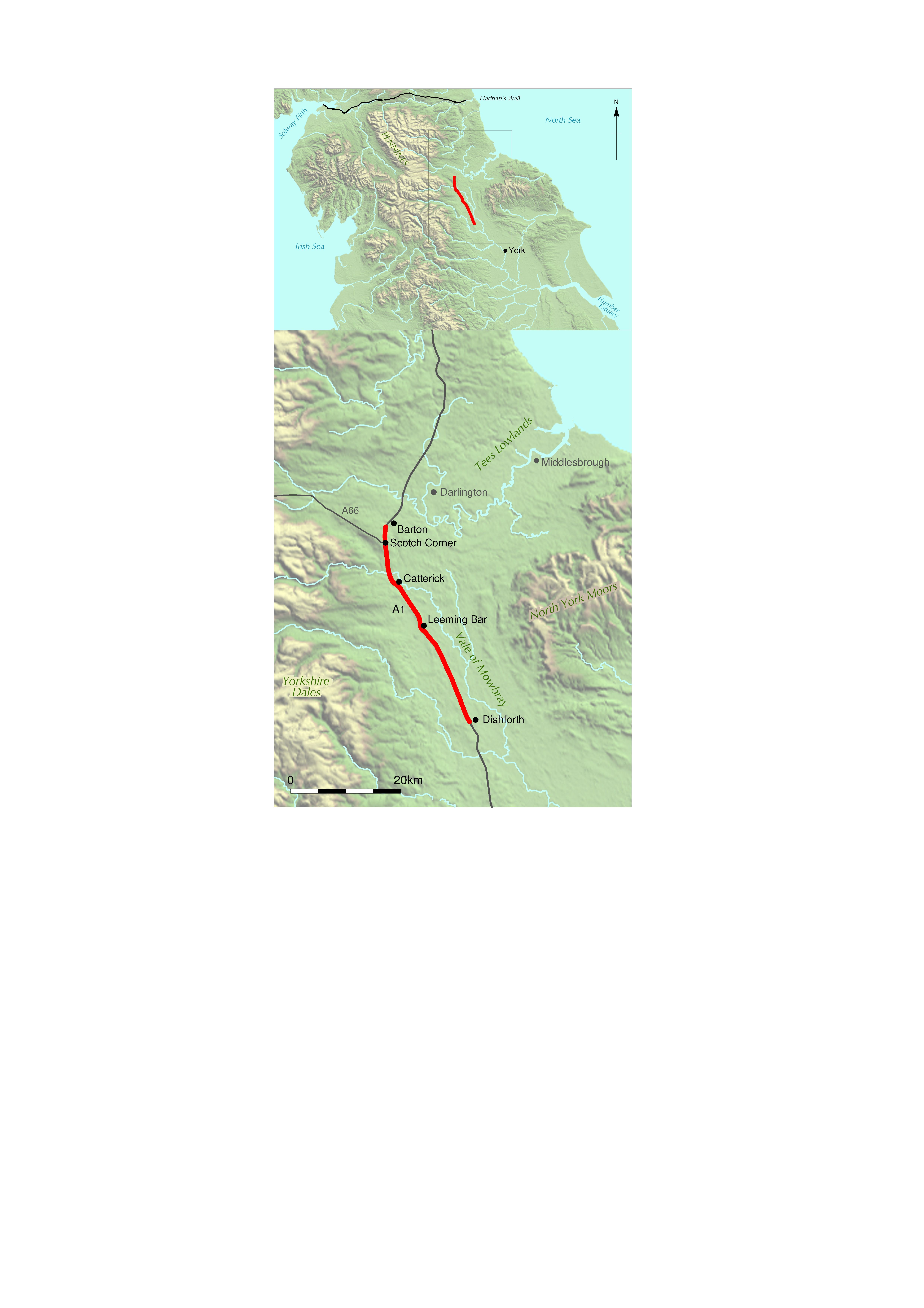
Title: Figure 1.1: location of the A1 schemes. Filename: Prehist_Ch01_Fig-01.jpg (1 MB) |
JPG |
Info
Download |

|
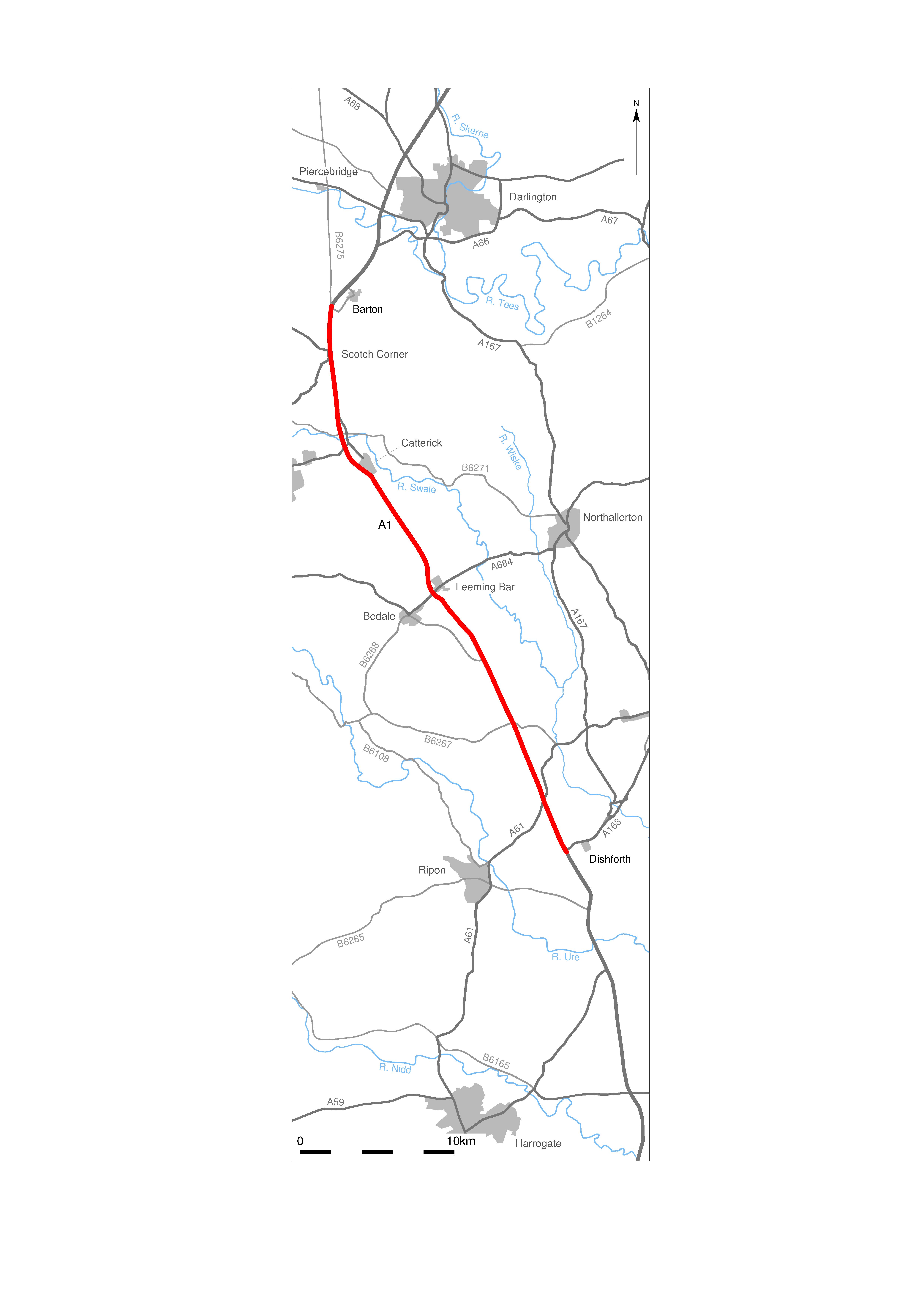
Title: Figure 1.2: the route of the A1 schemes. Filename: Prehist_Ch01_Fig-02.jpg (1 MB) |
JPG |
Info
Download |

|
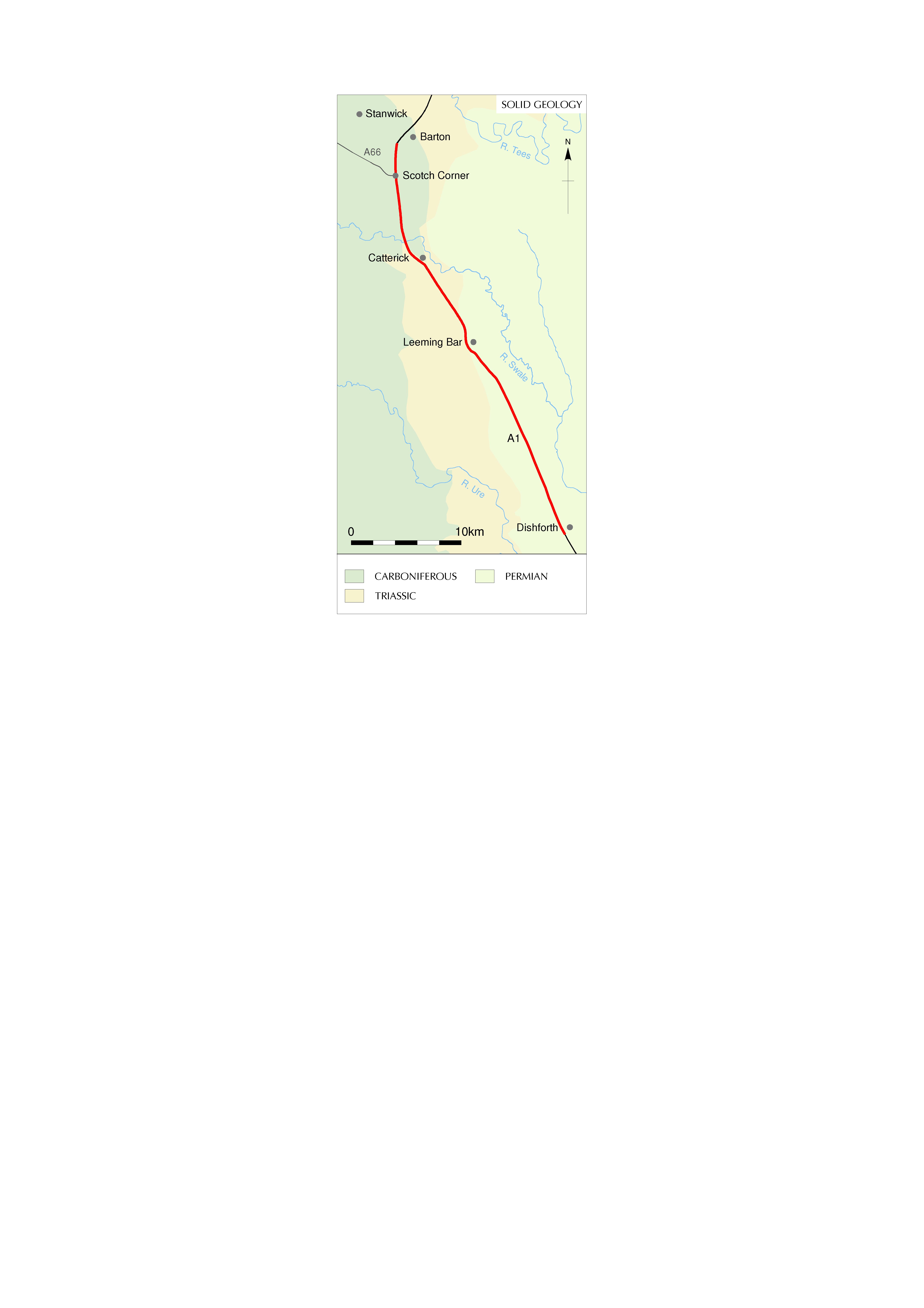
Title: Figure 1.3: solid geology. Filename: Prehist_Ch01_Fig-03.jpg (698 kB) |
JPG |
Info
Download |

|
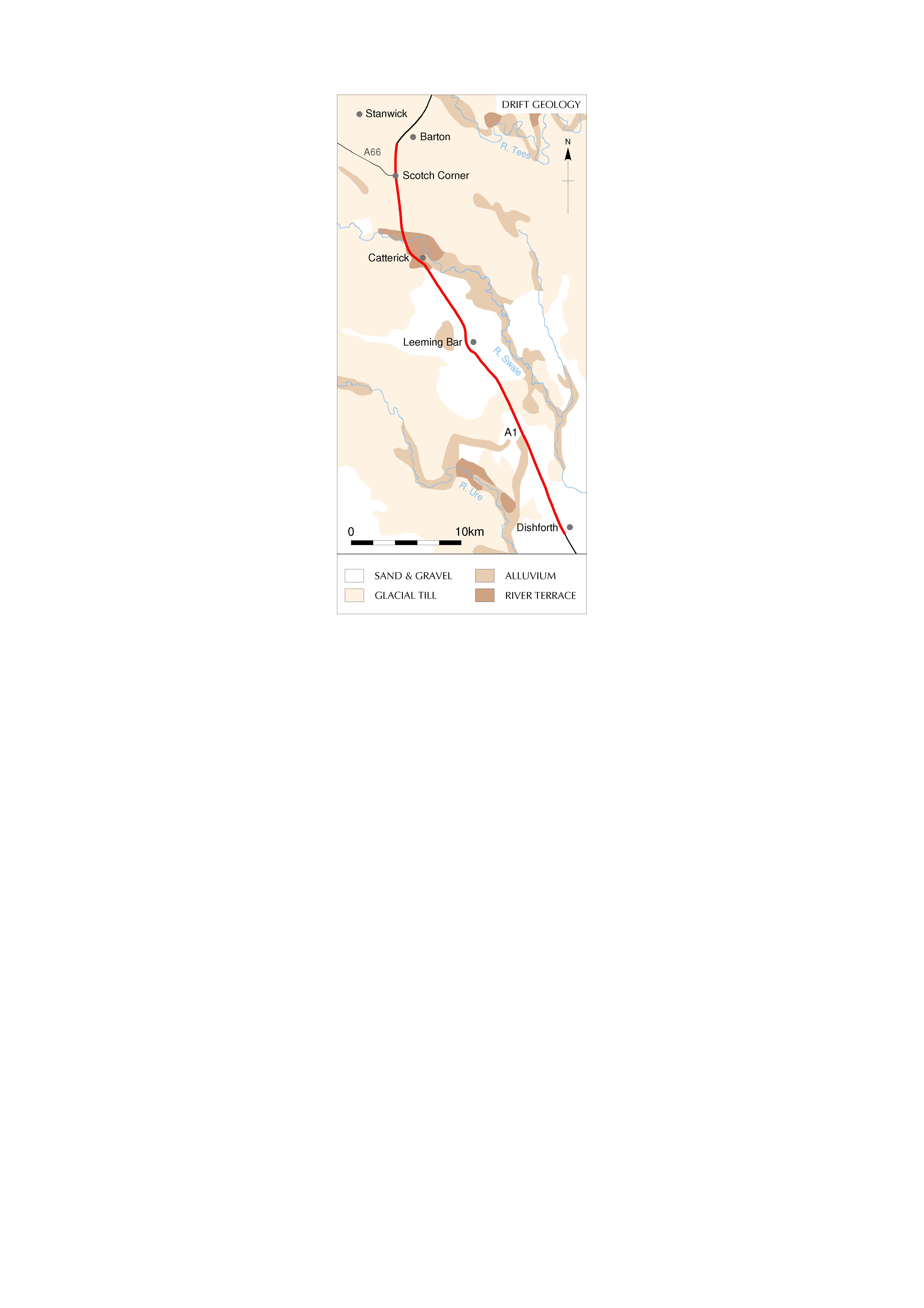
Title: Figure 1.4: drift geology. Filename: Prehist_Ch01_Fig-04.jpg (733 kB) |
JPG |
Info
Download |

|
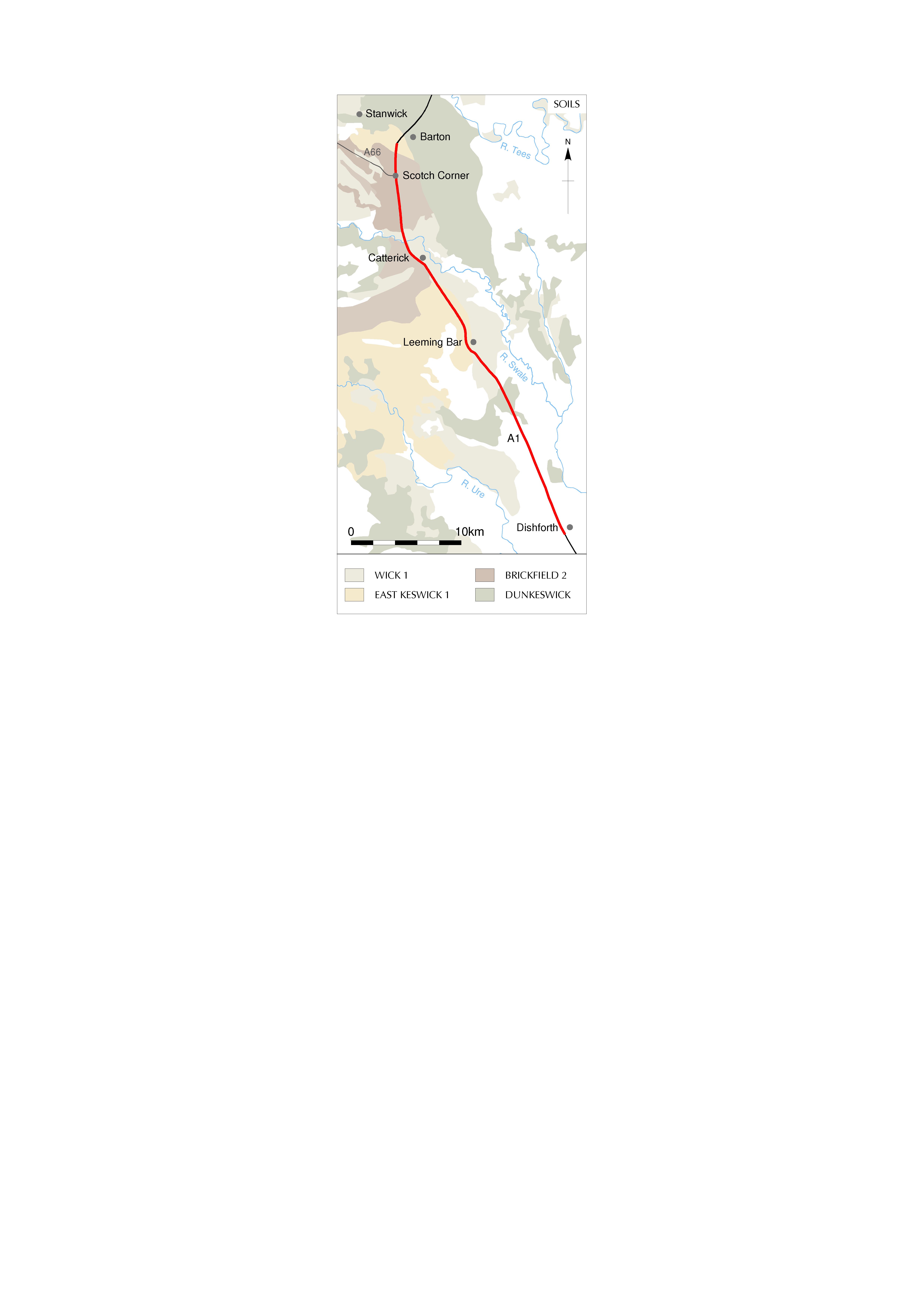
Title: Figure 1.5: soils along the route. Filename: Prehist_Ch01_Fig-05.jpg (739 kB) |
JPG |
Info
Download |

|
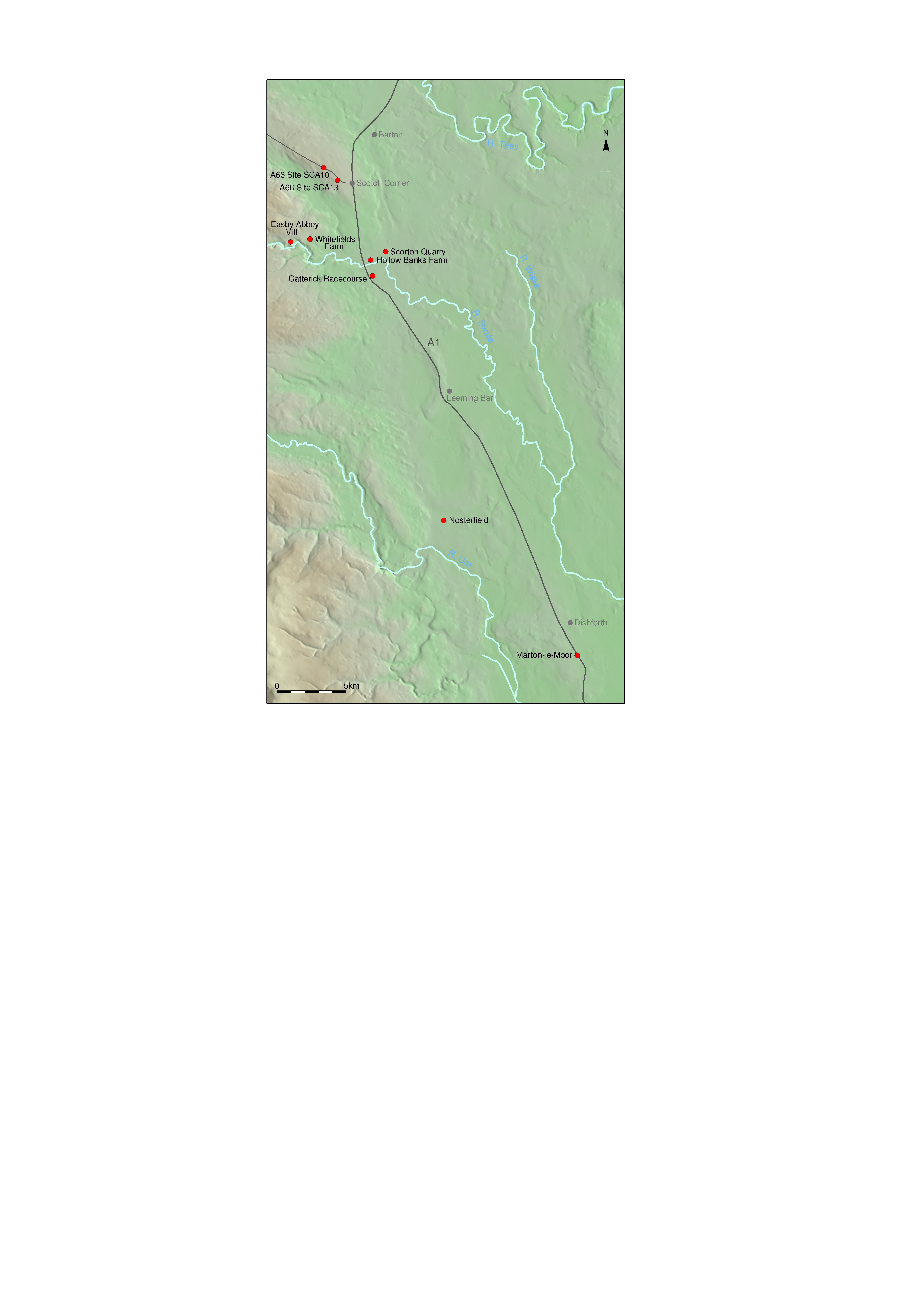
Title: Figure 1.6: sites mentioned in text. Filename: Prehist_Ch01_Fig-06.jpg (2 MB) |
JPG |
Info
Download |

|
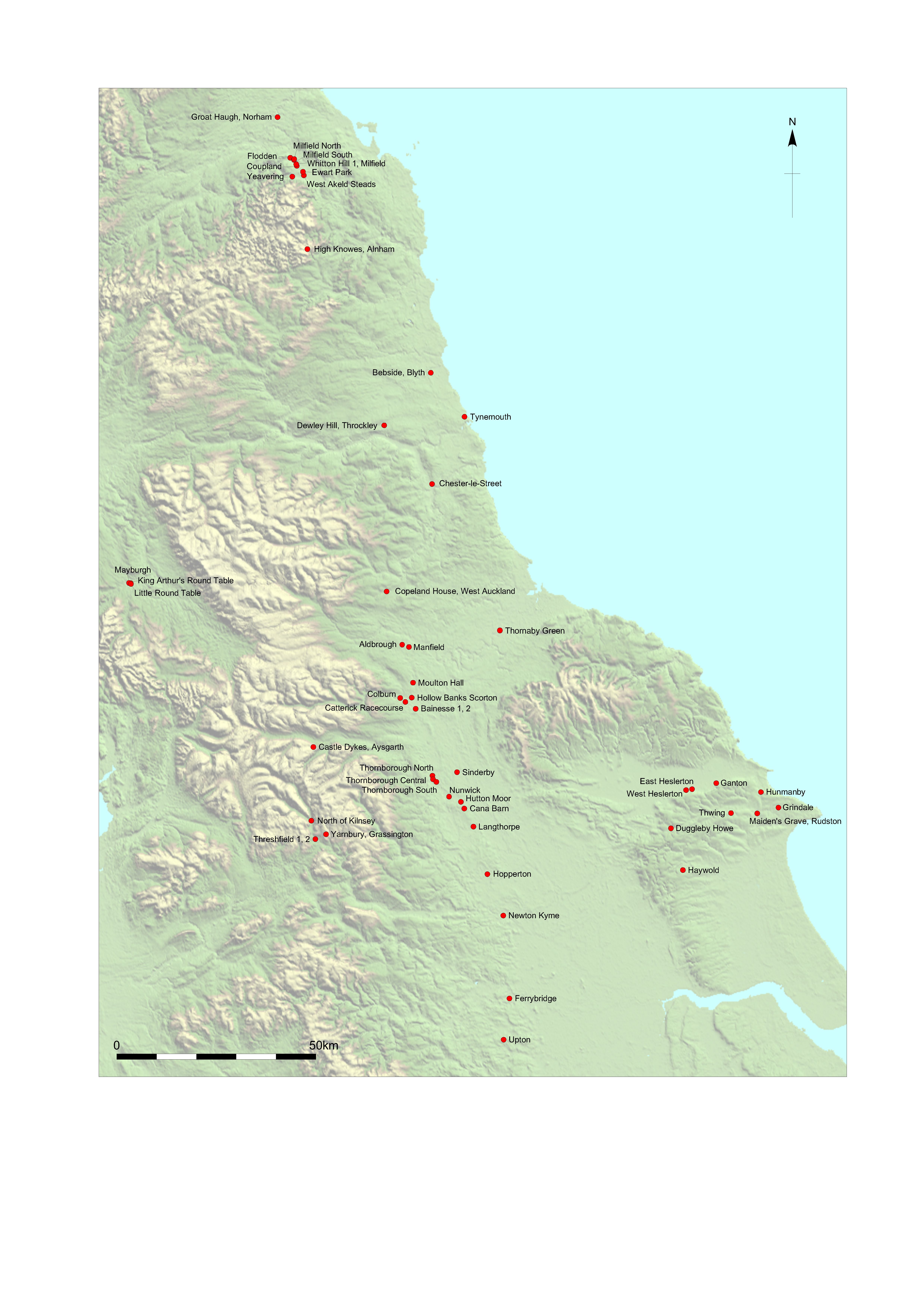
Title: Figure 1.7: sites within the study area mentioned in text. Filename: Prehist_Ch01_Fig-07.jpg (1 MB) |
JPG |
Info
Download |

|
Title: Figure 1.8: field numbering and topographic zones. Filename: Prehist_Ch01_Fig-08.jpg (2 MB) |
JPG |
Info
Download |

|
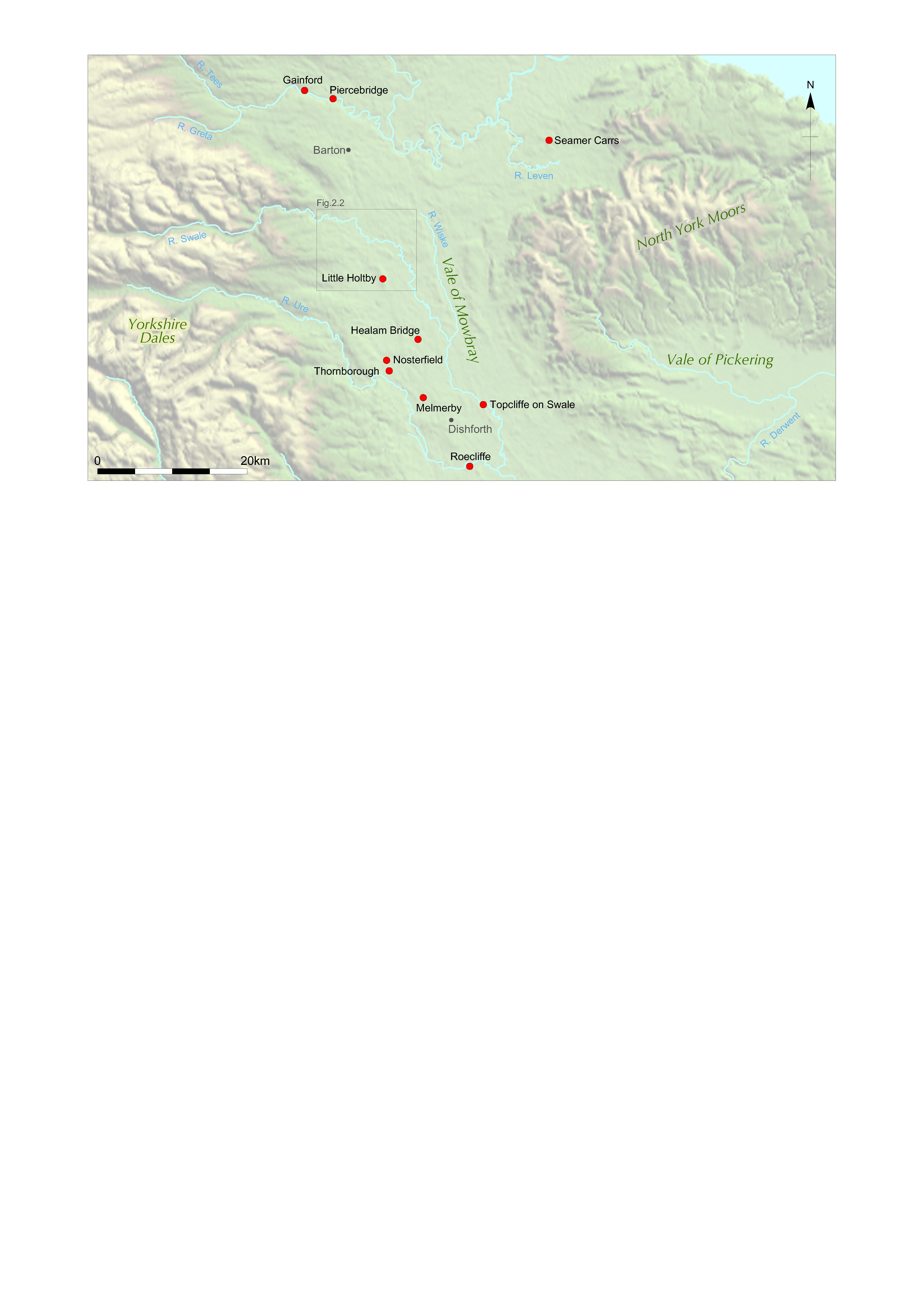
Title: Figure 2.1: Mesolithic sites in the Vale of Mowbray and Tees Valley mentioned in the text. Filename: Prehist_Ch02_Fig-01.jpg (997 kB) |
JPG |
Info
Download |

|
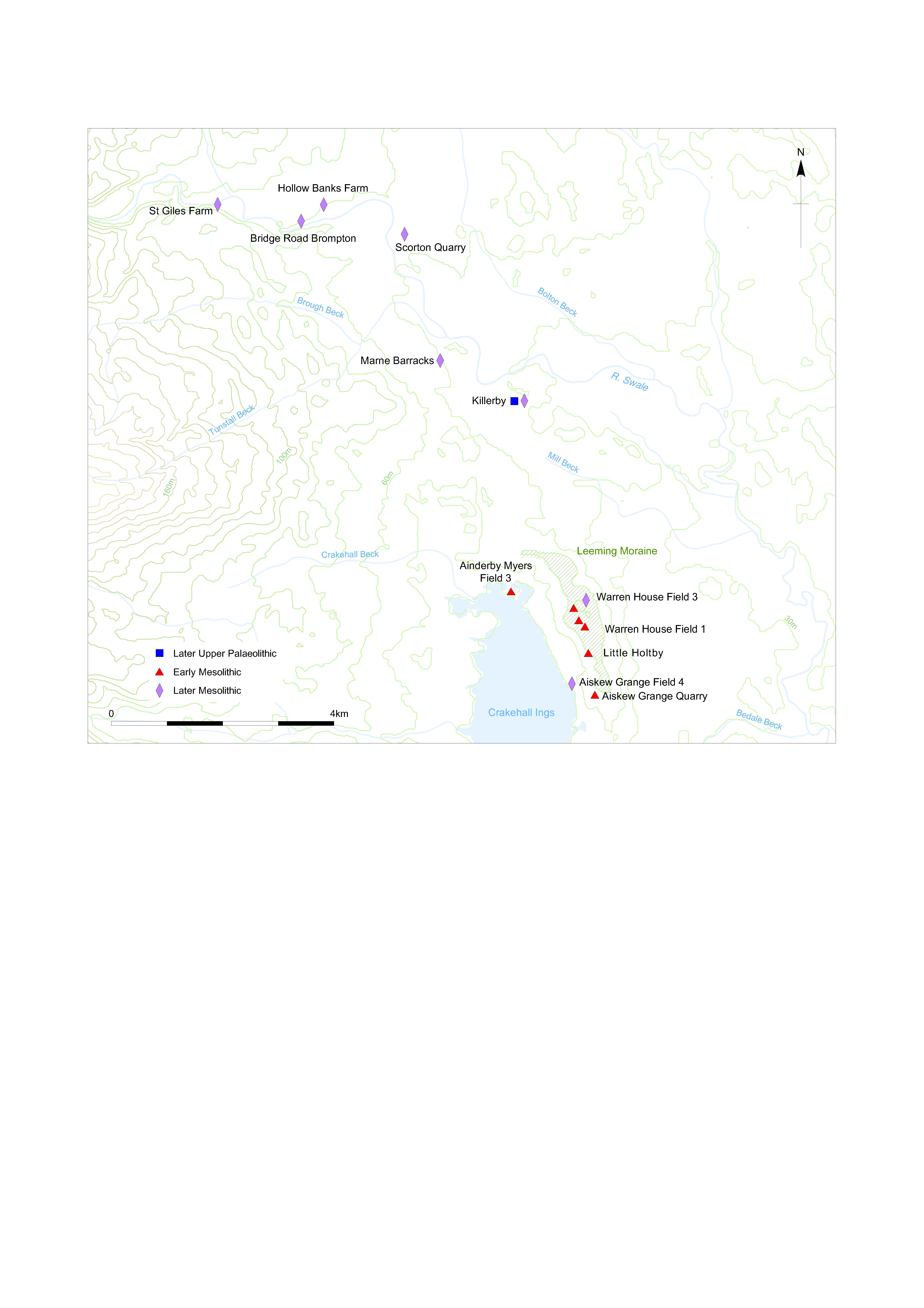
Title: Figure 2.2: Mesolithic sites in the vicinity of the A1 scheme. Filename: Prehist_Ch02_Fig-02.jpg (1 MB) |
JPG |
Info
Download |

|
Title: Figure 2.3: Mesolithic and Mesolithic/Early Neolithic findspots from the A1 schemes. Filename: Prehist_Ch02_Fig-03.jpg (2 MB) |
JPG |
Info
Download |

|
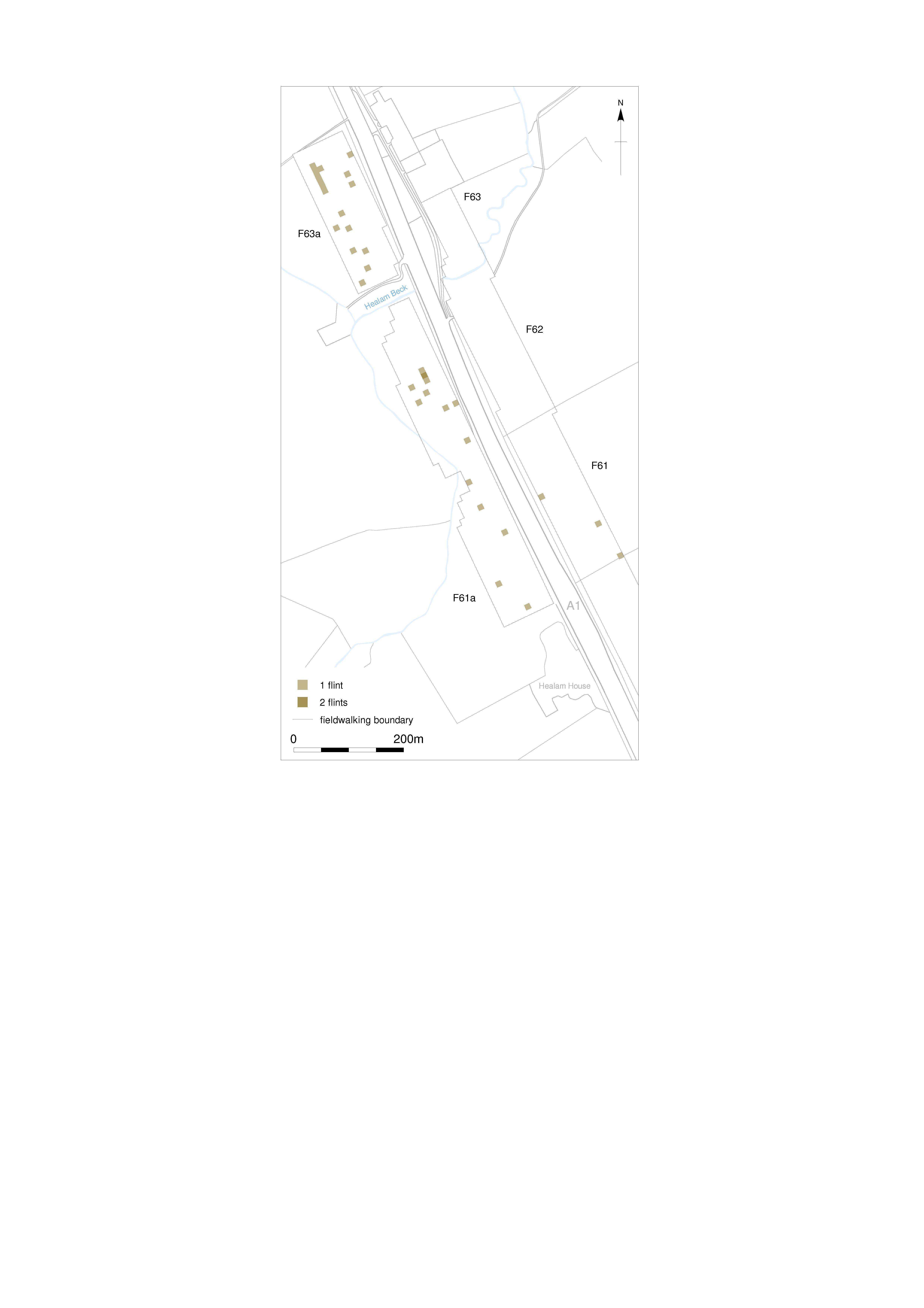
Title: Figure 2.4: Mesolithic fieldwalking finds at Healam Bridge. Filename: Prehist_Ch02_Fig-04.jpg (792 kB) |
JPG |
Info
Download |

|
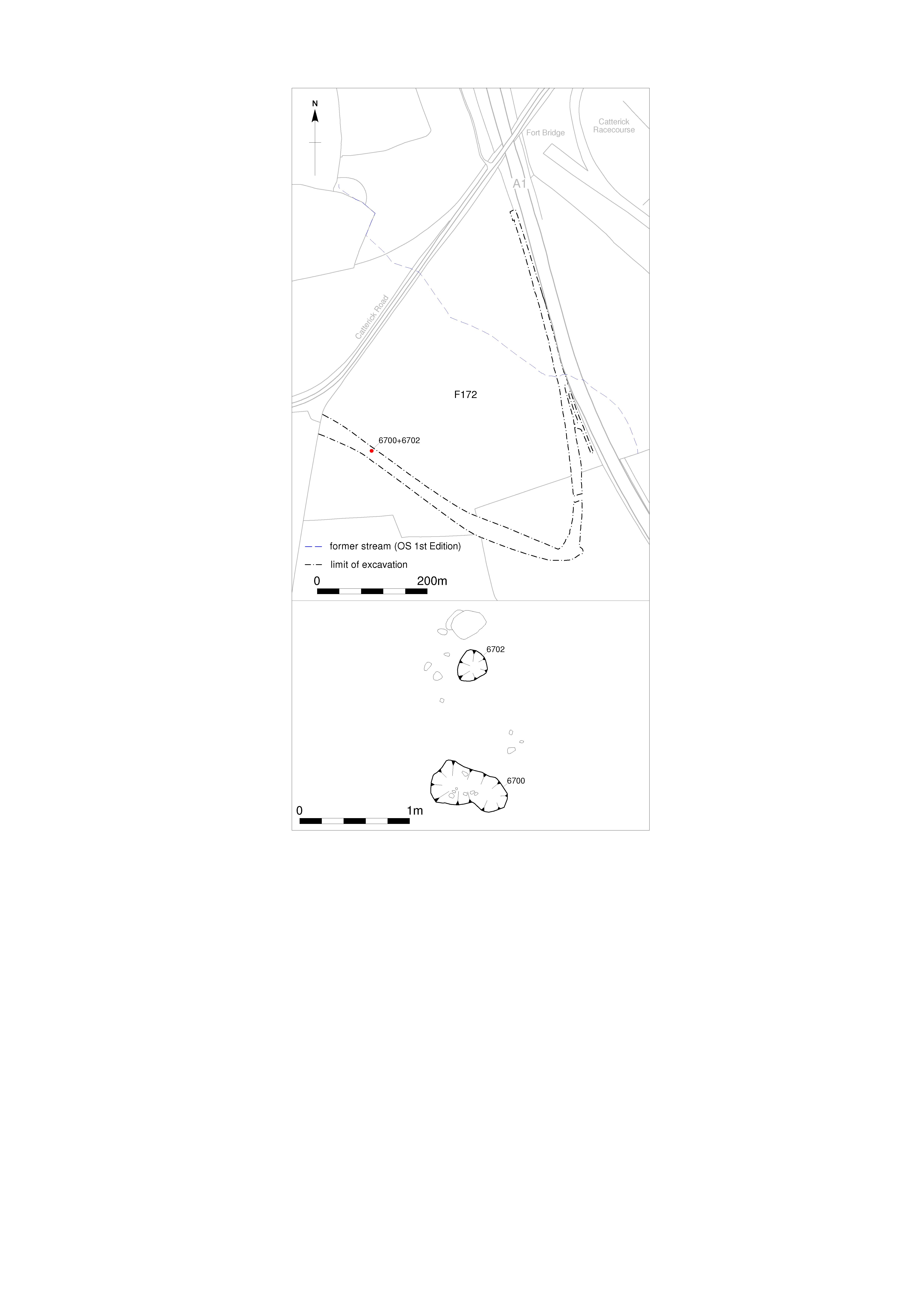
Title: Figure 2.5: Field 172 pits 6700 and 6702. Filename: Prehist_Ch02_Fig-05.jpg (801 kB) |
JPG |
Info
Download |

|
Title: Figure 2.6: location of flint scatters in Scotch Corner Fields 158 and 165. Filename: Prehist_Ch02_Fig-06.jpg (744 kB) |
JPG |
Info
Download |

|
Title: Figure 3.1: major prehistoric monuments in the Vale of Mowbray. Filename: Prehist_Ch03_Fig-01.jpg (1 MB) |
JPG |
Info
Download |

|
Title: Figure 3.2: sites described in this section. Filename: Prehist_Ch03_Fig-02.jpg (1 MB) |
JPG |
Info
Download |

|
Title: Figure 3.3: prehistoric monuments at Bainesse. Filename: Prehist_Ch03_Fig-03.jpg (860 kB) |
JPG |
Info
Download |

|
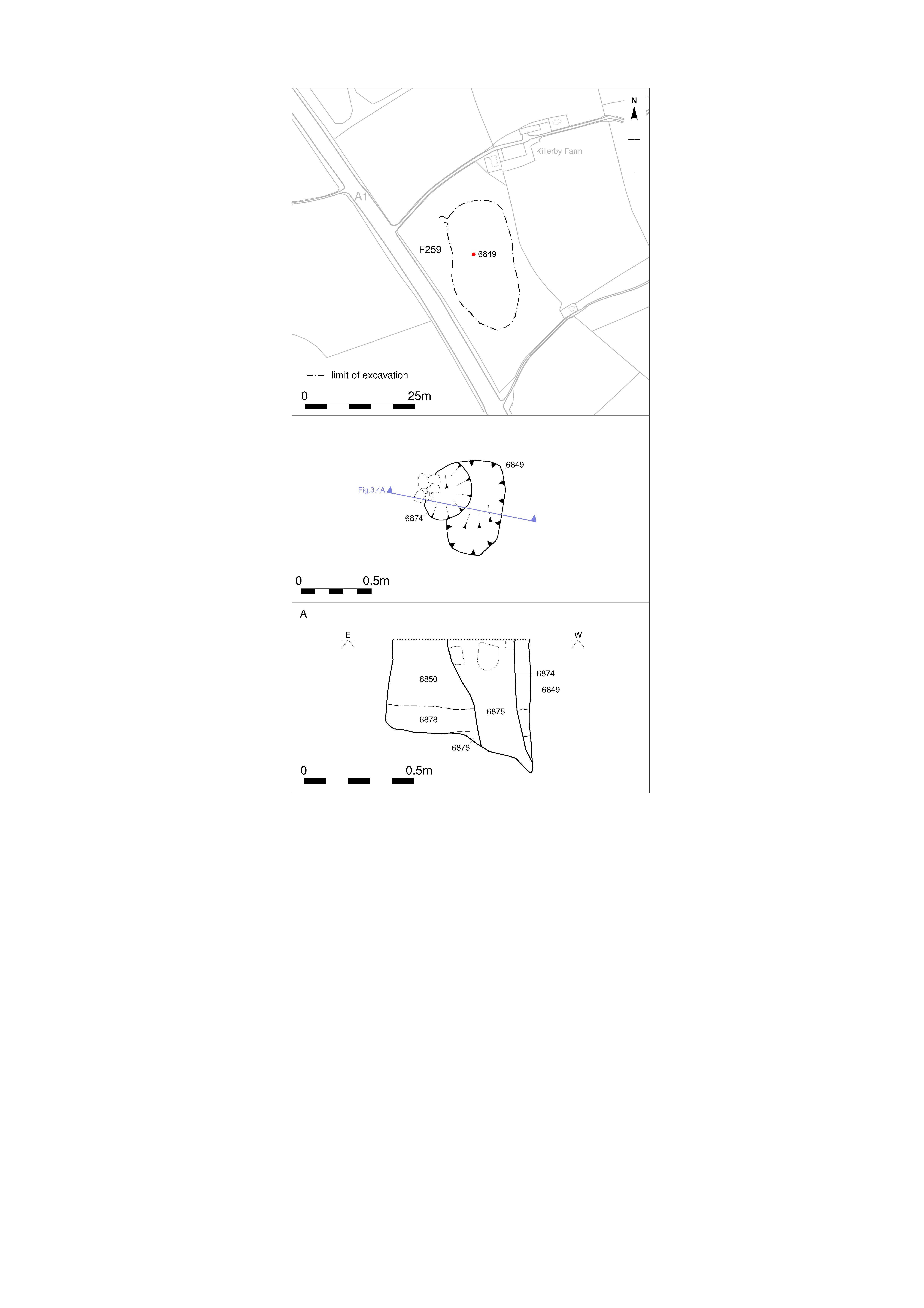
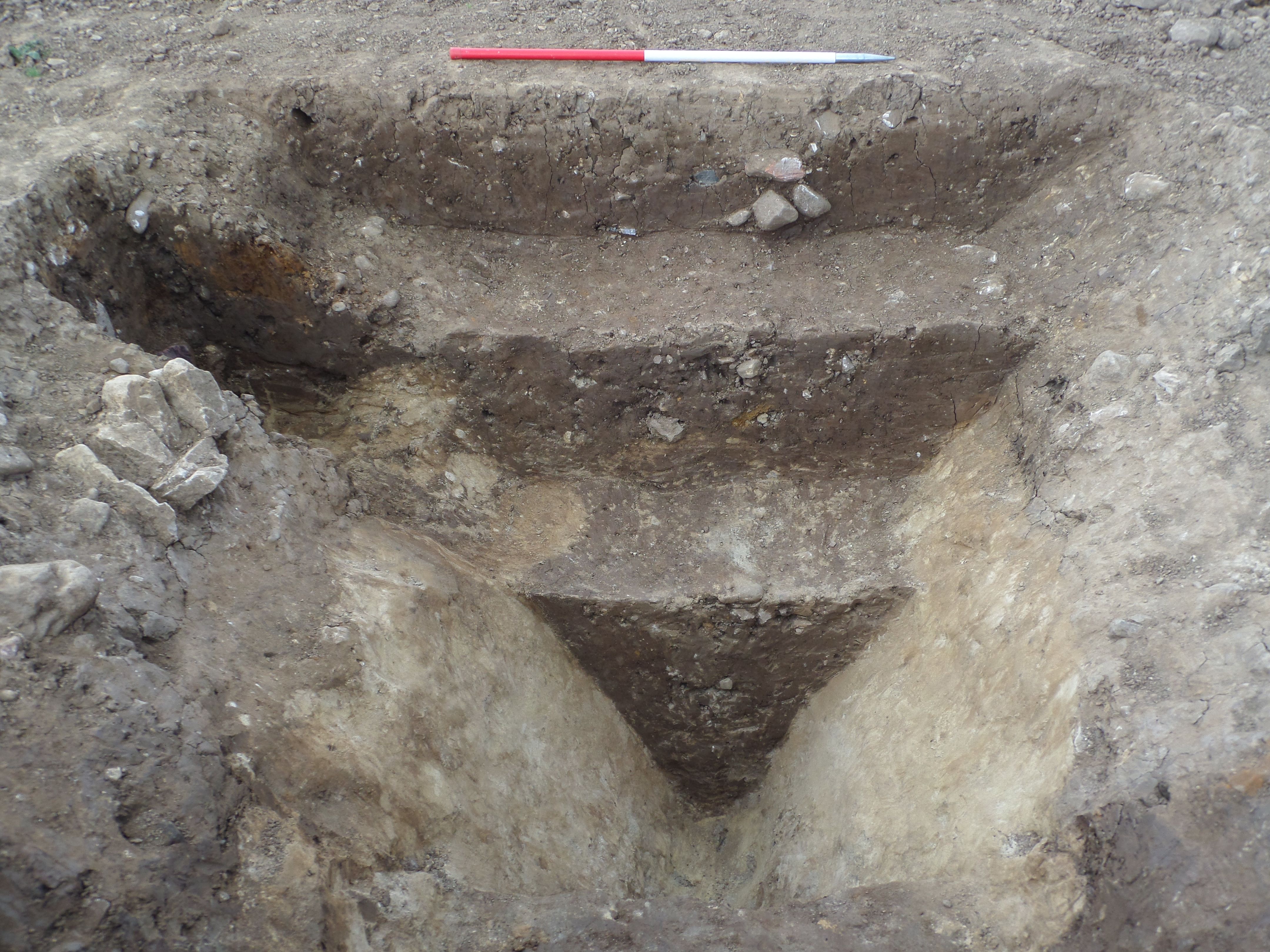
Title: Figure 3.4: section of post-pit 6849. Filename: Prehist_Ch03_Fig-04.jpg (784 kB) |
JPG |
Info
Download |

|
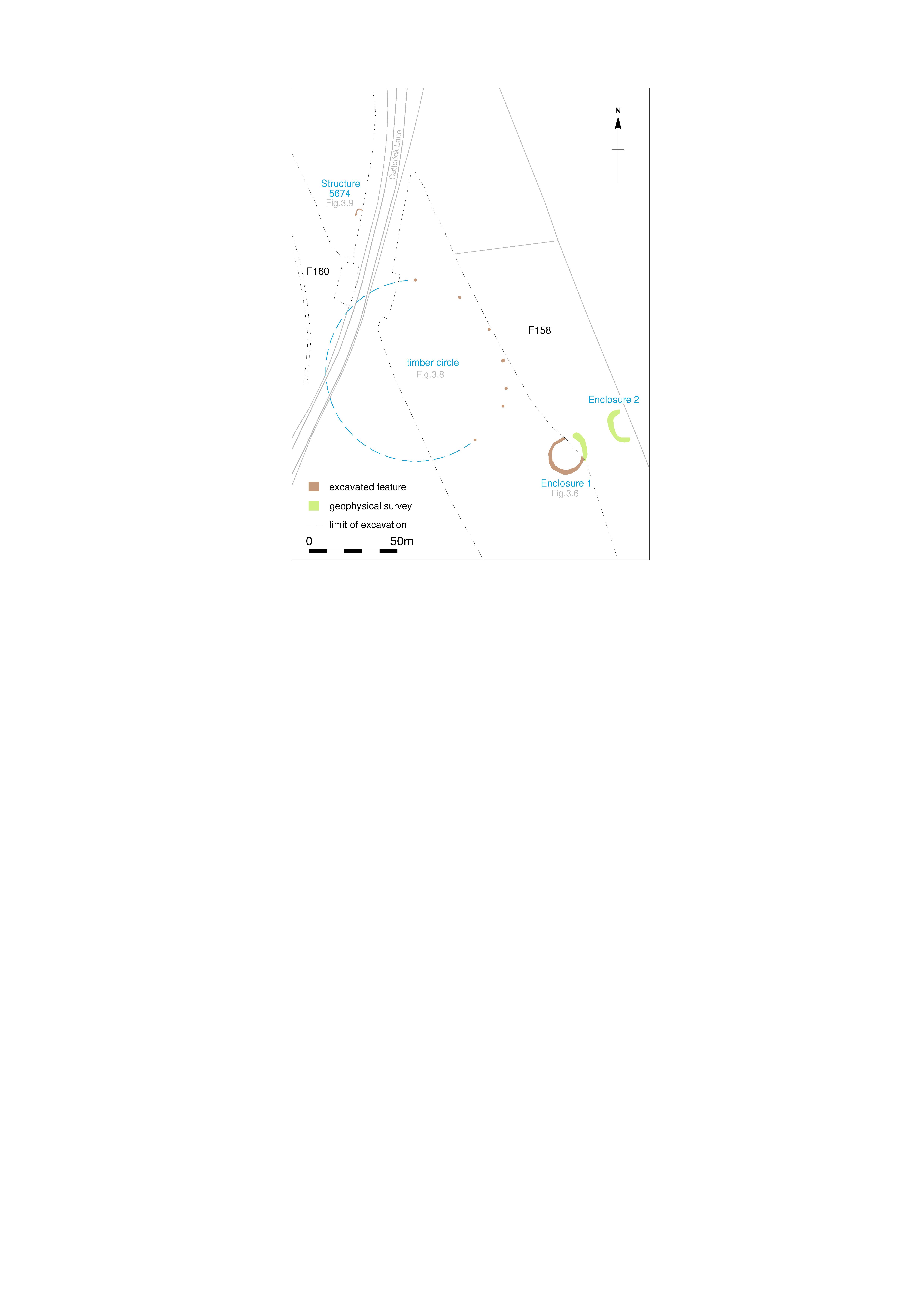
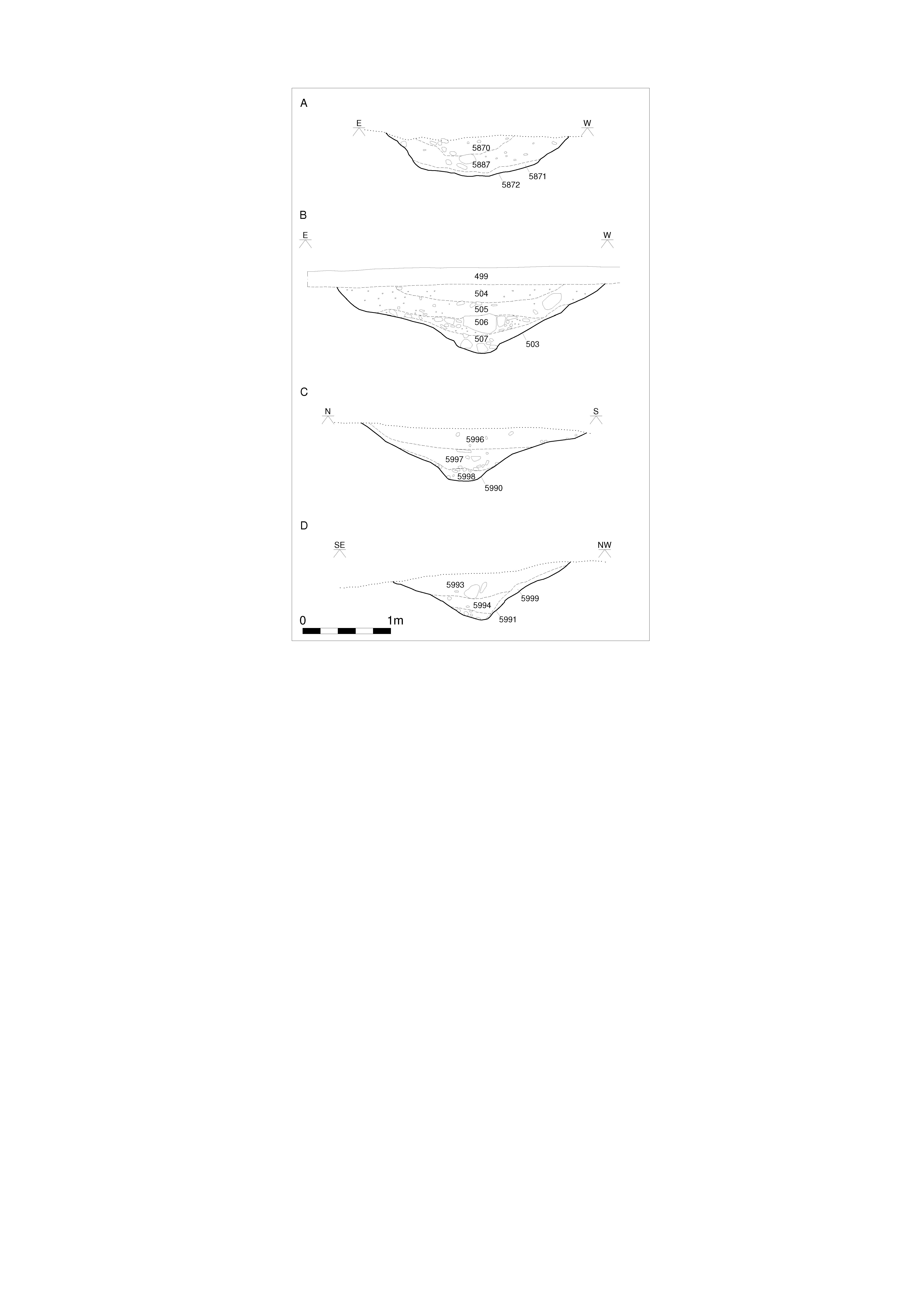
Title: Figure 3.5: ceremonial monuments in Fields 158 and 160. Filename: Prehist_Ch03_Fig-05.jpg (695 kB) |
JPG |
Info
Download |

|
Title: Figure 3.6: Bainesse Enclosure 1 plan. Filename: Prehist_Ch03_Fig-06.jpg (798 kB) |
JPG |
Info
Download |

|
Title: Figure 3.7: Bainesse Enclosure 1 sections. Filename: Prehist_Ch03_Fig-07.jpg (729 kB) |
JPG |
Info
Download |

|
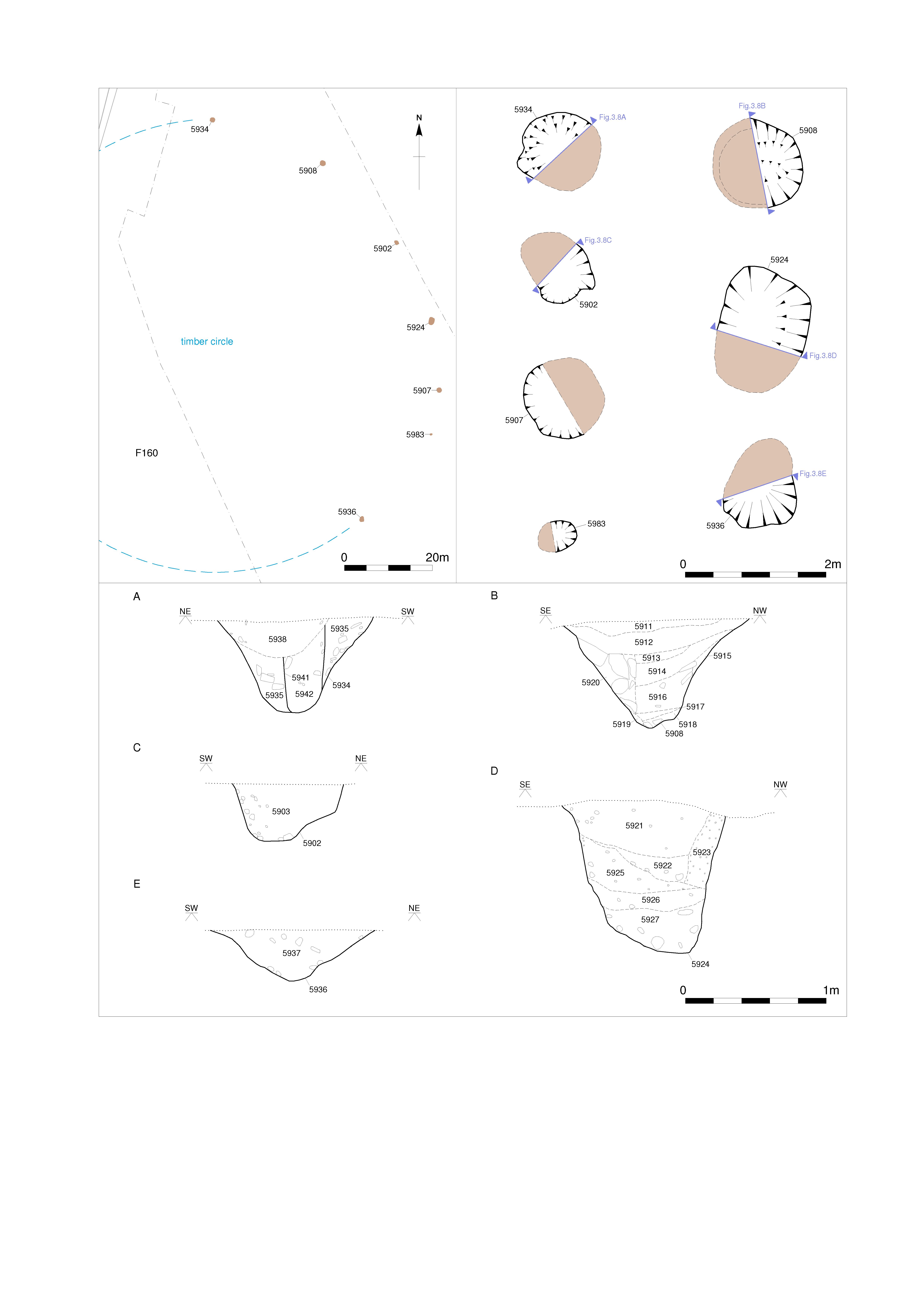
Title: Figure 3.8: Bainesse timber circle. Filename: Prehist_Ch03_Fig-08.jpg (1021 kB) |
JPG |
Info
Download |

|
Title: Figure 3.9: the Bainesse possible Neolithic structure and comparanda. Filename: Prehist_Ch03_Fig-09.jpg (894 kB) |
JPG |
Info
Download |
 in relation to the Scorton Cursus and other nearby prehistoric monuments. as a JPG image")
|
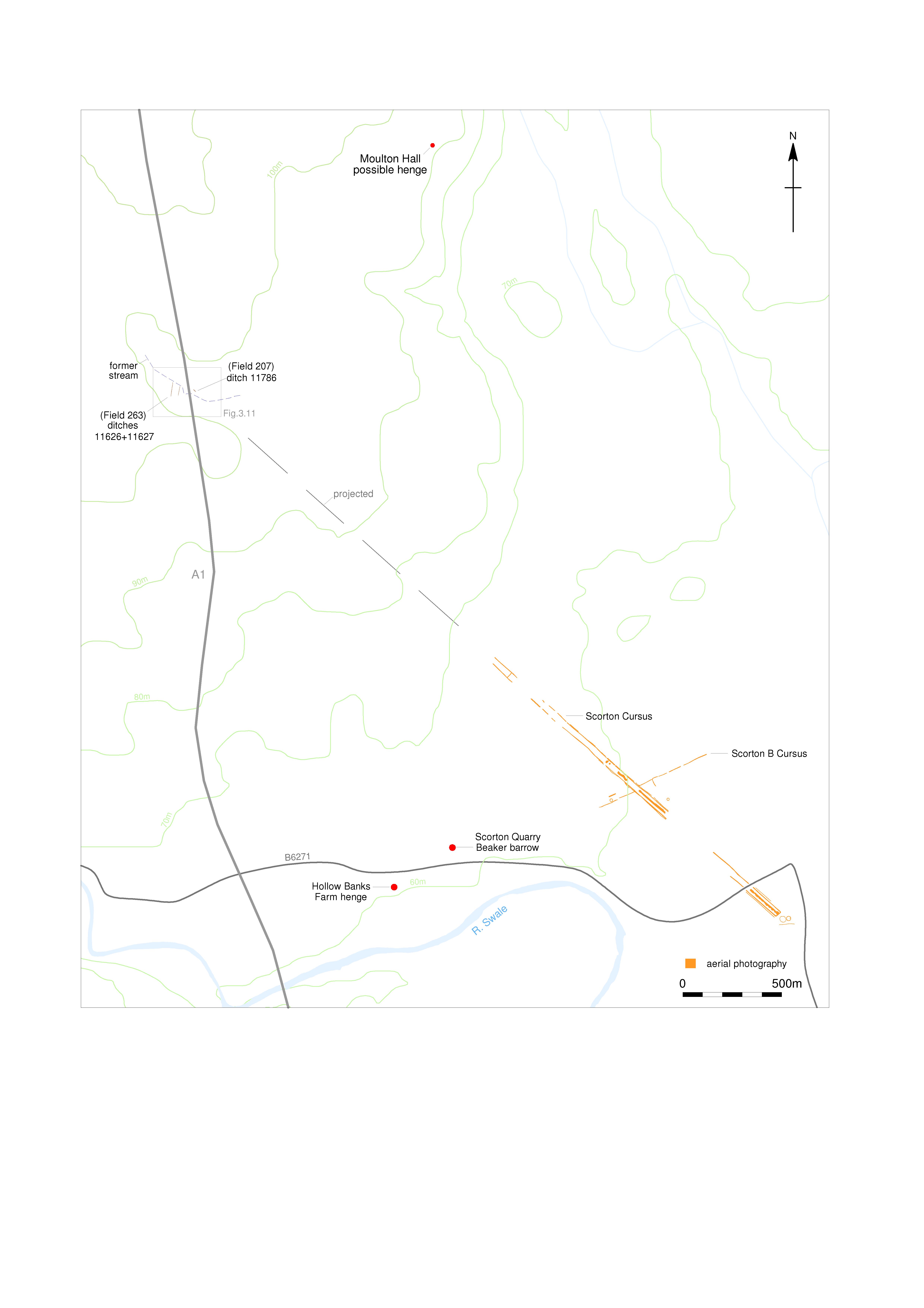
Title: Figure 3.10: features at Oak Grange (Fields 206, 207 and 263) in relation to the Scorton Cursus and other nearby prehistoric monuments. Filename: Prehist_Ch03_Fig-10.jpg (929 kB) |
JPG |
Info
Download |
. as a JPG image")
|
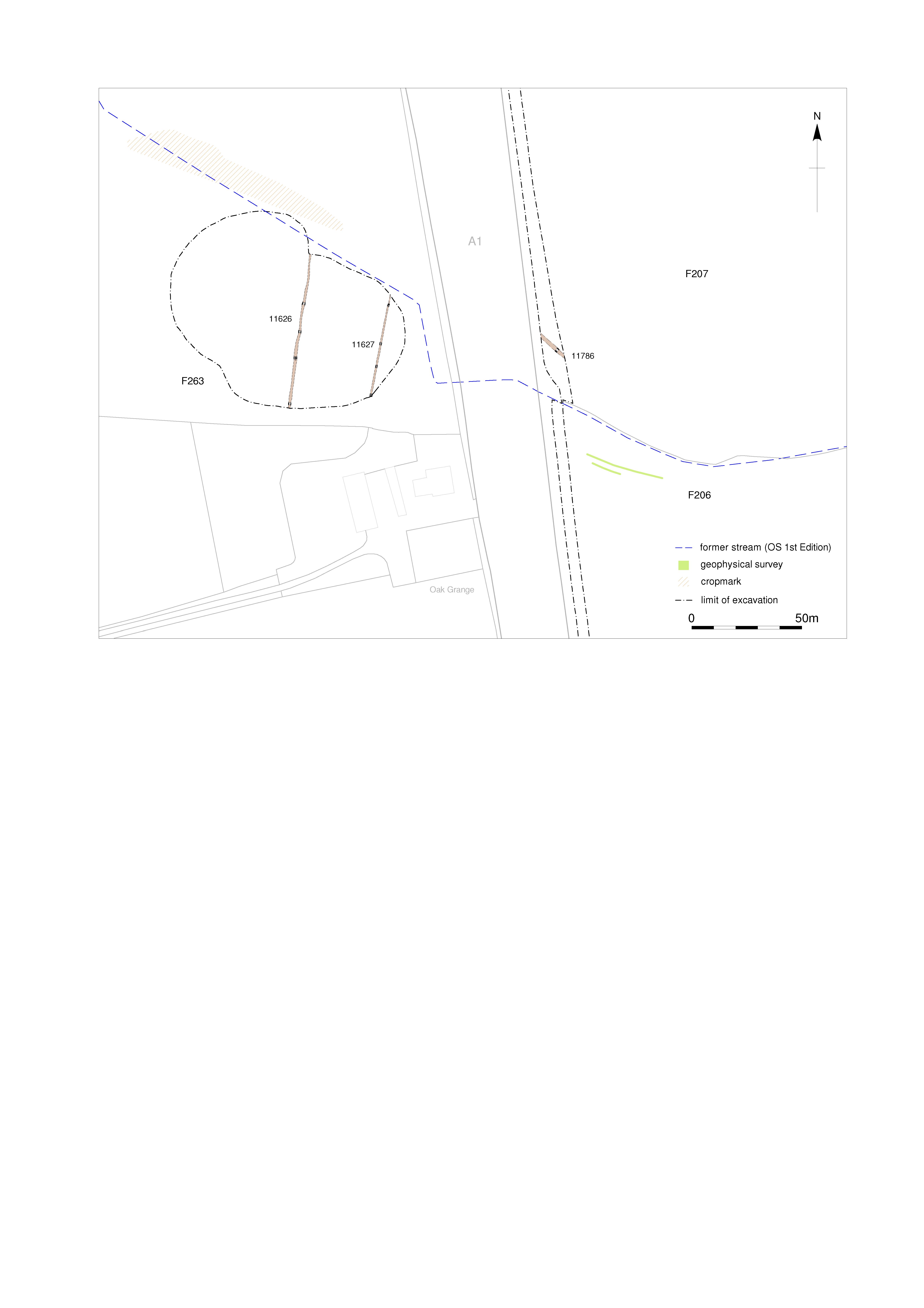
Title: Figure 3.11: features at Oak Grange (Fields 206, 207 and 263). Filename: Prehist_Ch03_Fig-11.jpg (833 kB) |
JPG |
Info
Download |

|
Title: Figure 3.12: geophysical survey of the ring-ditch in Field 220. Filename: Prehist_Ch03_Fig-12.jpg (673 kB) |
JPG |
Info
Download |

|
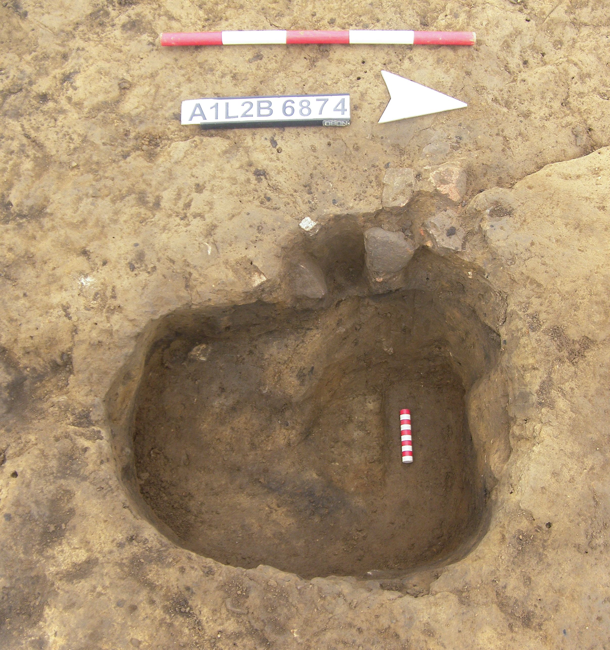
Title: Plate 3.1: post-pit 6849 showing the base of post-pipe 6874, facing south-facing west, scales 0.5 and 0.1m. Filename: Prehist_Ch03_Plate-01.jpg (1 MB) |
JPG |
Info
Download |

|
Title: Plate 3.2: Bainesse Enclosure 1 during excavation, facing east. The Bainesse cursus crossed the field beyond, with Marne Barracks in the background. Filename: Prehist_Ch03_Plate-02.jpg (4 MB) |
JPG |
Info
Download |

|
Title: Plate 3.3: impressed Ware pottery from the enclosure ditch. Filename: Prehist_Ch03_Plate-03.jpg (1 MB) |
JPG |
Info
Download |

|
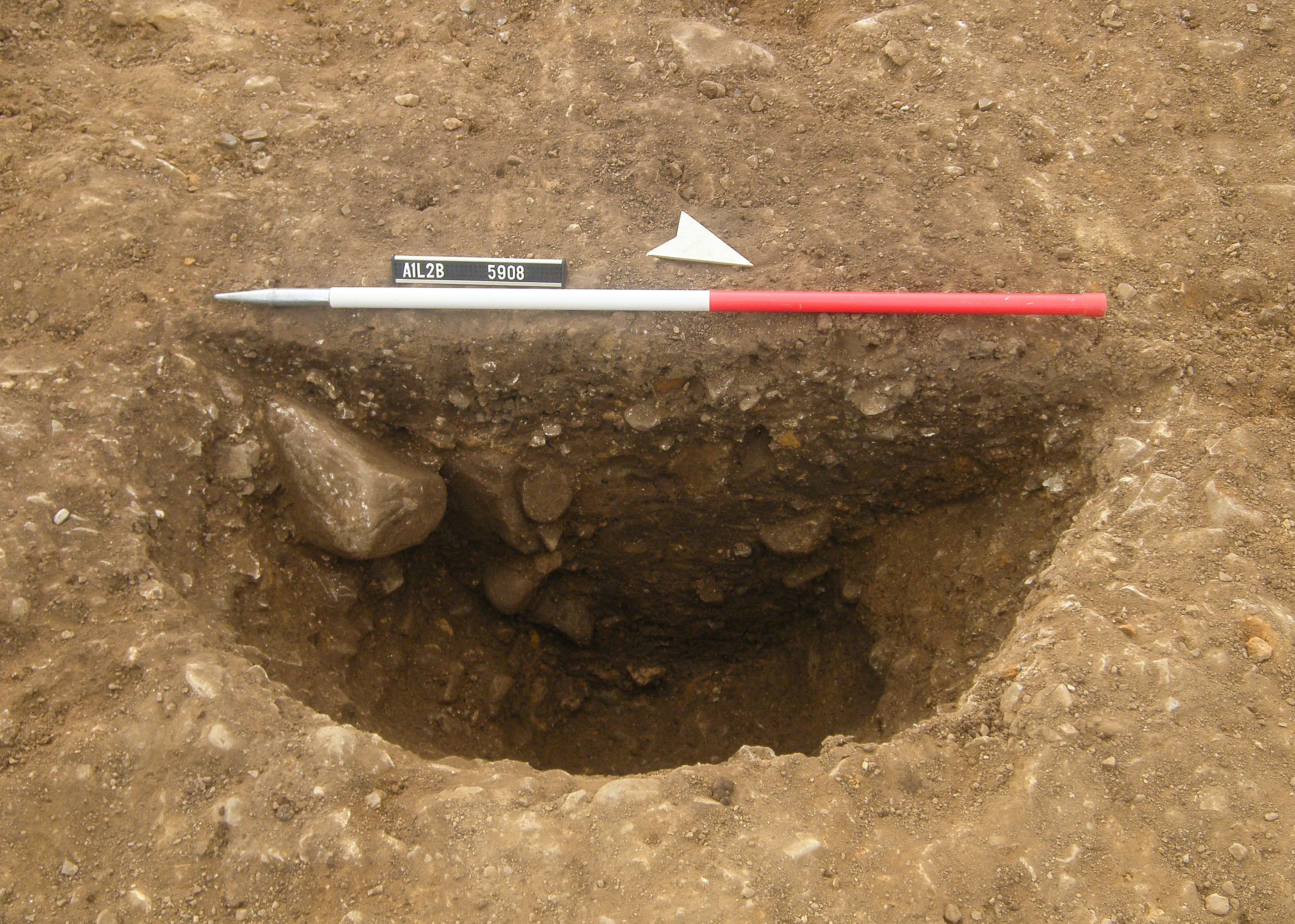
Title: Plate 3.4: post-pit 5908 half-sectioned, facing south-west, scale 1m. Filename: Prehist_Ch03_Plate-04.jpg (1 MB) |
JPG |
Info
Download |

|
Title: Plate 3.5: post-pit 5934 half-sectioned, facing south-east, scale 0.5m. Filename: Prehist_Ch03_Plate-05.jpg (1 MB) |
JPG |
Info
Download |

|
Title: Figure 4.1: other pit sites in the study area. Filename: Prehist_Ch04_Fig-01.jpg (905 kB) |
JPG |
Info
Download |

|
Title: Figure 4.2: fields on the A1 schemes with pits or other ‘domestic’ features. Filename: Prehist_Ch04_Fig-02.jpg (937 kB) |
JPG |
Info
Download |

|
Title: Figure 4.3: pits in Field 1. Filename: Prehist_Ch04_Fig-03.jpg (638 kB) |
JPG |
Info
Download |

|
Title: Figure 4.4: fieldwalking results at Baldersby Gate. Filename: Prehist_Ch04_Fig-04.jpg (855 kB) |
JPG |
Info
Download |

|
Title: Figure 4.5: pits in Fields 18–25. Filename: Prehist_Ch04_Fig-05.jpg (940 kB) |
JPG |
Info
Download |

|
Title: Figure 4.6: features in Field 19. Filename: Prehist_Ch04_Fig-06.jpg (693 kB) |
JPG |
Info
Download |

|
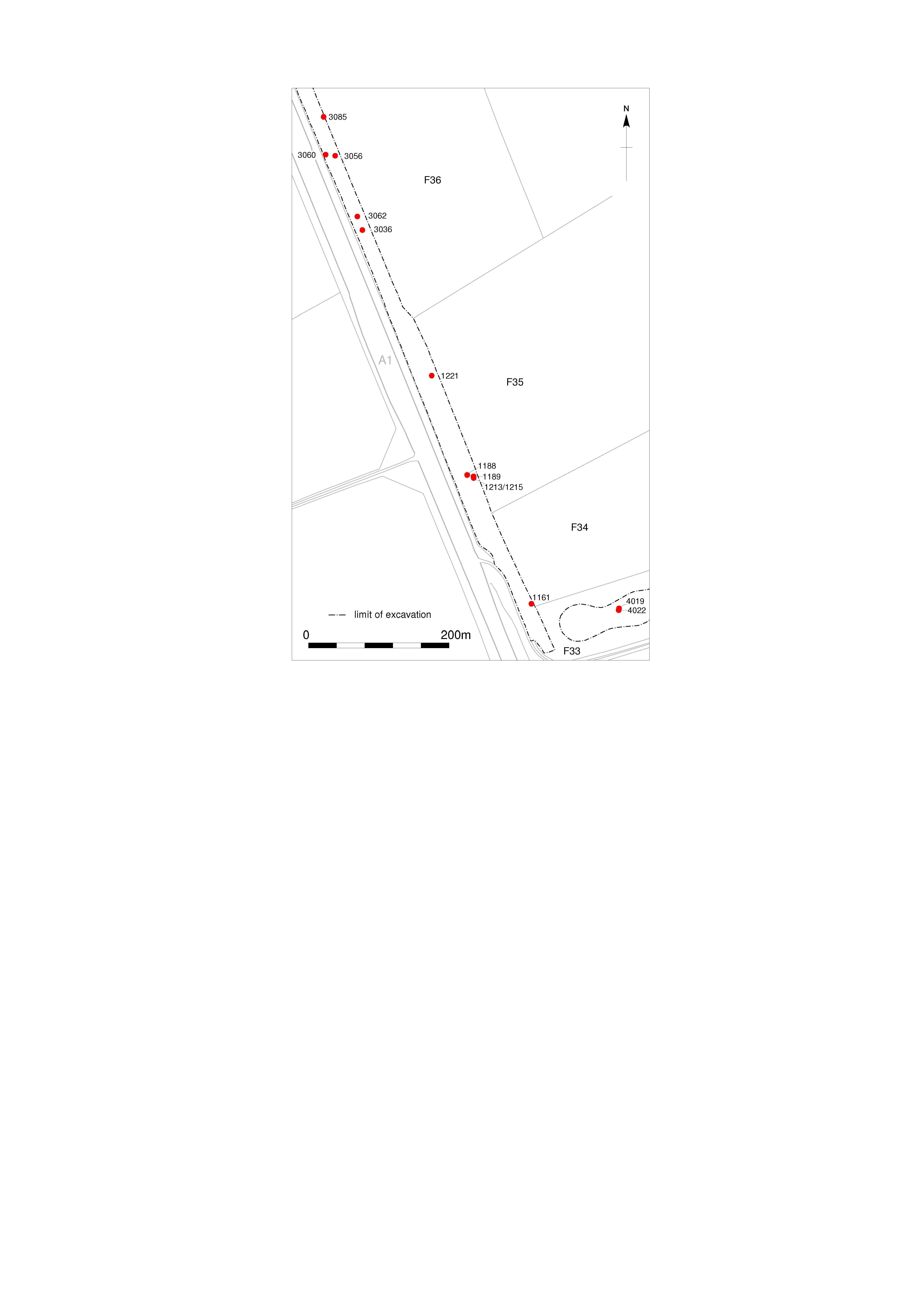
Title: Figure 4.7: pits in Fields 33–36. Filename: Prehist_Ch04_Fig-07.jpg (738 kB) |
JPG |
Info
Download |
. as a JPG image")
|
Title: Figure 4.8: Fields 33–36 pit sections (1). Filename: Prehist_Ch04_Fig-08.jpg (637 kB) |
JPG |
Info
Download |
. as a JPG image")
|
Title: Figure 4.9: Fields 33–36 pit sections (2). Filename: Prehist_Ch04_Fig-09.jpg (667 kB) |
JPG |
Info
Download |

|
Title: Figure 4.10: Howe Moor fieldwalking. Filename: Prehist_Ch04_Fig-10.jpg (847 kB) |
JPG |
Info
Download |

|
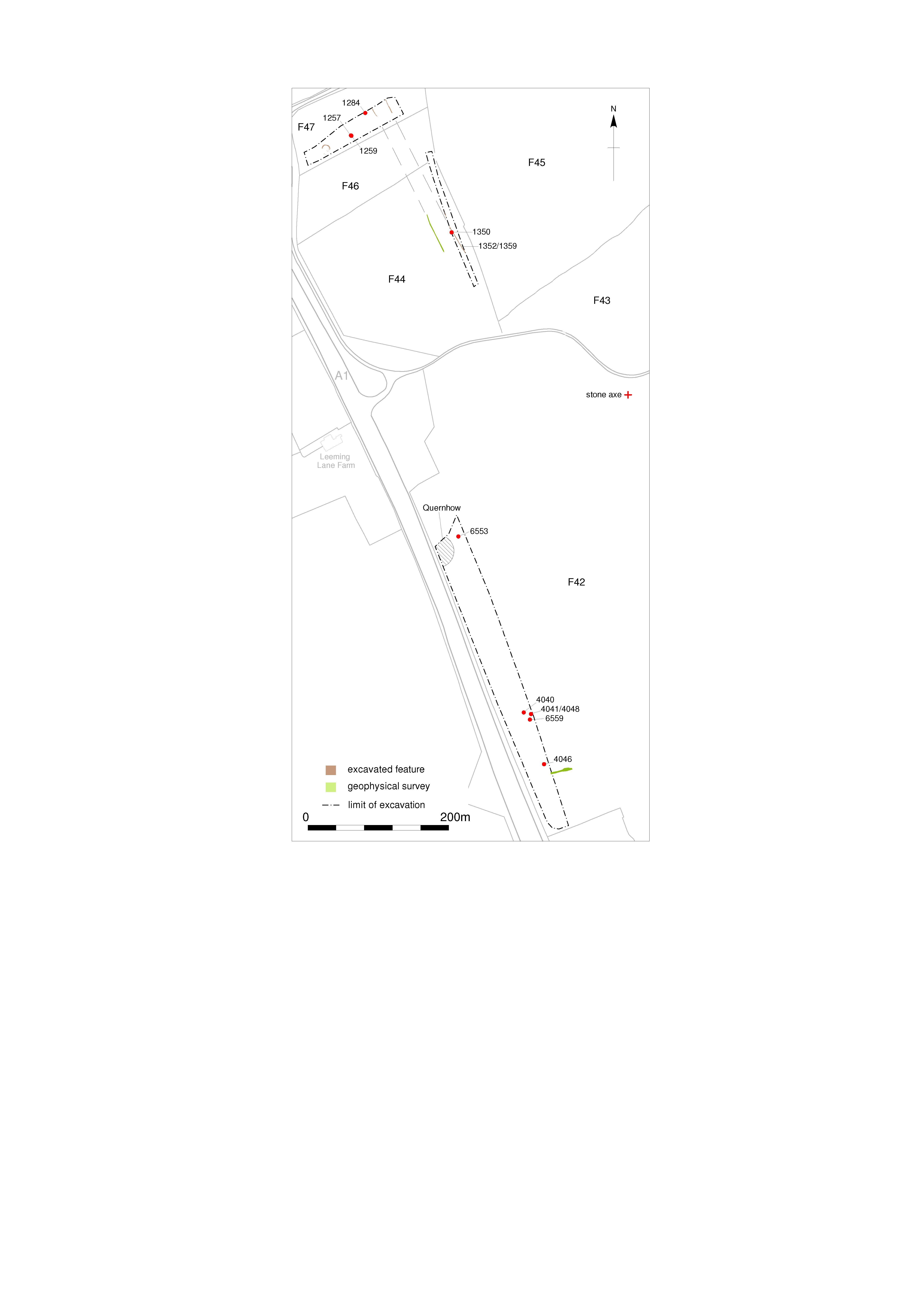
Title: Figure 4.11: pits in Fields 42–47. Filename: Prehist_Ch04_Fig-11.jpg (798 kB) |
JPG |
Info
Download |

|
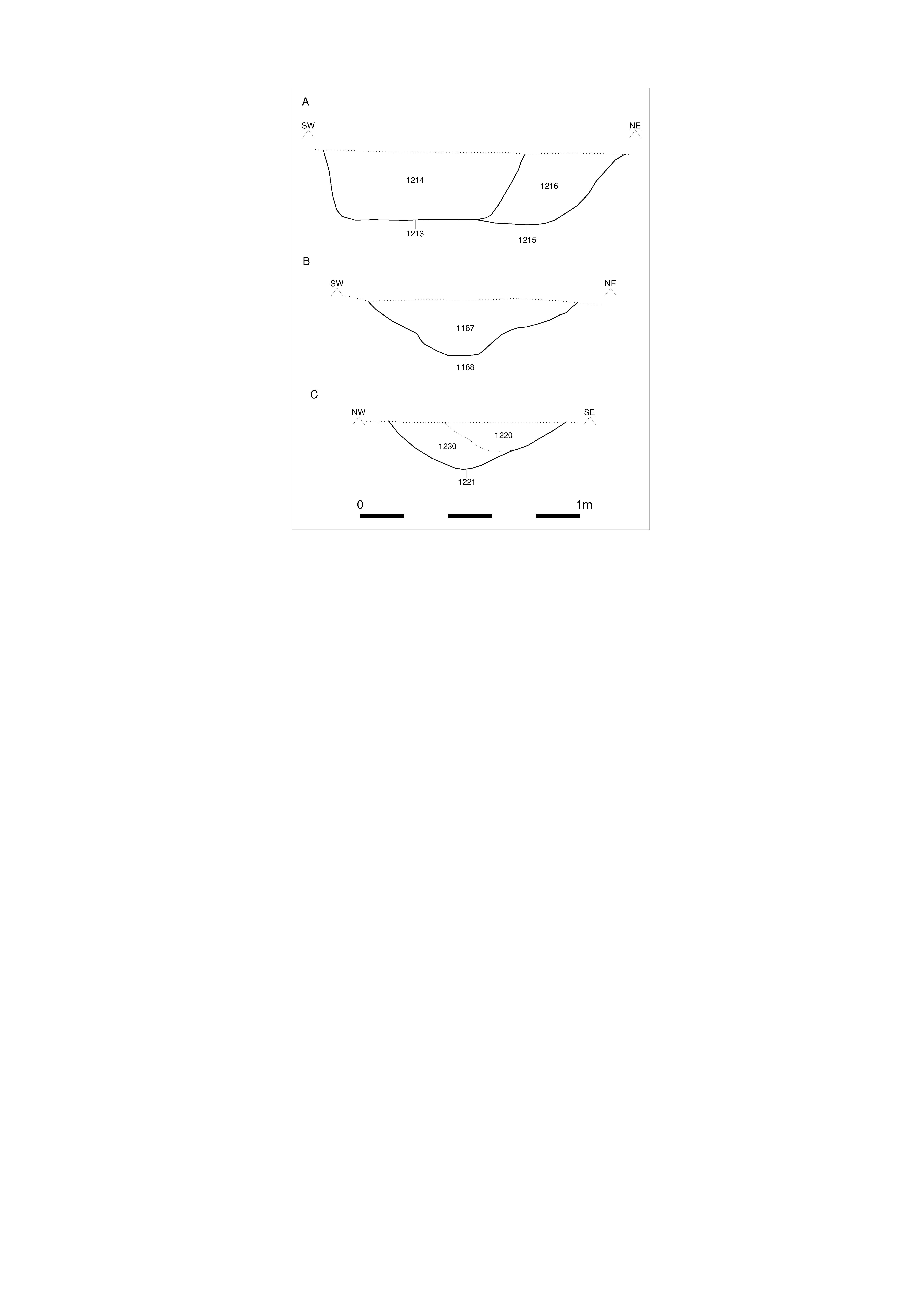
Title: Figure 4.12: pits in Field 42, sections. Filename: Prehist_Ch04_Fig-12.jpg (740 kB) |
JPG |
Info
Download |

|
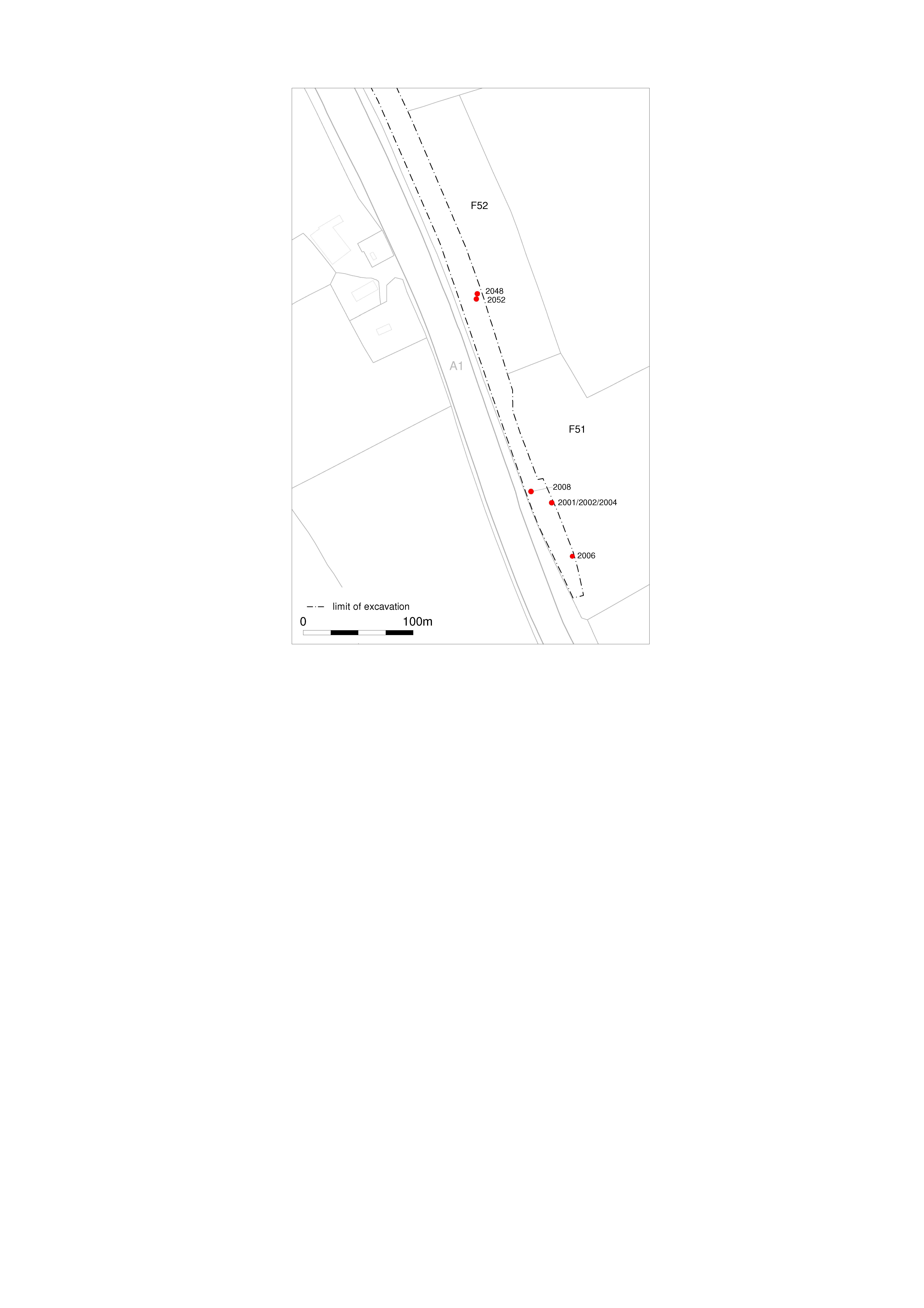
Title: Figure 4.13: pits in Fields 51 and 52. Filename: Prehist_Ch04_Fig-13.jpg (705 kB) |
JPG |
Info
Download |

|
Title: Figure 4.14: pits in Fields 60–72. Filename: Prehist_Ch04_Fig-14.jpg (1 MB) |
JPG |
Info
Download |

|
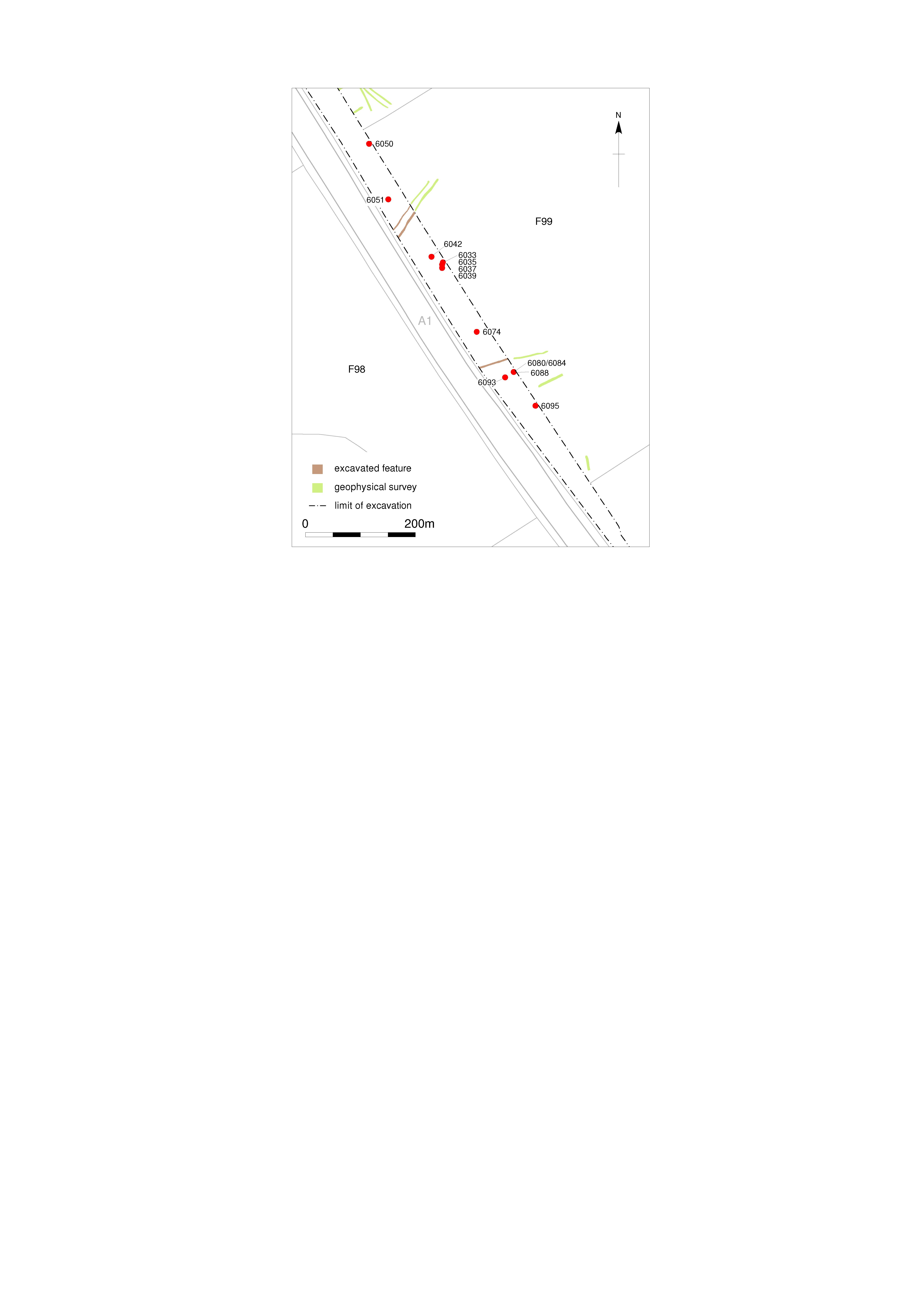
Title: Figure 4.15: Fields 99, 107 and 108 in relation to Burtree Dyke. Filename: Prehist_Ch04_Fig-15.jpg (880 kB) |
JPG |
Info
Download |

|
Title: Figure 4.16: pits in Field 99. Filename: Prehist_Ch04_Fig-16.jpg (718 kB) |
JPG |
Info
Download |

|
Title: Figure 4.17: pits in Fields 107 and 108. Filename: Prehist_Ch04_Fig-17.jpg (788 kB) |
JPG |
Info
Download |

|
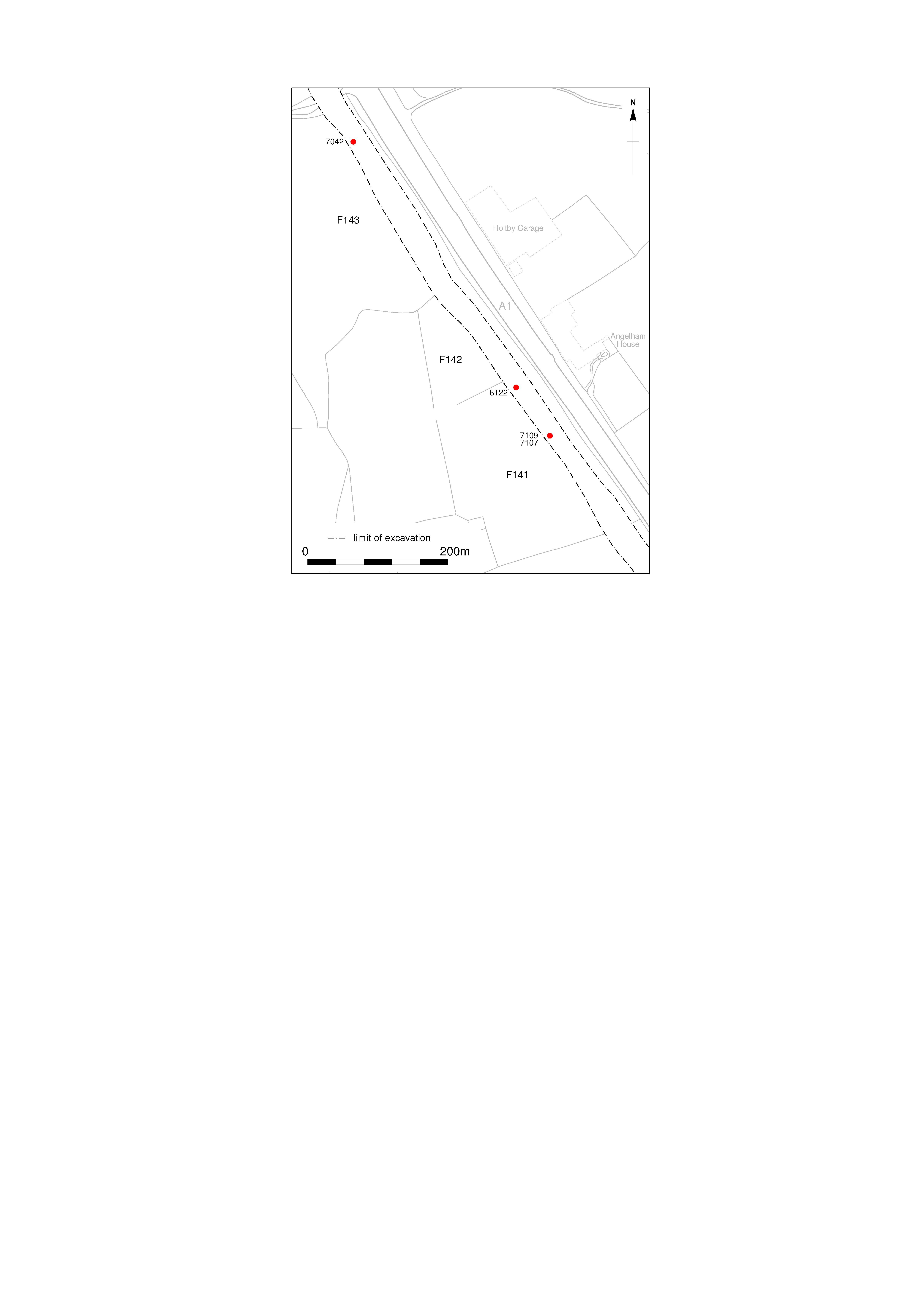
Title: Figure 4.18: pits in Fields 141 and 143. Filename: Prehist_Ch04_Fig-18.jpg (727 kB) |
JPG |
Info
Download |

|
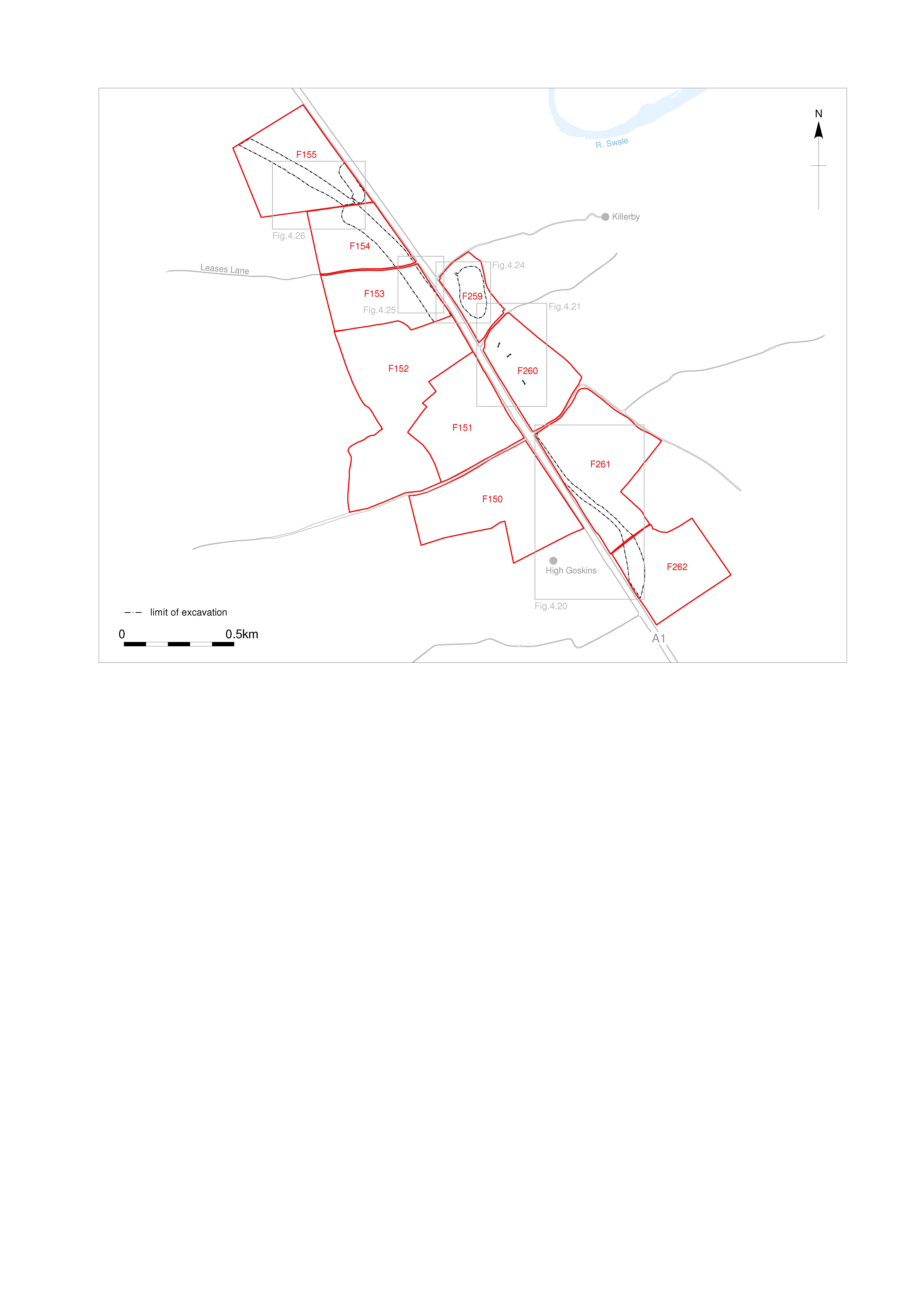
Title: Figure 4.19: Fields 259–262 and 150–155. Filename: Prehist_Ch04_Fig-19.jpg (919 kB) |
JPG |
Info
Download |

|
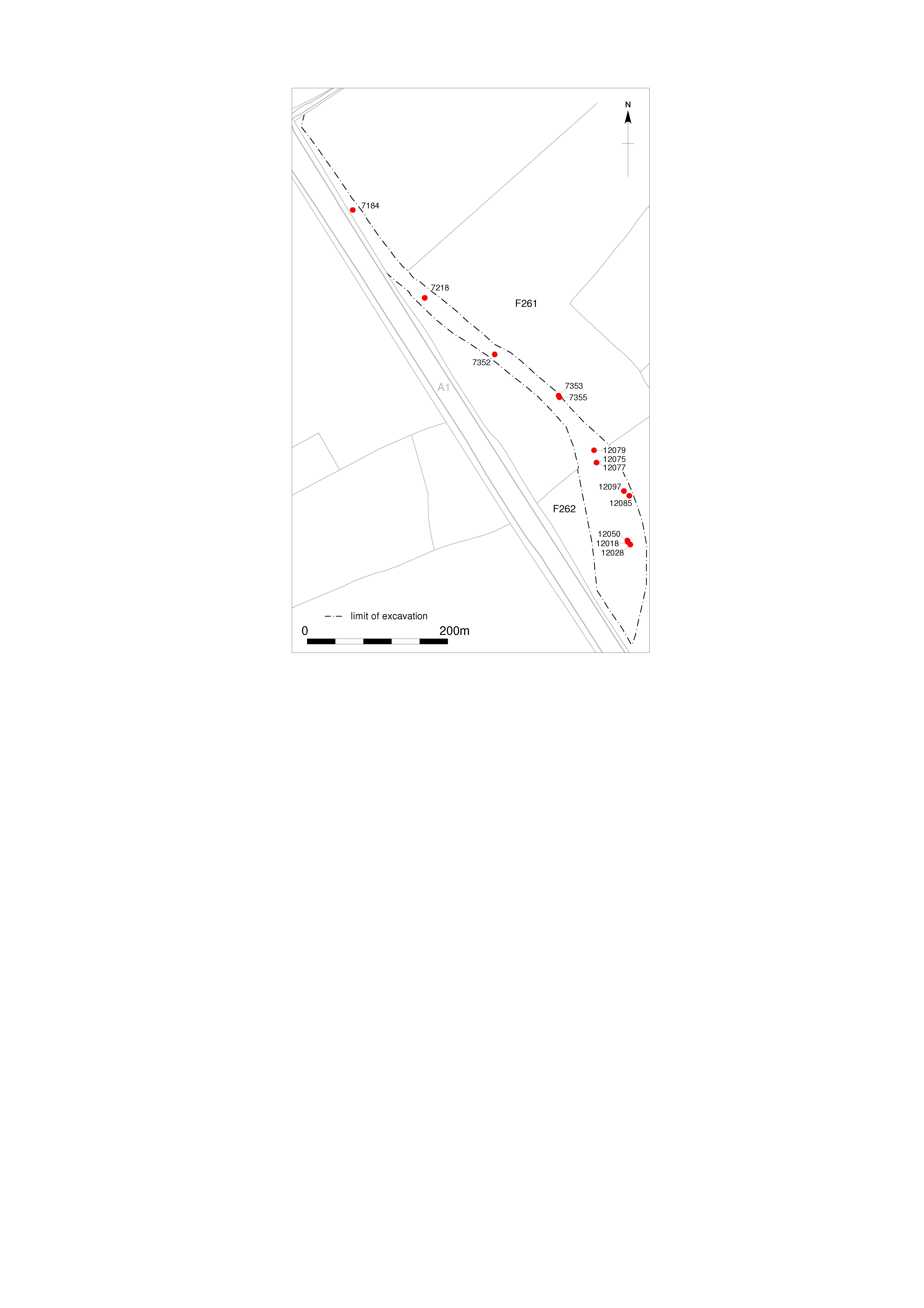
Title: Figure 4.20: pits in Fields 262 and 261. Filename: Prehist_Ch04_Fig-20.jpg (727 kB) |
JPG |
Info
Download |

|
Title: Figure 4.21: evaluation trenches and auger survey results in Field 260. Filename: Prehist_Ch04_Fig-21.jpg (732 kB) |
JPG |
Info
Download |

|
Title: Figure 4.22: Field 260 Trench B14. Filename: Prehist_Ch04_Fig-22.jpg (653 kB) |
JPG |
Info
Download |

|
Title: Figure 4.23: Field 260 Trench B16. Filename: Prehist_Ch04_Fig-23.jpg (606 kB) |
JPG |
Info
Download |

|
Title: Figure 4.24: features in Field 259. Filename: Prehist_Ch04_Fig-24.jpg (1 MB) |
JPG |
Info
Download |
. as a JPG image")
|
Title: Figure 4.25: features in Fields 153 and 154 (southern end). Filename: Prehist_Ch04_Fig-25.jpg (892 kB) |
JPG |
Info
Download |
 and 155. as a JPG image")
|
Title: Figure 4.26: pits in Fields 154 (northern end) and 155. Filename: Prehist_Ch04_Fig-26.jpg (715 kB) |
JPG |
Info
Download |

|
Title: Figure 4.27: pits in Fields 157 and 158/159. Filename: Prehist_Ch04_Fig-27.jpg (720 kB) |
JPG |
Info
Download |

|
Title: Figure 4.28: pits in Fields 160 and 162. Filename: Prehist_Ch04_Fig-28.jpg (733 kB) |
JPG |
Info
Download |
. as a JPG image")
|
Title: Figure 4.29: pits in Fields 163N, 164S and 164 (south-east half). Filename: Prehist_Ch04_Fig-29.jpg (903 kB) |
JPG |
Info
Download |

|
Title: Figure 4.30: pit sections. Filename: Prehist_Ch04_Fig-30.jpg (672 kB) |
JPG |
Info
Download |
 and 165. as a JPG image")
|
Title: Figure 4.31: features in Fields 164 (north-western half) and 165. Filename: Prehist_Ch04_Fig-31.jpg (982 kB) |
JPG |
Info
Download |

|
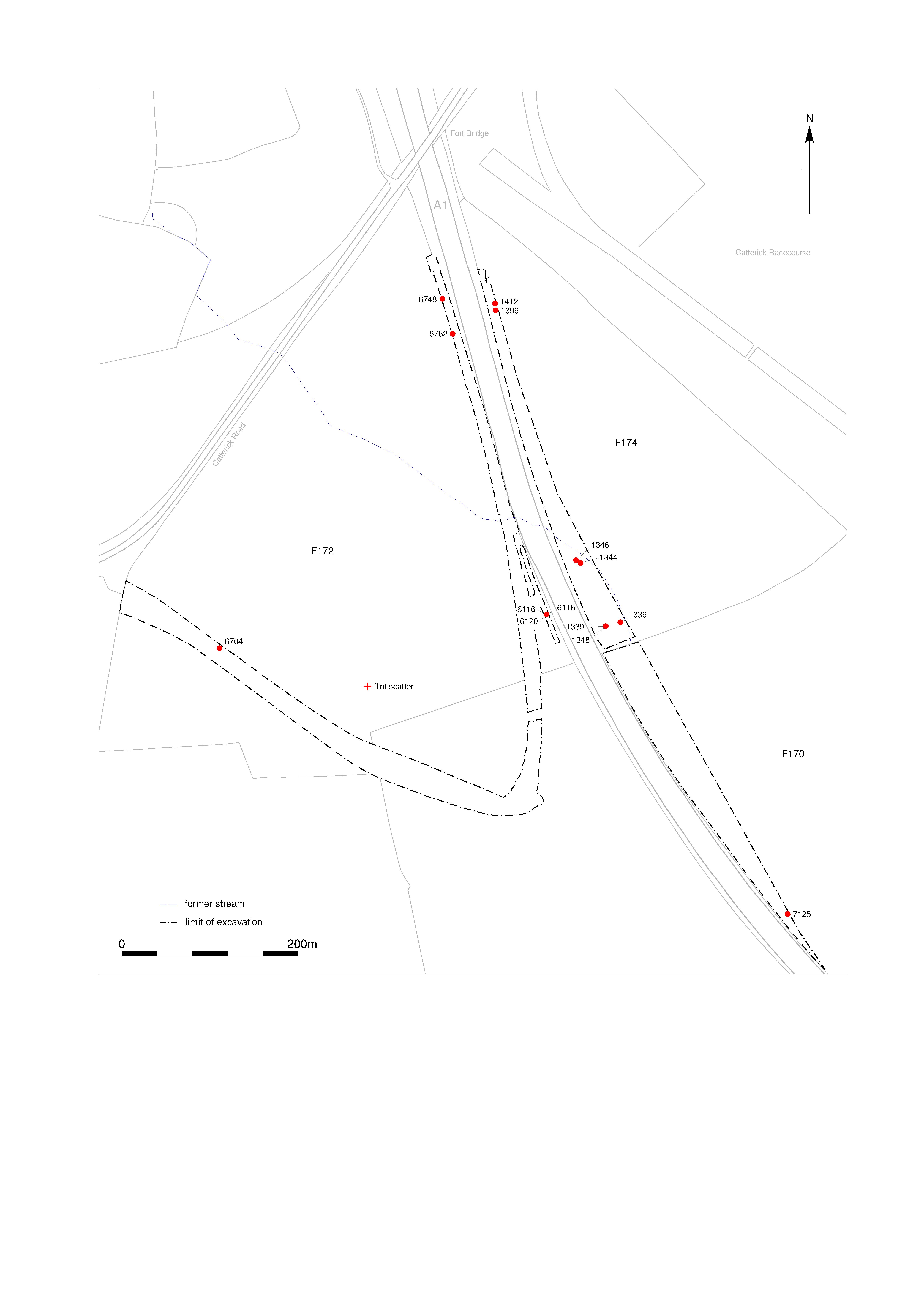
Title: Figure 4.32: pits and flint scatter in Fields 170, 172 and 174. Filename: Prehist_Ch04_Fig-32.jpg (992 kB) |
JPG |
Info
Download |

|
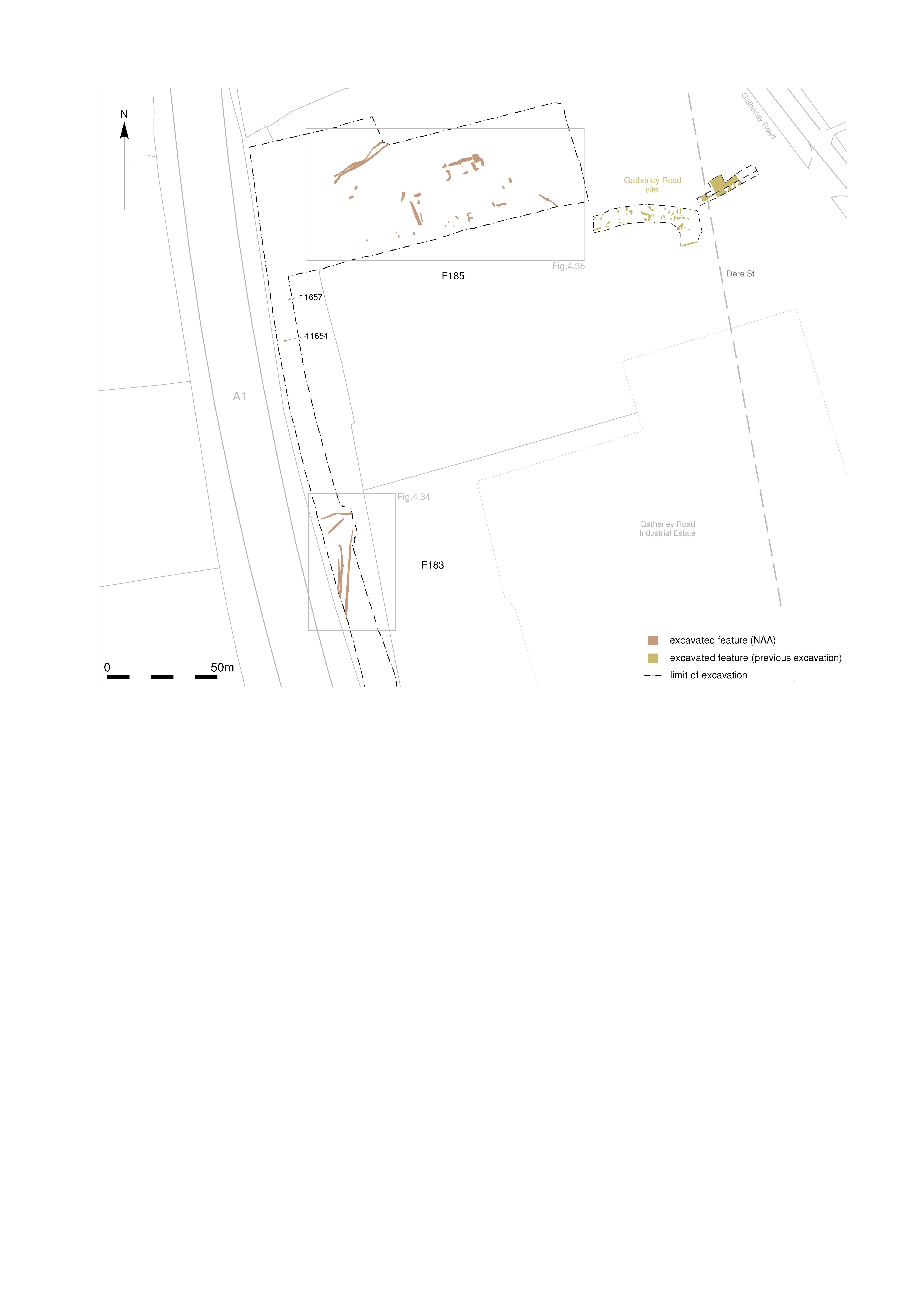
Title: Figure 4.33: location of excavated areas in Fields 183, Field 185 and the previous Gatherley Road excavation. Filename: Prehist_Ch04_Fig-33.jpg (842 kB) |
JPG |
Info
Download |

|
Title: Figure 4.34: plan of ditches in Field 183. Filename: Prehist_Ch04_Fig-34.jpg (727 kB) |
JPG |
Info
Download |

|
Title: Figure 4.35: features in Field 185. Filename: Prehist_Ch04_Fig-35.jpg (782 kB) |
JPG |
Info
Download |

|
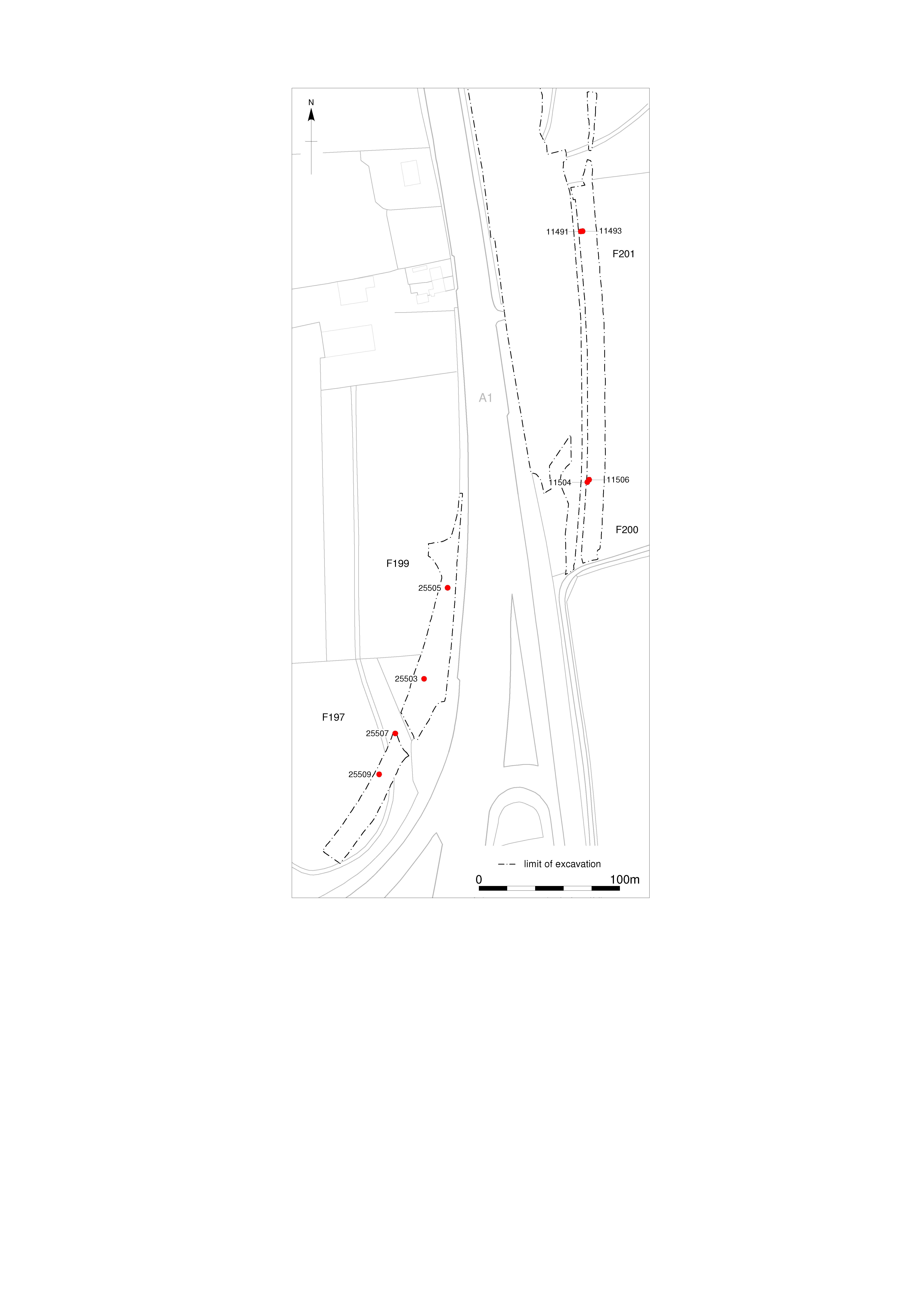
Title: Figure 4.36: pits in Fields 197–201. Filename: Prehist_Ch04_Fig-36.jpg (816 kB) |
JPG |
Info
Download |

|
Title: Figure 4.37: pits in Fields 211 and 214. Filename: Prehist_Ch04_Fig-37.jpg (771 kB) |
JPG |
Info
Download |

|
Title: Figure 4.38: pits in Fields 217, 219 and 220. Filename: Prehist_Ch04_Fig-38.jpg (859 kB) |
JPG |
Info
Download |

|
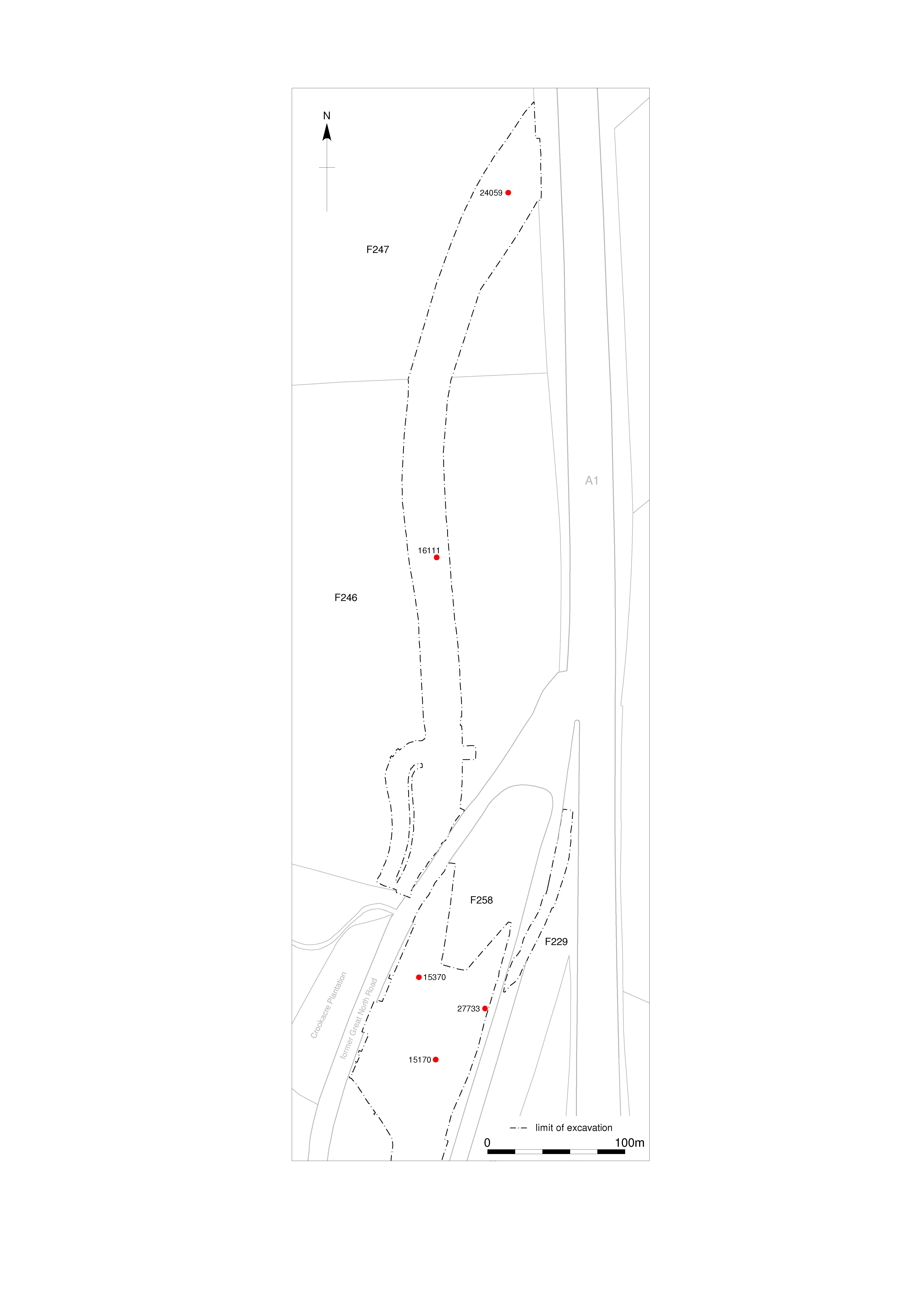
Title: Figure 4.39: pits in Fields 258, 246 and 247. Filename: Prehist_Ch04_Fig-39.jpg (801 kB) |
JPG |
Info
Download |

|
Title: Figure 4.40: pits in Field 236. Filename: Prehist_Ch04_Fig-40.jpg (632 kB) |
JPG |
Info
Download |

|
Title: Figure 4.41: sections of pits in Field 236. Filename: Prehist_Ch04_Fig-41.jpg (596 kB) |
JPG |
Info
Download |

|
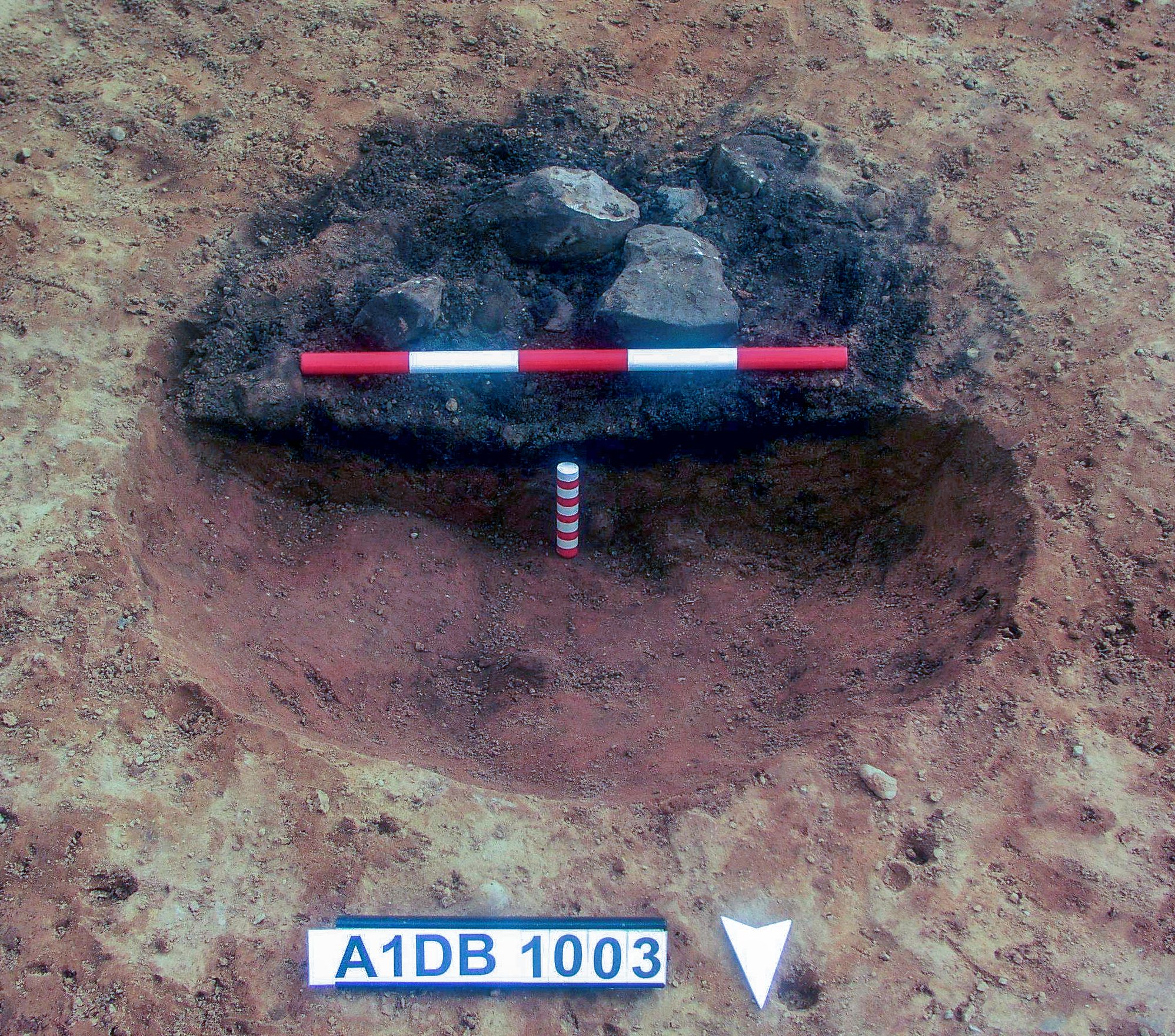
Title: Plate 4.1: pit 1003 half-sectioned, facing south, scales 0.5m and 0.1m. Filename: Prehist_Ch04_Plate-01.jpg (1 MB) |
JPG |
Info
Download |

|
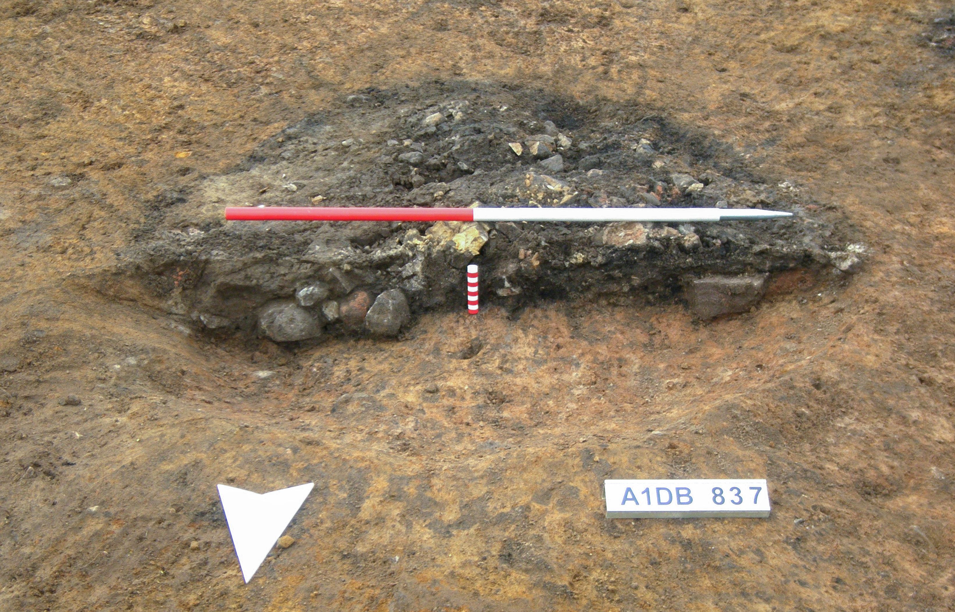
Title: Plate 4.2: pit 837 half-sectioned, facing south, scales 1m and 0.1m. Filename: Prehist_Ch04_Plate-02.jpg (1 MB) |
JPG |
Info
Download |

|
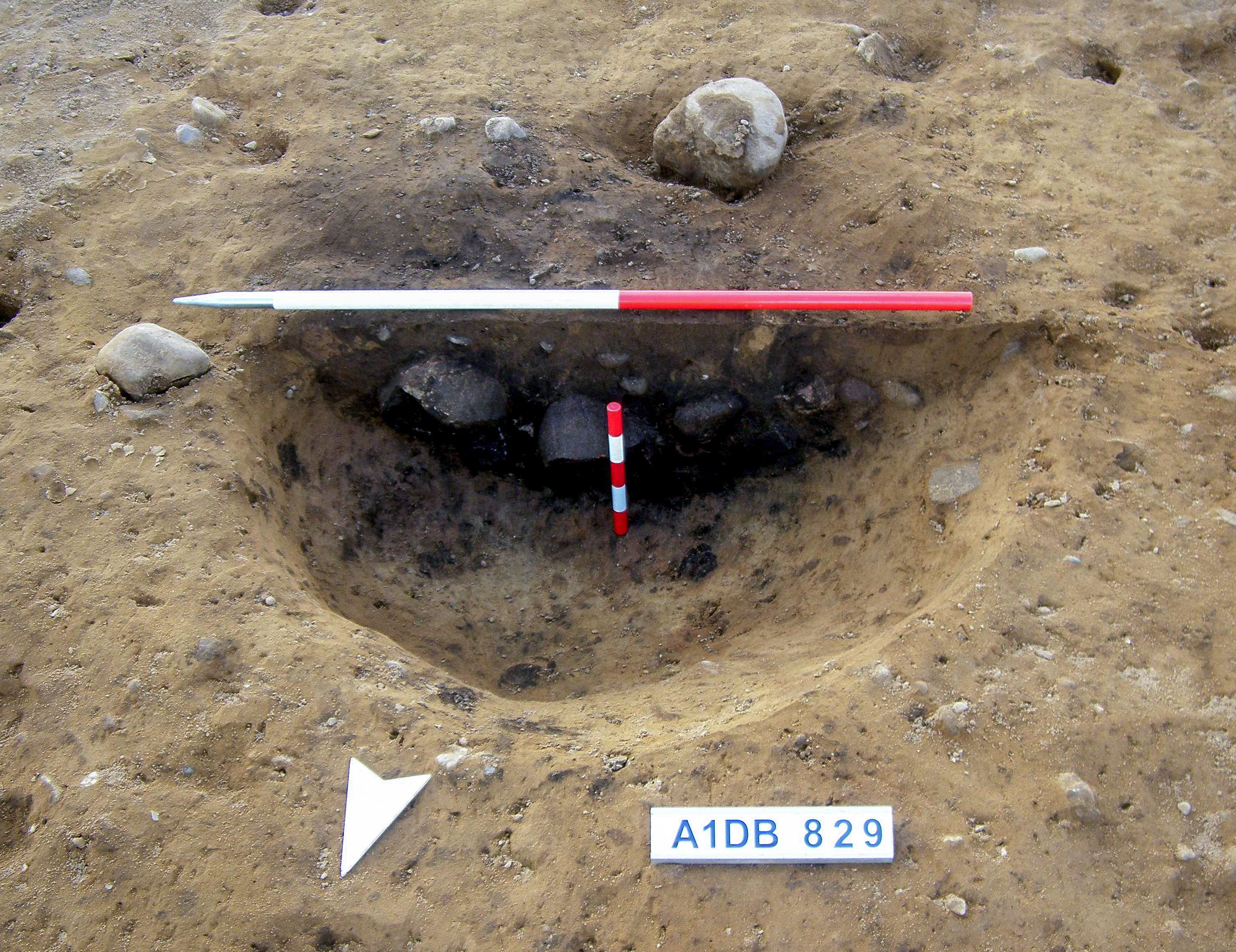
Title: Plate 4.3: pit 829 half-sectioned, facing south, scales 1m and 0.25m. Filename: Prehist_Ch04_Plate-03.jpg (1 MB) |
JPG |
Info
Download |

|
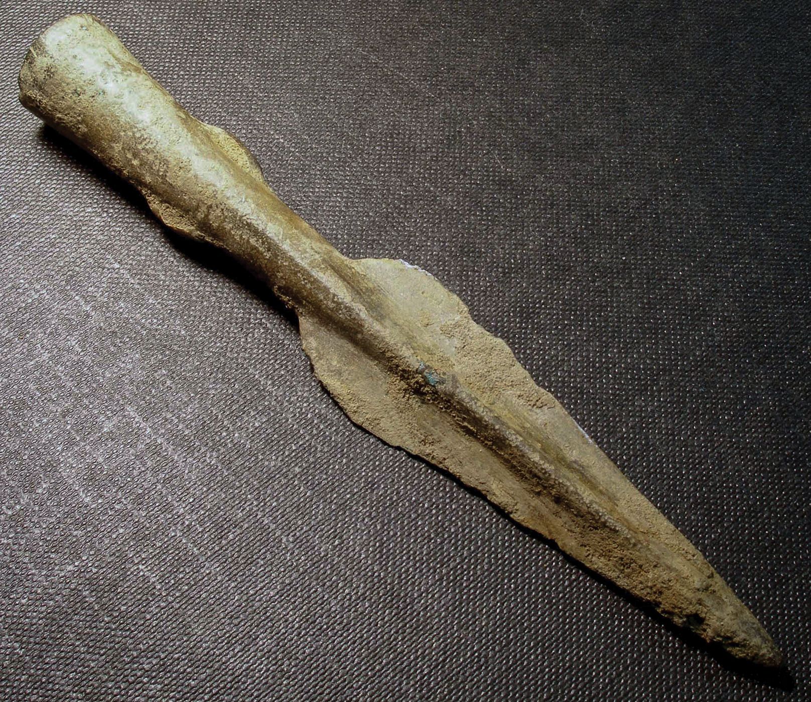
Title: Plate 4.4: spearhead from Field 39. Filename: Prehist_Ch04_Plate-04.jpg (655 kB) |
JPG |
Info
Download |

|
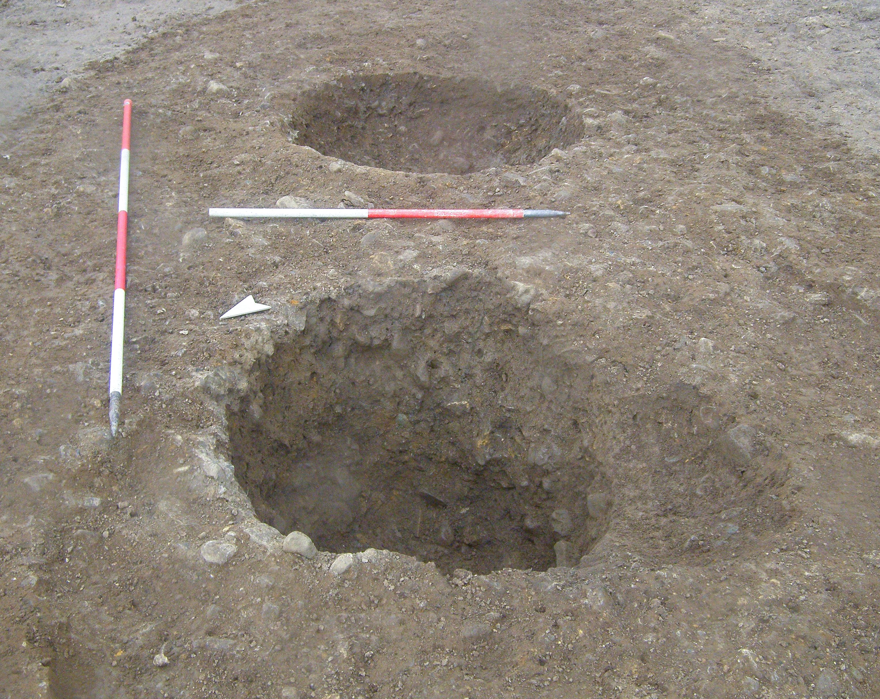
Title: Plate 4.5: pit 6051 during excavation, facing west. Filename: Prehist_Ch04_Plate-05.jpg (1 MB) |
JPG |
Info
Download |

|
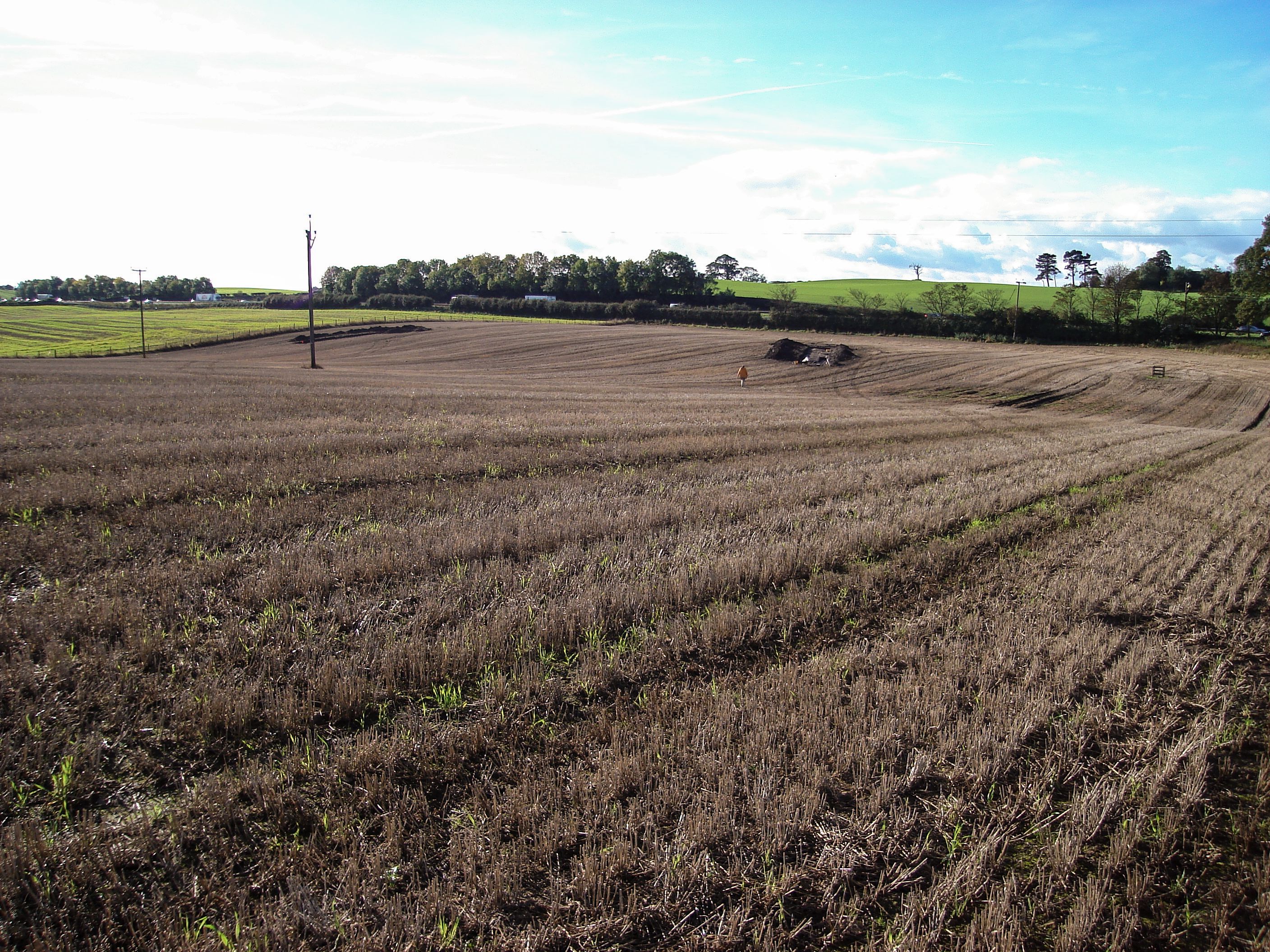
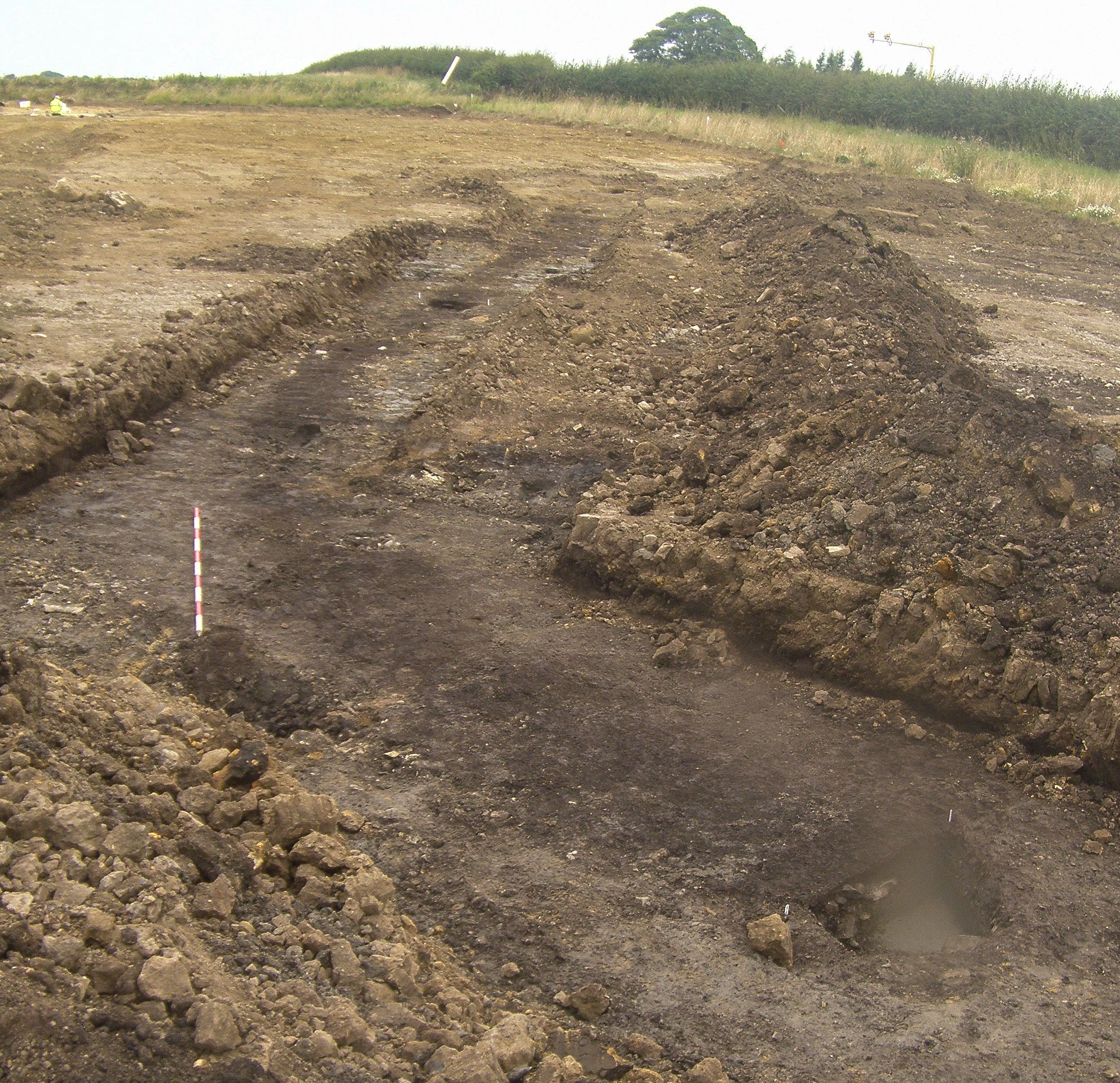
Title: Plate 4.6: view to the south-west across Field 260 from Pike Hill towards the A1 showing the peat-filled basin. Filename: Prehist_Ch04_Plate-06.jpg (1 MB) |
JPG |
Info
Download |

|
Title: Plate 4.7: pit 689 showing the overlying peat layer. Facing north, scales 2m, 1m and 0.5m. Filename: Prehist_Ch04_Plate-07.jpg (447 kB) |
JPG |
Info
Download |

|
Title: Plate 4.8: pit 6832 half-sectioned, facing east, scales 0.5m and 0.1m. Filename: Prehist_Ch04_Plate-08.jpg (1 MB) |
JPG |
Info
Download |

|
Title: Plate 4.9: pit 6851 pre-excavation, facing west, scale 1m. Filename: Prehist_Ch04_Plate-09.jpg (1 MB) |
JPG |
Info
Download |

|
Title: Plate 4.10: gully 10634 facing north, showing the overlying peat and the high ground between Fields 153 and 154. Scale 2m. Filename: Prehist_Ch04_Plate-10.jpg (1 MB) |
JPG |
Info
Download |

|
Title: Plate 4.11: pit 7362 half-sectioned, facing west, scale 0.5m. Filename: Prehist_Ch04_Plate-11.jpg (1 MB) |
JPG |
Info
Download |

|
Title: Plate 4.12: polished stone axe from Field 155. Filename: Prehist_Ch04_Plate-12.jpg (1 MB) |
JPG |
Info
Download |

|
Title: Plate 4.13: pit 4129 half-sectioned, showing pottery in situ, scale 0.25m. Filename: Prehist_Ch04_Plate-13.jpg (2 MB) |
JPG |
Info
Download |

|
Title: Plate 4.14: detail of pottery in situ in pit 4129, scale 0.1m. Filename: Prehist_Ch04_Plate-14.jpg (1 MB) |
JPG |
Info
Download |

|
Title: Plate 4.15: Grooved Ware pottery from pit 4129. Filename: Prehist_Ch04_Plate-15.jpg (770 kB) |
JPG |
Info
Download |

|
Title: Plate 4.16: pits 4129, 4162 and 4279 fully excavated, facing south-east, scales 1m and 2m. Filename: Prehist_Ch04_Plate-16.jpg (1 MB) |
JPG |
Info
Download |

|
Title: Plate 4.17: pit 15370. Scale 1m. Filename: Prehist_Ch04_Plate-17.jpg (1 MB) |
JPG |
Info
Download |

|
Title: Plate 4.18: pits 16553 and 16555, facing south-west, scale 1m. Filename: Prehist_Ch04_Plate-18.jpg (1 MB) |
JPG |
Info
Download |

|
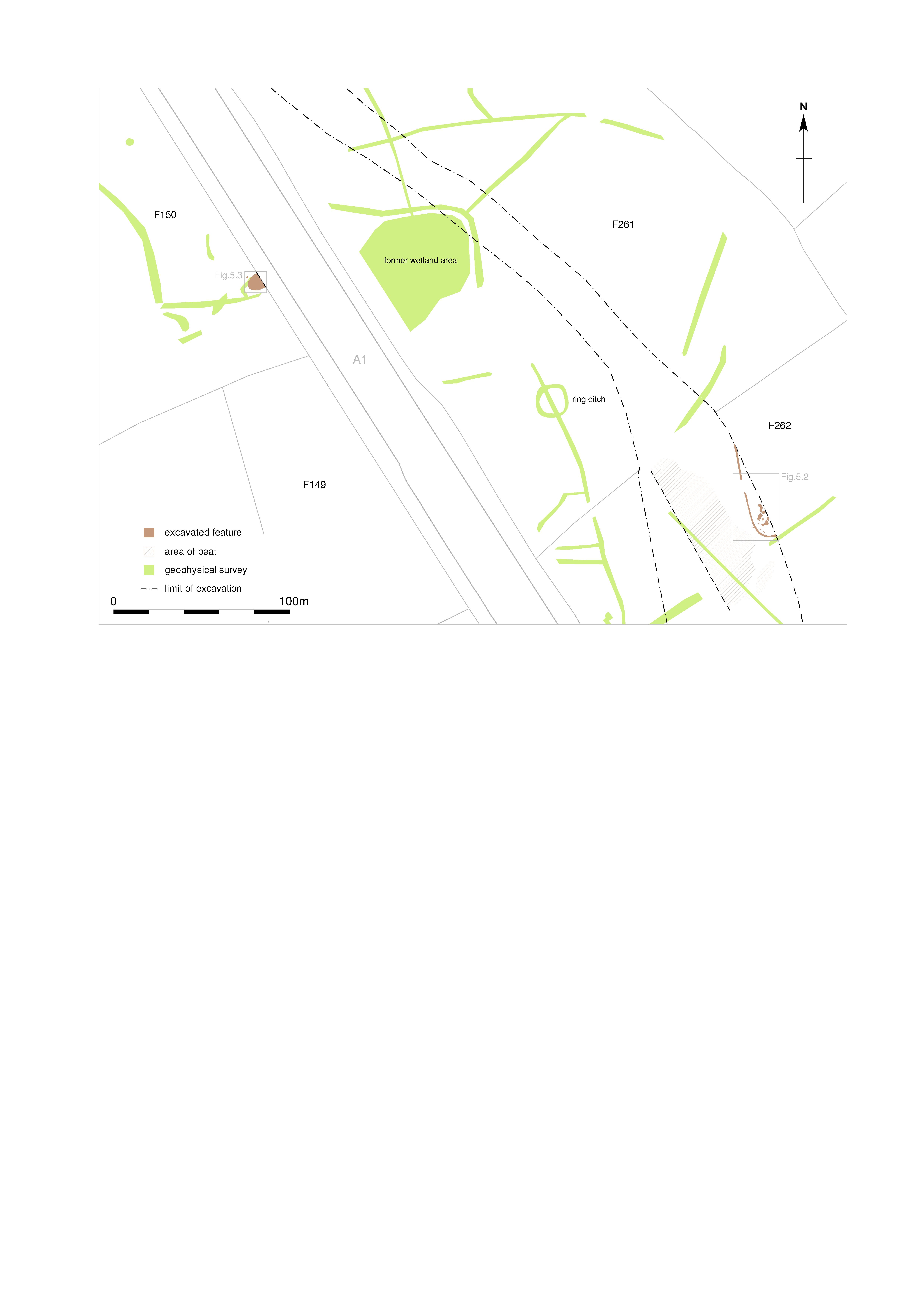
Title: Figure 5.1: Bronze Age features in Fields 150, 262 and 261. Filename: Prehist_Ch05_Fig-01.jpg (857 kB) |
JPG |
Info
Download |

|
Title: Figure 5.2: Bronze Age features in Field 262. Filename: Prehist_Ch05_Fig-02.jpg (940 kB) |
JPG |
Info
Download |

|
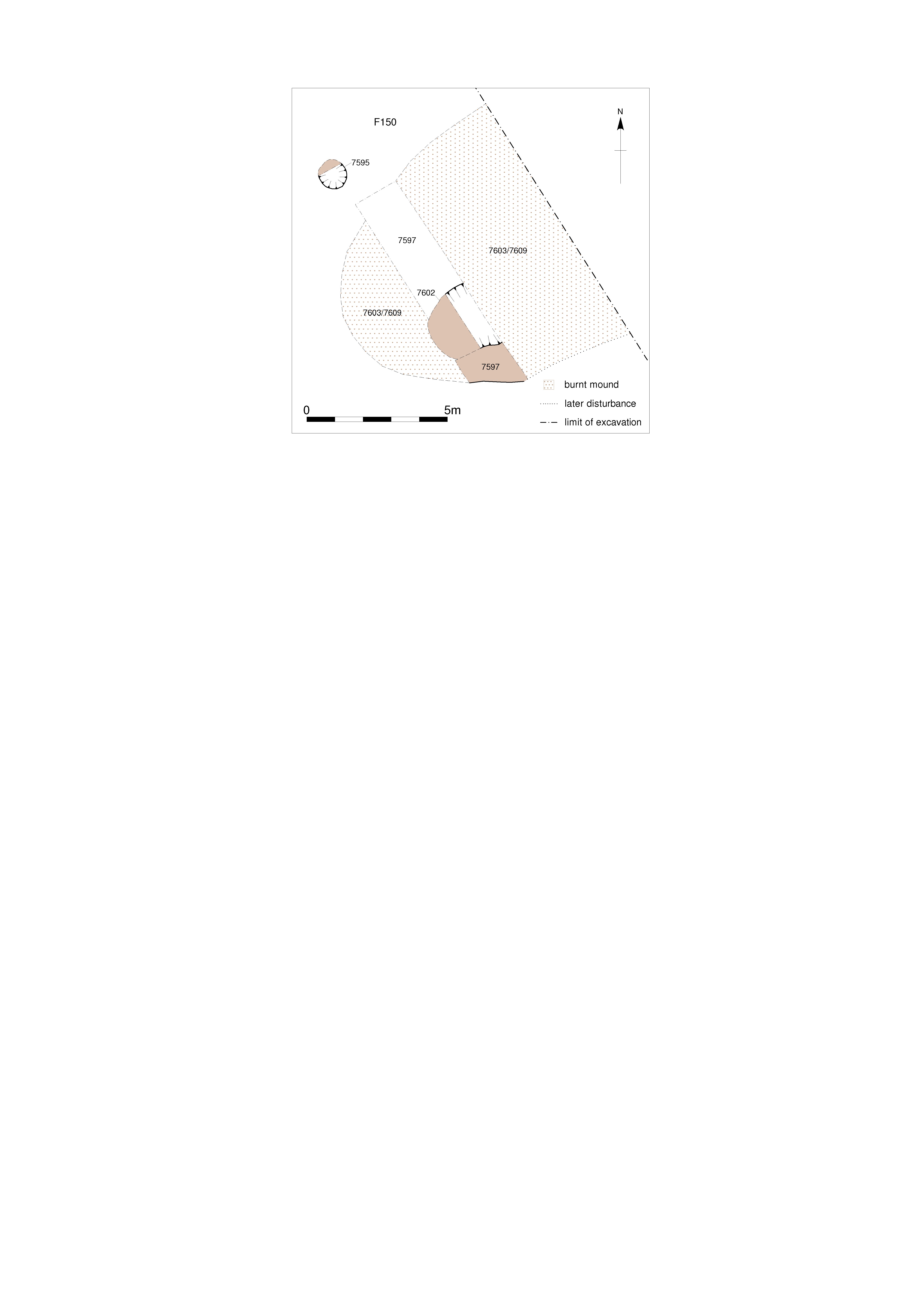
Title: Figure 5.3: Bronze Age features in Field 150. Filename: Prehist_Ch05_Fig-03.jpg (728 kB) |
JPG |
Info
Download |

|
Title: Figure 5.4: the Bowbridge Lane enclosure and its surrounding landscape. Filename: Prehist_Ch05_Fig-04.jpg (898 kB) |
JPG |
Info
Download |

|
Title: Figure 5.5: the Bowbridge Lane Early Iron enclosure and ‘four-post’ structure. Filename: Prehist_Ch05_Fig-05.jpg (799 kB) |
JPG |
Info
Download |

|
Title: Plate 5.1: postholes 10119 cut into the lower fill of ditch 10082, facing south-west, scale 0.5m. Filename: Prehist_Ch05_Plate-01.jpg (2 MB) |
JPG |
Info
Download |

|
Title: Plate 5.2: packing stones 10070 within palisade trench 10082, facing south. The A1 cutting lies to the left and the Bowbridge Lane cutting crosses between the excavation area and the cabins. Filename: Prehist_Ch05_Plate-02.jpg (301 kB) |
JPG |
Info
Download |

|
Title: Figure 6.1: fields containing dated pits, by period. Filename: Prehist_Ch06_Fig-01.jpg (2 MB) |
JPG |
Info
Download |

|
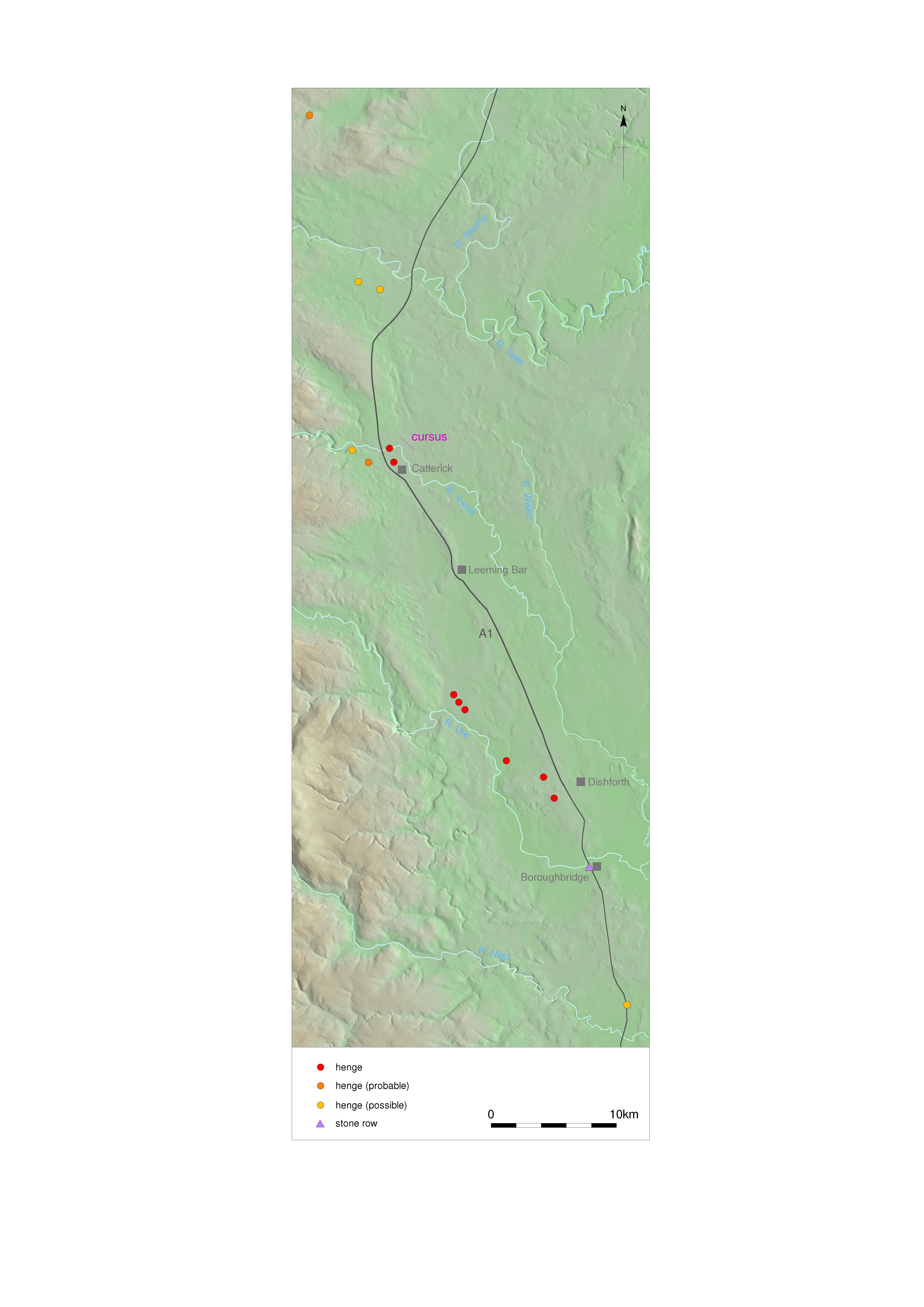
Title: Figure 6.2: henges in northern England between the Rivers Aire and Tweed. Filename: Prehist_Ch06_Fig-02.jpg (1 MB) |
JPG |
Info
Download |

|
Title: Figure A.1: plan of the Field 157 enclosure. Filename: Prehist_App_Fig-A1.jpg (921 kB) |
JPG |
Info
Download |

|
Title: Plate A.1: ditch segment 6621 section, facing north, scales 1m. Filename: Prehist_App_Plate-A1.jpg (2 MB) |
JPG |
Info
Download |

|
Title: Plate A.2: ditch segment 6592 section, facing north, scale 1m. Filename: Prehist_App_Plate-A2.jpg (2 MB) |
JPG |
Info
Download |

|
Title: Back cover Filename: Prehist_cover_back.jpg (1 MB) |
JPG |
Info
Download |
