
Site Data from an Excavation and Mitigation between Sizewell Gap and Sizewell Beach, Part 2 of Galloper Offshore Wind Farm Onshore Archaeological Works 2014-2016
Wessex Archaeology, 2022. https://doi.org/10.5284/1093228. How to cite using this DOI
Data copyright © Wessex Archaeology unless otherwise stated
This work is licensed under a Creative Commons Attribution 4.0 International License.

Primary contact
Wessex Archaeology
Portway House
Old Sarum Park
Salisbury
SP4 6EB
UK
Tel: 01722 326867
Fax: 01722 337562
Resource identifiers
- ADS Collection: 4542
- DOI:https://doi.org/10.5284/1093228
- How to cite using this DOI
Introduction
This collection comprises site data (reports, images, a CAD drawing, spreadsheets, databases, GIS data and site records) from the second phase of archaeological work associated with the development of a new onshore substation and related infrastructure for Galloper Offshore Wind Farm.
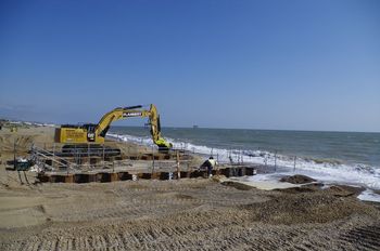
Between 2011 and 2016, Wessex Archaeology carried out a programme of trial trenching, area excavation and watching briefs in association with the onshore elements of the Galloper Offshore Wind Farm development. This part of the archive relates to fieldwork between 2014 and 2016 under project numbers 104810-104812. The investigated area coincided with the footprint of the new onshore substation, located between Leiston and Sizewell, some 1 km from the Suffolk coast, as well as the cable route linking it to the landfall site on Sizewell beach.
The works revealed little evidence for activity during earlier prehistoric periods, although a cluster of pits and other features seem to be indicative of Early Iron Age occupation. One of the pits was notable due to the large quantity (over 6 kg) of pottery and fired clay found in its upper fill. Several undated ditches may represent the fragmentary remains of a late prehistoric field system. The principal findings of the investigations relate to the early and mid-Romano-British period, with an extensive system of conjoined enclosures and trackways periodically modified and abandoned after the mid-3rd century AD. Four cremation graves, dating to the late 1st to mid-2nd centuries AD, were also found near the margins of the enclosure complex. Although the enclosures are thought to have largely been used for agricultural purposes - particularly livestock management - there were also indications of contemporary occupation, possibly the remains of a farmstead. The unexpected almost total absence of post-Roman remains seems to suggest the westward expansion of medieval Sizewell was constrained, to the south, by the route of Sizewell Gap.
Fieldwork undertaken from 2010 to 2013, under projects 77610 and 77611 are deposited separately in part 1.
