
Site Data from a Ridge and Furrow Survey at DIRFT III, Northamptonshire 2016
Cotswold Archaeology, 2022. https://doi.org/10.5284/1095483. How to cite using this DOI
Data copyright © Cotswold Archaeology unless otherwise stated
This work is licensed under a Creative Commons Attribution 4.0 International License.

Primary contact
Cotswold Archaeology
Building 11
Kemble Enterprise Park
Cirencester
GL7 6BQ
UK
Tel: 01285 771022
Fax: 01285 771033
Resource identifiers
- ADS Collection: 4666
- DOI:https://doi.org/10.5284/1095483
- How to cite using this DOI
Introduction
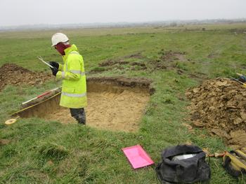
Thiis collection comprises site data (images and CAD) from a geoarchaeological investigation of the medieval/early post-medieval ridge and furrow earthworks and later field boundaries at the site of Daventry International Rail Freight Terminal (DIRFT III), Northamptonshire. The work was carried out During March and April 2016, by Cotswold Archaeology. Five hand-dug test pits and twenty-one machine-excavated trenches were excavated across the northern half of the site. The trenches were targeted on remnant ridge and furrow and other earthwork features shown on a LiDAR survey of the site, with the aim of investigating the development of the medieval agricultural landscape. On the floodplain, a buried soil horizon was encountered beneath the mineralised medieval ploughsoil. This deposit had some of the characteristics of a Boreal soil (i.e. Mesolithic/Neolithic), but pollen analysis suggests that it was probably a cultivated soil. The soil horizon overlay a variety of vegetation features (tree throw hollows etc.), suggesting that the floodplain supported some degree of tree cover prior to clearance for agricultural use. There was no suitable organic material for radiocarbon dating, so the age of the buried soil is uncertain. However, small ditches were also identified beneath the buried soil, probably forming part of an agricultural ditch system of Late Iron Age or Roman date. It is therefore probable that the buried soil horizon dates to the first millennium AD. Investigation of the medieval ridge and furrow earthworks identified some changes to its organisation during its period of active use, but dating these changes was constrained by the lack of dateable artefactual material and the homogeneity of the subsoil that formed the earthwork features.
