Images and GIS Data from Archaeological Investigations at 11 Old Town, Brackley, Northamptonshire 2017-1018

Cotswold Archaeology, 2022. https://doi.org/10.5284/1100076. How to cite using this DOI

Digital Object Identifiers

Digital Object Identifiers (DOIs) are persistent identifiers which can be used to consistently and accurately reference digital objects and/or content. The DOIs provide a way for the ADS resources to be cited in a similar fashion to traditional scholarly materials. More information on DOIs at the ADS can be found on our help page.

Citing this DOI

The updated Crossref DOI Display guidelines recommend that DOIs should be displayed in the following format:

https://doi.org/10.5284/1100076
Sample Citation for this DOI

Cotswold Archaeology (2022) Images and GIS Data from Archaeological Investigations at 11 Old Town, Brackley, Northamptonshire 2017-1018 [data-set]. York: Archaeology Data Service [distributor] https://doi.org/10.5284/1100076

Data copyright © Cotswold Archaeology unless otherwise stated

This work is licensed under a Creative Commons Attribution 4.0 International License.
Creative Commons License


Cotswold Archaeology logo

Primary contact

Cotswold Archaeology
Building 11
Kemble Enterprise Park
Cirencester
GL7 6BQ
UK
Tel: 01285 771022
Fax: 01285 771033

Send e-mail enquiry

Resource identifiers

Digital Object Identifiers

Digital Object Identifiers (DOIs) are persistent identifiers which can be used to consistently and accurately reference digital objects and/or content. The DOIs provide a way for the ADS resources to be cited in a similar fashion to traditional scholarly materials. More information on DOIs at the ADS can be found on our help page.

Citing this DOI

The updated Crossref DOI Display guidelines recommend that DOIs should be displayed in the following format:

https://doi.org/10.5284/1100076
Sample Citation for this DOI

Cotswold Archaeology (2022) Images and GIS Data from Archaeological Investigations at 11 Old Town, Brackley, Northamptonshire 2017-1018 [data-set]. York: Archaeology Data Service [distributor] https://doi.org/10.5284/1100076

Introduction

General view of site showing archaeological features, looking south-west

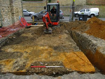
This collection comprises images and GIS data from a programme of Archaeological Observation, Investigation, Recording, Analysis and Publication (OIRAP) undertaken by Cotswold Archaeology during groundworks associated with the construction of two semi-detached dwellings at 11 Old Town, Brackley, Northamptonshire. Work was undertaken between July 2017 and August 2018.

The remains of six pits were revealed during the groundworks, which due to the constraints of the development groundworks were not fully exposed. A single pit provided ceramic evidence of medieval origin comprising the remains of coarse ware pottery, of domestic usage. The pottery dated to the 12th and 14th centuries and likely relates to domestic activity around the historic core of Old Town, concentrated near the church to the south-west. Two undated pits are putatively of the same period, with other undated pits likely associated with activity of more recent date. The location of these archaeological remains can be associated with activity along Church Lane and perhaps street frontage buildings evident on historic mapping.


ADS logo
Data Org logo
University of York logo