
Data from an Archaeological Recording at Deserted Medieval Village of Lower Radbourne, Warwickshire, 2021-2022 (HS2 Phase One)
High Speed Two Ltd., Archaeological Research Services Ltd, 2023.
Data copyright © High Speed Two Ltd. unless otherwise stated
This work is licensed under a The Open Government Licence (OGL).

Primary contact
High Speed Two Ltd.
2 Snowhill
Queensway
Birmingham
B4 6GA
United Kingdom
Tel: 08081 434 434
Resource identifiers
- ADS Collection: 5014

Introduction
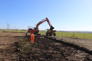
This collection comprises images, spreadsheets, reports, vector graphics, and scanned site records and drawings from archaeological recording by Archaeological Research Services at Lower Radbourne Deserted Medieval Village, Warwickshire. The work was undertaken between April and December 2021.
The recording forms part of Phase One of the High Speed 2 (HS2) rail project, which will involve the construction of a new railway approximately 230km (143 miles) in length between London and the West Midlands. Powers for the construction, operation and maintenance of Phase One are conferred by the High-Speed Rail (London - West Midlands) Act 2017.
Project Summary
The site, located at NGR 443821 257286 (centred), comprised three areas (land parcels C32070, C32071 and C32072) in three fields, separated by a T-junction in the farm track. The total site area was c. 2.85 ha. The site was known to be the location of the deserted medieval village (DMV) of Lower Radbourne and had previously been subject to trial trench evaluation in 2020, which had demonstrated the presence of medieval and earlier remains in the areas subsequently targeted by the Archaeological Recording.
The aims of the project were to
- further define and characterise the remains of the Deserted Medieval Village of Lower Radbourne including the identification of separate house plots, building platforms, enclosures and evidence of timber and stone buildings
- understand the chronology and phasing of the medieval settlement and how and why it may have been depopulated by the early post-medieval period.
Area C32070 was dominated by intercutting features predominantly dated to two broad phases, prehistoric and medieval. The prehistoric features were represented by a large ring ditch, potentially dating to the Early Bronze Age, four smaller potential Bronze Age ring ditches and a series of intercutting drip gullies, probably Iron Age in date. An undated rectangular post-built structure was also present to the immediate south of the largest ring ditch. The medieval period in this area was represented by a sequence of field boundary ditches, a holloway aligned north-west to south-east that bisected the site, and occasional interspersed pits.
Area C32071 had heavily truncated medieval stone building foundations in the northern part of the area, and the remains of the village church at Chapel Bank and its associated cemetery. The church and the majority of the cemetery within C32071 were not fully excavated as they were not intended to lie within the development. Several medieval boundary ditches were identified outside of the buildings, as well as four possible prehistoric ring gullies below them, potentially attesting to earlier occupation in this area. The C32071 extension was opened to evaluate the potential for a continuation of building remains in this area. No building remains were present, however, only the continuation of medieval boundary ditches was confirmed.
Area C32072 was dominated by medieval enclosures and other medieval plot boundaries, all of which were truncated by later furrows. There were two potential rudimentary structures located along the north-eastern edge of the area represented by some postholes and roughly laid cobbled surfaces. In the northern part of the area, the cemetery associated with the medieval church continued from which 24 burials were exhumed and several ditches that pre-dated the cemetery were recorded.
