
Digital Archive from an Archaeological Evaluation East of Moreton Hall, Mount Road, Bury St Edmunds, Suffolk (Phases 3, 4 and 5), October 2018
Archaeology South-East, 2023. https://doi.org/10.5284/1105522. How to cite using this DOI
Data copyright © Archaeology South-East unless otherwise stated
This work is licensed under a Creative Commons Attribution 4.0 International License.

Primary contact
Archaeology South-East
27 Eastways
Eastways Industrial Estate
Witham
Essex
CM8 3YQ
United Kingdom
Tel: +44(0)1376 331470
Resource identifiers
- ADS Collection: 5192
- DOI:https://doi.org/10.5284/1105522
- How to cite using this DOI
Introduction
This collection comprises images, a site plan, spreadsheet and survey statement from an archaeological evaluation of Land East of Moreton Hall, Mount Road, Bury St Edmunds, Suffolk undertaken by Archaeology South-East in October 2018.
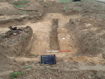
Following geophysical survey of the c.20.5ha development site, archaeological evaluation comprised the investigation of 76 trenches, some of which were targeted on geophysical anomalies interpreted to be indicative of natural geology or modern land use relating to the former Rougham Airfield. Twenty-one trenches contained archaeological remains, comprising ditches and pits, with a slight concentration in the north-east of the site. A small number of pits have been generally dated to the Late Neolithic/Early Bronze Age period. The majority of recorded features are dated to the first half of the 20th century, many of which correspond with the geophysical anomalies. Several of the ditches, most likely functioning as a drainage system, correlate with a former airfield road and runway. Other, similarly dated features are most likely related to the former airfield.
