
Culmstock Road, Hemyock, Devon (OASIS ID: acarchae2-134908)
AC Archaeology Ltd, 2017. https://doi.org/10.5284/1046740. How to cite using this DOI
Data copyright © Charlotte Coles, Andrew Passmore unless otherwise stated
This work is licensed under the ADS Terms of Use and Access.

Primary contact
Charlotte
Coles
AC Archaeology Ltd
4 Halthaies Workshops
Bradninch
Exeter
EX5 4LQ
Devon
Resource identifiers
- ADS Collection: 2962
- DOI:https://doi.org/10.5284/1046740
- How to cite using this DOI
Introduction
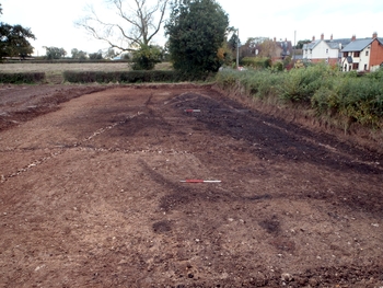
An archaeological excavation was carried out by AC archaeology on agricultural land to the south of Culmstock Road, Hemyock from October to November 2012. The excavation followed an earlier evaluation which had uncovered a significant area of smelting debris and features in the north-west corner of the field which had been protected from plough damage by an accumulation of colluvium. The date of the ironworking was not established at this stage, but it was thought to relate to the early medieval period. The principal aim of the excavation was to further investigate the features and deposits identified in the evaluation and it was undertaken in support of a planning application for residential development. The excavation was commissioned following consultation with Devon County Historic Environment Team. The land sloped gently down to the north at around 150 m above OD, with the underlying solid geology comprising Triassic Mercia Mudstone. An area of 40 m by 15 m was stripped of topsoil revealing the remains of slagpit furnaces, pits and gullies which were sealed beneath a deposit of slag and fuel waste derived from iron smelting activity. Two radiocarbon dates indicate a probable late 8th century date for this activity.
