Atlas of Rural Settlement in England
Andrew Lowerre, Eddie Lyons, Brian K Roberts, Stuart Wrathmell, 2015. https://doi.org/10.5284/1031493. How to cite using this DOI
Data copyright © Historic England, Dr Stuart Wrathmell, Brian K Roberts unless otherwise stated
This work is licensed under the ADS Terms of Use and Access.
Primary contact
Andrew
Lowerre
Historic England
Fort Cumberland
Fort Cumberland Road
Portsmouth
PO4 9LD
UK
Resource identifiers
- ADS Collection: 1980
- DOI:https://doi.org/10.5284/1031493
- How to cite using this DOI
Overview
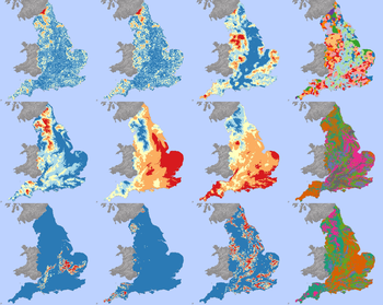
 Multiple maps of settlement and environmental variables used in the analysis project. © Historic England. Contains Ordnance Survey data © Crown copyright and database right 2014
The Atlas of Rural Settlement in England GIS data collection comprises the following elements:
- spatial and attribute data, supplied in two different formats: Esri Shapefile and Google/Open Geospatial Consortium KMZ (compressed or 'zipped' Keyhole Markup Language);
- a file containing the text and figures for the settlement province and sub-province descriptions found on pages 40–57 of the printed Atlas;
- a data dictionary detailing the attribute field names, types, lengths, suggested aliases and descriptions of the data held in each field; and
- a document discussing the nature and limitations of the data and the processes by which the data were created.
The conversion project data include nucleated settlements, the sample locations where Roberts and Wrathmell quantified settlement dispersion, the settlement provinces, sub-provinces and local regions they defined, and the terrain types, zones and escarpments they delineated, characterising the physical landscape of England. The point, line and polygon data were converted from the original graphics files created for the printed Atlas. Relevant attributes derived from the text and maps of the printed Atlas are attached to each feature. A file reproducing Roberts and Wrathmell's descriptions of the settlement provinces and sub-provinces (pages 40–57 of the printed Atlas) is included to aid understanding of the data. The data are supplied in both shapefile format (for use in GIS and CAD software applications) and in KMZ, which can be viewed in so-called 'geobrowsers', such as Google Earth.
The approach taken in the analysis project data was to divide England into a grid or lattice of regularly-spaced cells and, working from known data, calculate a value for each cell. The grid cell size used was 2 x 2km, mirroring the size of the sample areas Roberts and Wrathmell used when quantifying settlement dispersion. Data for distance to nucleated settlement and interpolated values for dispersion scores and hamlet counts were generated from settlement data included in this data collection. Data on the environmental variables were obtained from a variety of sources.
Where necessary, the environmental datasets were reprojected onto the Ordnance Survey’s British National Grid coordinate system. Pre-processing of the data (e.g., deriving measures of surface roughness or insolation from elevation data) was done with the data in their original resolution. Once all reprojection and pre-processing was complete, all the environmental data layers were resampled down to a 2 x 2km resolution, calculating the mean value for each 2 x 2km grid cell, to match the interpolated settlement nucleation and dispersion data.
Due to copyright/intellectual property rights restrictions, some data used in the analysis project (e.g., soils and monthly days of rain) are not included in the archived data collection. The analysis project data are supplied only in shapefile format.


