
Land at Towergate A, Milton Keynes, Buckinghamshire. Archaeological Evaluation (OASIS ID: cotswold2-351574)
Cotswold Archaeology, 2020. https://doi.org/10.5284/1081992. How to cite using this DOI
Data copyright © Cotswold Archaeology unless otherwise stated
This work is licensed under a Creative Commons Attribution 4.0 International License.

Primary contact
Cotswold Archaeology
Building 11
Kemble Enterprise Park
Cirencester
GL7 6BQ
UK
Tel: 01285 771022
Fax: 01285 771033
Resource identifiers
- ADS Collection: 3820
- DOI:https://doi.org/10.5284/1081992
- How to cite using this DOI
Introduction
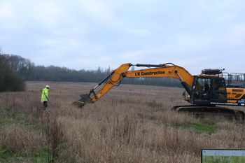
In January 2019, Cotswold Archaeology carried out an archaeological evaluation of land at Towergate A, Milton Keynes. The evaluation comprised the excavation of fifteen trenches measuring between 15m and 50m long totalling 692 linear metres of trenching. Eight of the fifteen trenches were blank and five of the seven trenches revealing archaeological features were concentrated towards the south of the site, targeting the geophysical anomalies.
A series of enclosures, ditches and pits of Late Iron Age to Roman date were located toward the southern part of the site, broadly corresponding with the results of preceding geophysical survey. Additional archaeological features not identified by the geophysical survey were recorded within the vicinity of the enclosures. A possible trackway/droveway was in close proximity to the enclosure ditches and respects their alignment suggesting that it is of a similar date to the enclosures. Further archaeological remains were identified in the northern part of the site comprising a series of gullies. However, these were undated and there was no evidence for any association with the Late Iron Age/Roman dated features.
Overall, the site is generally characterised by agricultural activity of possible Late Iron Age/Roman date, concentrated within the southern part of the site. There is evidence for associated occupation of a rural nature. It is considered likely that the remains recorded within the site represent outlying occupation and it is possible that the core settlement area lay further to the south and south-east of the site.
