
England's Historic Seascapes: Southwold to Clacton
Oxford Archaeology (South), 2007. https://doi.org/10.5284/1000277. How to cite using this DOI
Data copyright © Historic England unless otherwise stated
This work is licensed under the ADS Terms of Use and Access.


Primary contact
Oxford Archaeology (South)
Janus House
Osney Mead
Oxford
OX2 0ES
UK
Tel: 01865 263800
Fax: 01865 793496
Resource identifiers
- ADS Collection: 746
- ALSF Project Number: 4729
- DOI:https://doi.org/10.5284/1000277
- How to cite using this DOI
England's Historic Seascapes:
Southwold to Clacton
ALSF Project Number 4729
Oxford Archaeology, 2007
Alde Ore and Butley Estuaries
- Alde Ore and Butley Estuaries
- Martello Tower
- Military Orford Ness
- Orford Lighthouse
- Orford Merman
- The Scallop
Military Orford Ness
As a remote and isolated area, Orford Ness was seen to be perfect for military activity. From 1915 access to the ness was restricted and the area was used for experimental flying. After 1936 experiments conducted included radar, rockets and radio navigation and in1940 the area was used as an army training ground. During the cold war period the ness was used as an atomic research establishment and in 1971 the base was used for development of COBRA, an over the horizon early warning system. This was abandoned in1974 as a failure. The military establishment is now incorporated in the nature reserve and is accessible to the public but the activities which took place remain a mystery and the remains are shrouded in secrecy.
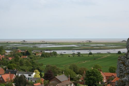
Caption: View of Orford Ness and nuclear test pagodas from Orford Castle
Photo courtesy:Oxford Archaeology
