
England's Historic Seascapes: Southwold to Clacton
Oxford Archaeology (South), 2007. https://doi.org/10.5284/1000277. How to cite using this DOI
Data copyright © Historic England unless otherwise stated
This work is licensed under the ADS Terms of Use and Access.


Primary contact
Oxford Archaeology (South)
Janus House
Osney Mead
Oxford
OX2 0ES
UK
Tel: 01865 263800
Fax: 01865 793496
Resource identifiers
- ADS Collection: 746
- ALSF Project Number: 4729
- DOI:https://doi.org/10.5284/1000277
- How to cite using this DOI
England's Historic Seascapes:
Southwold to Clacton
ALSF Project Number 4729
Oxford Archaeology, 2007
Clacton Area
- Clacton Area
- 'Clactonian'
- Clacton
- Frinton-on-Sea
- Jaywick
- Martello Tower
- The Lyonesse Surface
- Walton-on-the-Naze
Jaywick
Jaywick is currently a small bungalow seaside resort.
The earliest evidence of settlement at Jaywick is in the form of Neolithic and Bronze Age artefacts and features found at Lion Point including Grooved Ware pottery, Beaker pits and a pair of paddles. These were found associated with the Lyonesse surface (see link). Salt working remains and Iron Age coins have also been found at this location (http://www.jaywick.net/).
Jaywick was later part of Clakyngewyk, meaning 'dairy farm of the people of Clacc', (a Saxon Chieftain).
The farm appears on Chapman and Andre's map of Essex (1777) as Jewick and continued to be farmed until the land went up for sale in 1920. The area was also popular for smuggling. In 1928 it was bought by Frank Stedman who constructed a seaside resort intended as a holiday resort for Londoners. The houses were often poorly constructed and intended for short term holiday use. However, many people moved in and stayed, the result of which is that the resort still stands and contains some of the poorest housing in Europe (http://www.jaywick.net/). It is the subject of ongoing regeneration plans, with proposals to demolish some areas.
Jaywick is the site of one of the many Martello Towers along this stretch of coast. The building is now a digital art gallery.
The current sea defences were erected after the 1953 storm surge (see link) in which 35 people were killed and 600 people made homeless in Jaywick. The shingle beach was all but washed away by successive storms battering against the sea wall, leading to a series of beach replenishments and construction of breakwaters since the 1980s (Strachan 1998).
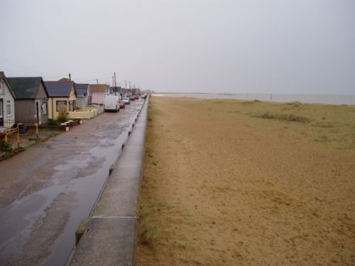
Caption: View of Jaywick beach and houses
Photo Source: Oxford Archaeology
