
England's Historic Seascapes: Southwold to Clacton
Oxford Archaeology (South), 2007. https://doi.org/10.5284/1000277. How to cite using this DOI
Data copyright © Historic England unless otherwise stated
This work is licensed under the ADS Terms of Use and Access.


Primary contact
Oxford Archaeology (South)
Janus House
Osney Mead
Oxford
OX2 0ES
UK
Tel: 01865 263800
Fax: 01865 793496
Resource identifiers
- ADS Collection: 746
- ALSF Project Number: 4729
- DOI:https://doi.org/10.5284/1000277
- How to cite using this DOI
England's Historic Seascapes:
Southwold to Clacton
ALSF Project Number 4729
Oxford Archaeology, 2007
Hollesley Bay Channel and Whiting Bank
Primary Subcharacter Type:
Sailing area
Main Character / current form and use
The Hollesley Bay Channel and Whiting Bank area is one of several pairings of sandbank and channel off the Suffolk coast near Orford which form a series of treacherous navigational features and hazards in the approach to the Alde/Ore, Butley and Deben estuaries. The pairings are considered together due to the dynamic nature of sandbanks. The area is predominantly characterised as a navigational feature.
The depth of the area varies from 0 m in the centre of the Whiting bank to 15 m within the channel. A light buoy is located at the south-west end of Hollesley Bay Channel near the 'Flagstone', a small ridge of cemented volcanic ash within the London Clay, rising to 7-10 m deep. The northern tip of the channel is affected by an area of water turbulence. The overlying geology of the area is predominantly gravelly muddy sand with areas of gravel in Hollesley Bay Channel and towards the east of the character area. The tidal range in the character area is within the range of 2-4 m at Mean Spring Tide (DTI 2004).
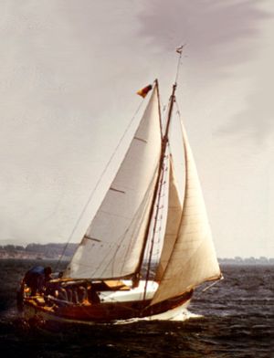
Due to its location close to the Suffolk coast and particularly the Alde/Ore and Butley estuaries the area is used for recreational sailing. A Royal Yacht Association (RYA) route passes along the channel and a second skirts around Flagstone to the south and both head into the estuaries. The area is too close to the coast to sustain commercial shipping. The area is also a potential recreational dive site.
As a result of its proximity to the ports of Harwich and Felixstowe the area comes within the jurisdiction of the Harwich regulatory system. It is subject to restrictions concerned with high speed craft, submarine cables and traffic separation and is covered by Vessel Traffic Services (VTS).
Historic Character and archaeological potential
Whiting Bank is marked as a hazard on the Admiralty chart of 1855. However due to the location of the character area in close proximity to the shore, few vessels have been wrecked on the bank. A total of four wrecks are known in the area, two of which belong to the same vessel, the Martinet. The potential of shipwreck archaeology is therefore low.
The area has potential to contain submerged prehistoric landscapes, features or artefacts, particularly considering its location in the area likely to have been coastal for thousands of years.
Character perceptions
The area is closely associated with the Alde/Ore and Butley estuaries and is predominantly seen as a sailing route giving access to these estuaries. It is recognised as a navigational feature and buoys mark out the route accordingly.
Bibliography
DTI, 2004, Mean Spring Tidal Range: Atlas of UK Marine Renewable Energy Resources. Department of Trade and Industry, 2004
Wikipedia. Available at: http://en.wikipedia.org (15/03/2007)
