
England's Historic Seascapes: Southwold to Clacton
Oxford Archaeology (South), 2007. https://doi.org/10.5284/1000277. How to cite using this DOI
Data copyright © Historic England unless otherwise stated
This work is licensed under the ADS Terms of Use and Access.


Primary contact
Oxford Archaeology (South)
Janus House
Osney Mead
Oxford
OX2 0ES
UK
Tel: 01865 263800
Fax: 01865 793496
Resource identifiers
- ADS Collection: 746
- ALSF Project Number: 4729
- DOI:https://doi.org/10.5284/1000277
- How to cite using this DOI
England's Historic Seascapes:
Southwold to Clacton
ALSF Project Number 4729
Oxford Archaeology, 2007
Outer Harwich Haven
Primary Subcharacter Type:
Channel
Main Character / current form and use
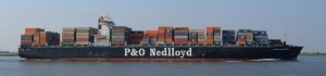
The Harwich Outer Haven character area is predominantly a shipping channel and administrative region attached to Harwich Haven. Its focus is the buoyed Deep water Channel through which all large vessels approach Harwich, Felixstowe and Ipswich. The area is subject to a number of restrictions concerned with high speed craft, submarine cables and traffic separation and is covered by Vessel Traffic Services (VTS). A variety of vessel types are known to use the channel intensively including ferries, bulk and cargo ships, gas carriers and tankers.
Depth varies widely across the area, from 2 m close to the coastline up to 20 m. The Deep Water Channel is dredged to a uniform 14.5 m. Immediately to the north of the channel is a feature known as Cork Knolls, the depth over which decreases to 5 m. Two thirds of the area is composed of gravelly muddy sand with patches of gravel. The western third of the area is mostly gravel. The tidal range in the character area is within the range of 3-4 m at Mean Spring Tide (DTI 2004).
Secondary characteristics include leisure sailing, the area is also a potential recreational dive site. A number of Royal Yacht Association (RYA) routes cross the area. One follows the Deep Water Channel to the south and west, one closely follows the coastline heading into Harwich Haven and one cuts through the channel to a large junction of routes near the Sunk.
Historic Character and archaeological potential
Due to the large number of navigational hazards within this region the character area is likely to have been an important approach to Harwich and Felixstowe from their emergence as ports in the Middle Ages. Considering this, surprisingly few shipwrecks are known to be located in the area; eight in total including three Royal Navy vessels. This may partly be the result of maintenance dredging carried out in the area on a regular basis, in order to keep the channel free of obstructions. Wrecks include HMS William Wesney, HMS Dundalk and HMS Ludlow, all of which sunk following mining.
The potential for shipwreck archaeology therefore exists in the character area. In addition, the area has potential to contain submerged prehistoric landscapes, features or artefacts, having been dry land prior to 8000 BP, particularly considering the location of the area close to the present day coastline in an area which may have been coastal for thousands of years. However, no investigation work is known to have been done in this area.
Character perceptions
The character area is generally perceived as an extension of Harwich Haven and a heavily used industrial region. It is also the major approach to the Stour and Orwell estuaries and consequently is also important for recreational users.
Bibliography
DTI, 2004, Mean Spring Tidal Range: Atlas of UK Marine Renewable Energy Resources. Department of Trade and Industry, 2004
Wikipedia. Available at: http://en.wikipedia.org/wiki/Main_Page (07/03/2007)
