
England's Historic Seascapes: Southwold to Clacton
Oxford Archaeology (South), 2007. https://doi.org/10.5284/1000277. How to cite using this DOI
Data copyright © Historic England unless otherwise stated
This work is licensed under the ADS Terms of Use and Access.


Primary contact
Oxford Archaeology (South)
Janus House
Osney Mead
Oxford
OX2 0ES
UK
Tel: 01865 263800
Fax: 01865 793496
Resource identifiers
- ADS Collection: 746
- ALSF Project Number: 4729
- DOI:https://doi.org/10.5284/1000277
- How to cite using this DOI
England's Historic Seascapes:
Southwold to Clacton
ALSF Project Number 4729
Oxford Archaeology, 2007
South Galloper Military Zone
Primary Subcharacter Type:
Military practice area
Main Character / current form and use
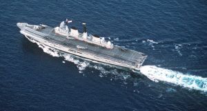
This character area is predominantly characterised as a military practice area, named after the nearby Galloper sandbank (see The Galloper character area). The zone is one of several within the study area used by the navy for mine laying and mine countermeasure exercises. The area is permanently delineated though access is only restricted during active exercises, notification of which is given by radio shortly before minelaying takes place.
The area is also a recognised shipping route, transited by bulk and cargo ships, ferries and gas carriers and tankers (Jones et al n.d.). The western half of the character area is subject to a number of shipping precautions including high speed craft, changing depth, draught restrictions and submarine cables. It is also covered by Vessel Traffic Services (VTS). To the east these restrictions do not apply.
The area is a known navigation hazard due to the presence of the �North Falls� sandbank in the south western corner, incorporating areas known as Four Mile knolls or North Falls Head and North Falls Tail. The majority of the character area has a depth of 30 m to 50 m, however around North Falls this decreases to 20-30 m with areas of 5-20 m over the feature. To the east some areas increase to 50-100 m. Shipping generally avoids the North Falls area.
The tidal range in the character area is within the range of 3-5 m at Mean Spring Tide (DTI 2004). The overlying geology is predominantly gravelly muddy sand except towards the eastern edge where it is gravel.
A submarine network cable runs north-south through the area connecting the United States with the UK, Germany and the Netherlands, maintained by Global Crossing. Additionally, two secondary Royal Yacht Association (RYA) routes cross the area to the north and south, heading towards the continent.
Historic Character and archaeological potential
North Falls is marked on the Admiralty chart of 1855 as a recognised navigational hazard. However, little is known about the historic character of the area. Considering its size it has a remarkably low number of known wrecks, though this could be a result of its depth and lack of exploration. Currently five wrecks are located within the character area including the Duke of York which sank after a collision with the USS Haiti Victory and the Ulrikken which was mined on passage from New York to Rotterdam.
The potential exists therefore for shipwreck archaeology though it is not expected to be high. In addition, the area has potential to contain submerged prehistoric landscapes, features or artefacts, having been dry land prior to 8000 BP. However, no investigation work is known to have been done in this area.
Character perceptions
The area is only likely to be recognised by shipping communities and the military. The extent of the use of these areas for current military practices is unknown, therefore it is possible that the area is best known as a route for commercial shipping.
Bibliography
DTI, 2004, Mean Spring Tidal Range: Atlas of UK Marine Renewable Energy Resources. Department of Trade and Industry, 2004
English Nature, 1997 Greater Thames Estuary Coastal Natural Area Profile. Technical Report. Colchester
Jones, L. A., Coyle, M. D., Evans, D., Gilliland, P.M., & Murray, A. R., Southern North Sea Marine Natural Area Profile: A contribution to regional planning and management of the seas around England. Peterborough: English Nature.
Wikipedia. Available at: http://en.wikipedia.org/wiki/Main_Page (07/03/2007)
