
England's Historic Seascapes: Withernsea to Skegness
Museum of London Archaeology, 2010. https://doi.org/10.5284/1000104. How to cite using this DOI
Data copyright © Historic England unless otherwise stated
This work is licensed under the ADS Terms of Use and Access.


Primary contact
David
Bowsher
Director of Research
Museum of London Archaeology
Mortimer Wheeler House
46 Eagle Wharf Road
London
N1 7ED
UK
Tel: 020 7410 2285
Resource identifiers
- ADS Collection: 935
- ALSF Project Number: 4730
- DOI:https://doi.org/10.5284/1000104
- How to cite using this DOI
Dogger Bank Character Area
Present Day Form
The Dogger Bank character area is situated at the north east limit of the study area and consists of moraine and pro-glacial lake deposits, with elbow formation of calcareous sands and peaty organic detritus infilling glacial depressions, and overlying Pleistocene sediments. The upper surface is Holocene sediments 5-20m thick on the south east flank. Deposits are mostly sand with patches of gravel (Flemming 2002). Holocene sediments of the Dogger Bank are a maximum thickness of 30-40m. The maximum tidal range in the area is c 2-3m. The area is a major navigation hazard for North Sea traffic as it forms an extensive bank.
Sea Use: Present
The character area contains the three operating gas fields Caister, part of Boulton and the southern part of Murdoch. The area is crossed by a number of active chemical and gas pipelines. Three smaller gas fields also lie within the area: Minke, Watt and Orca. Caister is comprised of two gas fields. B (Bunter) was discovered in 1968 and began production in 1993 and C (Carboniferous) was discovered in 1985 and began production in 1993. The pipeline for both these fields runs from Theddlethorpe to Murdoch. The Boulton gas field was discovered in 1984 and at peak production runs at 0.93 billion cubic metres per year. The pipeline runs from the field to Theddlethorpe via Murdoch and CMS. Murdoch gas field was discovered in 1985 and started production in 1995. Pipelines run to Theddlethorpe.
The Dogger Bank character area is an important offshore fishing area and part of larger spawning grounds for herring, sprat and sole in addition to being a nursery ground for sprat and whiting. The western extent of the character area also forms part of a sand eel spawning and nursery area.
It is also part of a wider RAF military practice area. The eastern part of the Dogger Bank is presently used as a submarine exercise area by the RAF.
Sea Use: Past
The Dogger Bank character area has been shaped by thousands of years of dynamic sea level changes and erosion and deposition. The area is thought to have been formed c. 8700BP. The relatively shallow nature of the sea bed means that the area was dry land almost certainly in the Upper Palaeolithic, Mesolithic and probably in the Neolithic periods.
The area was inundated between 10,000 and 7,500BP. Around 7,500BP this was a shallow sea basin approximately 5m deep, 150km in diameter and was connected to the open North Sea by a narrow channel to the north-west.
Archaeological Potential
From 22,000 BP to 2100 BP parts of the North Sea were dry land and human population levels were higher, especially in the Mesolithic age. Finds dating to the Mesolithic have been found to a depth of 40m so any area of sea bed above that has potential for habitation.
Inundation of the North Sea landscapes occurred between 10,000 and 6,000 BP and the most likely evidence for human occupation would be, therefore, Mesolithic in date. Earlier Palaeolithic occupation is less likely to be found however there is potential for later Neolithic occupation. Over the last 6000 years (if not more), humans have used sea faring vessels and so wrecks and related material may lie on the sea floor or be buried beneath the sea floor. UKHO and NMR data show 1 unnamed wreck in this area, of 29.9m length.
Human artefacts, flints, spear-heads, and mammal remains have been dredged from the Dogger Bank area and it is always assumed that the finds have been retrieved from the upper surface of the Bank. This may indeed be so, but closer analysis suggests that a richer environment for the origin and preservation of archaeological materials would be the vast lagoon which existed to the south of Dogger Bank from 8,000-7,000 years BP. At around 7,500 BP there was a shallow sea basin approximately 5m deep and 90 nautical miles in diameter. This basin was connected to the open North Sea to the north-west by a narrow channel which is now the Outer Silver Pit.
The Pleistocene fauna reported to have been trawled from Dogger Bank consist of mammoth and rhinoceros teeth. Tools and archaeological deposits left on the upper surface of Dogger Bank are likely to become exposed by modern currents and wave action (very severe, breaking waves in 10m), as well as being periodically covered by sand waves. It is probable that there are further artefacts, which were originally abandoned on the shore of this vast gulf, in the region which is now at a depth of about 40m and on the edge of Silver Pit itself.
The discoverability of such artefacts depends upon modern marine sediment thickness. BGS (1990) sediment map and notes thereon describes Holocene sediments 5-20m thick on the south east flank of Dogger Bank, while most of the surface of the Bank is covered by 1m thick Holocene deposits. Whitehead and Goodchild (1909) describe the recovery of peat deposits or "moorlog" by fishermen working the Dogger Bank, and Louwe Kooijmans shows extensive peat or moorlog at exactly this location, especially on the north side of the basin, on the flanks of Dogger Bank itself.
Character Perceptions
The area is perceived as an offshore fishing ground and also as a gas production area.
References
Cameron T.D.J., Crosby A. Balson P.S. Jeffrey D.H., Lott G.K., Bulat.J., Harrison D.J., 1992. The Geology of the Southern North Sea. BGS United Kingdom Offshore regional report. HMSO
Close's Fisherman's Chart (UKHO 1953)
Fisheries Sensitivity Maps in British Waters (MAFF 1989)
Flemming, N, C, 2002 The scope of strategic environmental assessment of North Sea areas SEA3 and SEA2 in regard to prehistoric archaeological remains, DTI rep
Jelgersma, S. (1979). Sea-level changes in the North Sea basin. In: Oele, E., Schuttenhelm, R.T.E. and Wiggers, A.J. (eds) The Quaternary history of the North Sea. Acta Universitatis Upsaliensis: Symposium Universitatis Upsaliensis Annum Quingentesimum Celebrantis: 2. 233-248.
Lambeck, K. (1995). Predicted Shoreline from Rebound Models. Journal of the Geological Society 152, 437-448.
The scope of Strategic Environmental Assessment of North Sea areas SEA3 and SEA2 in regard to prehistoric archaeological remains (Flemming et al, DTI, 2002)
http://www.arch.ant.bham.ac.uk/research/fieldwork_research_themes/projects/North_Sea_Palaeolandscapes/project_outline3D Seismics As A Source For Mitigation Mapping Of The Late Pleistocene And Holocene Depositional Systems And Palaeogeography Of The Southern North Sea
WWF World Wildlife Fund, 2001 The Dogger Bank - A Potential MPA.
Images
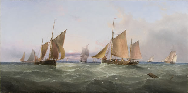
Redmore: Trawlers on the Dogger Bank
Web: http://www.ackermannandjohnson.co.uk
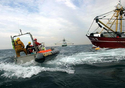
Greenpeace at Dogger Bank
Web:http://www.greenpeace.org.uk/media/press-releases/greenpeace-activists-defend-dogger-bank
