England's Historic Seascapes: Withernsea to Skegness
Museum of London Archaeology, 2010. https://doi.org/10.5284/1000104. How to cite using this DOI
Data copyright © Historic England unless otherwise stated
This work is licensed under the ADS Terms of Use and Access.
Primary contact
David
Bowsher
Director of Research
Museum of London Archaeology
Mortimer Wheeler House
46 Eagle Wharf Road
London
N1 7ED
UK
Tel: 020 7410 2285
Resource identifiers
- ADS Collection: 935
- ALSF Project Number: 4730
- DOI:https://doi.org/10.5284/1000104
- How to cite using this DOI
Donna Nook Character Area
Present Day Form
The Donna Nook intertidal character area is located in the western part of the study area, adjacent to the Cleethorpes to Mablethorpe coast. The area contains part of the Cleethorpes to Mablethorpe shoreline and also part of the open sea adjacent to this shoreline. The geology of the area is a wave cut platform of Cretaceous Chalk overlain by glacial till (clay, sand and gravel debris deposited from ice sheets) called the Upper Marsh Till along with some early Holocene deposits of peat known as the Huttoft Beds. The Huttoft Beds formed in the hollows of the Mesolithic land surface which developed on the Upper Marsh Till. The early land surface was inundated by a marine transgression leaving a clay deposit known as the Ingoldmells Beds. The Beds have been dated to periods between the Bronze Age and the Roman period and represent localised marine flooding over the area as the sea level rose.
The action of the sea in this area causes accretion rather than the erosion seen on beaches further to the south between Mablethorpe and Skegness. As a result the coast is characterised by wide sandy beaches, muddy areas, dunes and salt marsh where mariculture activities take place along with recreational activities. By contrast the beaches further to the south are regularly replenished and used almost solely for recreation purposes. The actions of the sea have strongly influenced patterns of historic land/sea use in the area.
Sea Use: Present
The dominant characteristic of the area is judged to be military because a military practice area and specifically an RAF firing range cover the entire area. These activities are largely intangible but may also result in military debris being deposited into the sea bed. No such debris has so far been recorded in the area, however.
The close proximity of the area to the Cleethorpes to Mablethorpe coastline means that the two areas are closely connected, although many of the land based features in the adjacent character area have lost their explicit connection to the sea in recent years. Lots of mariculture activities are carried out on a seasonal basis in this character area. For instance, there are spawning grounds for sole and herring, and well as nuseries for sprat, plaice, lemon sole. Trawling for sole takes place in the area. Samphire picking and shellfish harvesting also takes place at certain times of the year.
The character area contains two active channels; one is connected to the village of Saltfleetby and the other channel is connected to the haven at Somercotes (both are contained in character area Cleethorpes to Mablethorpe coastline). Fishing vessels leave for the open sea via these channels. The area contains many drying areas that present a hazard to navigation and so dredging is regularly carried out in both areas. There is also a leisure beach in the Donna Nook character area that runs between Saltfleetby and Skegness.
Sea Use: Past
The coastline has changed considerably in this area over the centuries. The medieval coastline was originally situated much further to the west (see Cleethorpes to Mablethorpe coastline character area description), which means that this area was located in deeper water in recent centuries.
It is not documented exactly how long the fishing and maritime activities have been carried out in the area but it is an activity that is likely to have taken place for as long as human beings have occupied the area. These particular activities, therefore, probably have considerable time depth.
The trawling activity that is still carried out in the area will have started in the 19th century and will have been more extensively carried out in the past. Other ports in the area are more strongly associated with this activity, however, such as Grimsby, Goole and Hull.
This area of coast became a popular destination for tourists during the Victorian period because of a belief that visits to the seaside were medicinal and health giving (Cleethorpes history. Com). This was facilitated by the advent of the railways which made it possible for day-trippers to visit regularly. The tourist trade boomed on the east coast during the Victorian period (ibid). Many of the buildings and seafronts that exist in the seaside towns of this area today were constructed during this period.
Archaeological Potential
The area has potential for the presence of drowned land surfaces resulting from the fact that sea level has fluctuated between -120 metres and +10 metres over the past 500,000 years. From the period 500,000 BP to 22,000 BP (before present), human population levels were low, and little more than stray finds may be expected, although these may still be of considerable archaeological importance.
From 22,000 BP to 2100 BP parts of the North Sea were dry land and human population levels were higher. Over the last 6000 years (if not more), humans have used sea faring vessels and so wrecks and related material may lie buried in the intertidal area or be buried beneath the sea floor.
Character Perceptions
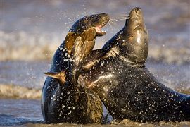
The area is widely recognised as a military practise area but is also perceived as being the location of a pleasure beach as being famous for the grey seal colonies of the Donna Nook Nature Reserve. Mariculture industries are also carried out in the area.
References
RAF Lincolnshire
Lincolnshire Wildlife Trust
Encyclopaedia Britannica: Lincolnshire
Images

Seals at the Nature Reserve
Web: www.photoanswers.co.uk/Facilities-Landing/Search-Results/England/Lincolnshire/Donna-Nook-Nature-Reserve/


