
England's Historic Seascapes: Withernsea to Skegness
Museum of London Archaeology, 2010. https://doi.org/10.5284/1000104. How to cite using this DOI
Data copyright © Historic England unless otherwise stated
This work is licensed under the ADS Terms of Use and Access.


Primary contact
David
Bowsher
Director of Research
Museum of London Archaeology
Mortimer Wheeler House
46 Eagle Wharf Road
London
N1 7ED
UK
Tel: 020 7410 2285
Resource identifiers
- ADS Collection: 935
- ALSF Project Number: 4730
- DOI:https://doi.org/10.5284/1000104
- How to cite using this DOI
Humber Mouth Character Area
Present Day Form
The Humber Mouth offshore character area is situated in the north-western section of the study area to the east of Holderness and the main Humber navigation channel. It is the most seaward extent of the Humber Estuary approach. The geology of the area comprises Chalk bedrock overlain by glacial till (clay, sand and gravel debris deposited from ice sheets) known as the Boulders Bank Formation. The water depth across the area varies between 10m and 15m and the maximum tidal range is 3-4 m.
Sea Use: Present
The dominant character in the Humber Mouth is navigation as the area forms part of the approach to the Humber Estuary from the north. The area is regularly crossed by commercial shipping and it also contains a modern deep water anchorage. The area contains the same active dredging zones as New Sand Hole (RMC marine).
The principal fishing activity in the area is lining for white fish such as cod and whiting and flat fish such as sole and plaice.
Sea Use: Past
The area is situated on the banks of the ancient New Sand Hole palaeochannel. The character area has, therefore, been shaped by thousands of years of dynamic sea level changes and erosion and deposition. The area has potential for the presence of drowned land surfaces resulting from the fact that sea level has fluctuated between -120 metres and +10 metres over the past 500,000 years.
From the period 500,000 BP to 22,000 BP (before present), human population levels were low, and little more than stray finds may be expected, although these may still be of considerable archaeological importance. From 22,000 BP to 2100 BP parts of the North Sea were dry land and human population levels were higher. The fact that the area is on the banks of the New Sand Hole palaeochannel makes it a prime habitation site.
Archaeological Potential
The Humber Mouth character area has potential for the presence of drowned land surfaces resulting from the fact that sea level has fluctuated between -120 metres and +10 metres over the past 500,000 years. From the period 500,000 BP to 22,000 BP (before present), human population levels were low, and little more than stray finds may be expected, although these may still be of considerable archaeological importance.
From 22,000 BP to 2100 BP parts of the North Sea were dry land and human population levels were higher, especially in the Mesolithic age. Finds dating to the Mesolithic have been found to a depth of 40m so any area of sea bed above that has potential for habitation. Inundation of the North Sea landscapes occurred between 10,000 and 6,000 BP and the most likely evidence for human occupation would be, therefore, Mesolithic in date. Earlier Palaeolithic occupation is less likely to be found and later Neolithic occupation is likely to have been limited to the inshore and very highest of the banks and shoals such as the Dogger Bank.
The area lies in the position of the Devensian terminal morrain field and it is likely that much of the area was relatively high land but has been subject to severe coastal erosion. This makes it a possible Upper Palaeolithic, Mesolithic and, in the east, Neolithic habitation site. Any residual artefacts, however, would have been eroded and scattered over a wide area by the tidal rip down this coast.
Over the last 6000 years (if not more), humans have used sea faring vessels and so wrecks and related material may lie on the sea floor or be buried beneath the sea floor. Marine traffic would have historically used this area because of it's proximity to the Humber approaches navigation channel to the south although it is a shallow area and numerous wrecks will be found here possibly dating from the Roman period onwards. Fishing activity would have been carried out in the area from the medieval period onwards.
Character Perceptions
The area is perceived as an important route into the Humber Estuary. It is also an important source of aggregates, attested by the presence of active dredge sites.
References
Close's Fisherman's Chart (UKHO 1953)
Fisheries Sensitivity Maps in British Waters (MAFF 1989)
University of Hull, 1994 Humber Estuary and Coast
Images
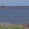
Mouth of the Humber
Web: http://www.picturesofengland.com/user/CliveT/pictures
