
England's Historic Seascapes: Withernsea to Skegness
Museum of London Archaeology, 2010. https://doi.org/10.5284/1000104. How to cite using this DOI
Data copyright © Historic England unless otherwise stated
This work is licensed under the ADS Terms of Use and Access.


Primary contact
David
Bowsher
Director of Research
Museum of London Archaeology
Mortimer Wheeler House
46 Eagle Wharf Road
London
N1 7ED
UK
Tel: 020 7410 2285
Resource identifiers
- ADS Collection: 935
- ALSF Project Number: 4730
- DOI:https://doi.org/10.5284/1000104
- How to cite using this DOI
Spurn Point Character Area
Present Day Form
The Spurn Point character area is situated in the north-western extent of the study area on the coastline in the parish of East Riding in Yorkshire at the point where the Humber Estuary meets the sea. The area is entirely land based at present and consists of an 8km long peninsula that extends out into the Humber Estuary mouth. The peninsula was formed during the last ice age and consists of a glacial moraine ridge underlain by chalk and boulder clay. It is closely associated with neighbouring character area The Binks.
Sea Use: Present
Spurn Point plays an important role in navigation of the Estuary because it is a landmark. It is also hazard to navigation and so lighthouses are located on the tip of the point. The area is dominated by rural settlement but also contains a relic military landscape in the form of a series of WWII coastal anti aircraft batteries.
The area contains one settlement with maritime character: the village of Kilnsea.
The area also falls partially within the Humber Estuary SSSI and is popular for recreational activities such as walking, etc.
The area is actively protected against the rising sea by groynes and boulders.
Sea Use: Past
Spurn Point has a 250 year life-cycle during which it is eroded away and reformed in a slightly different location (Hull University 1994). The rate of erosion in its current cycle has probably been accelerated both by sea level change and by the removal by the barge load of shingle, in the 18th and 19th centuries, which was then used as ballast for whaling boats that operated out of the port of Hull at this time (ibid).
The spurn point that we see today may, therefore, only be approximately 250 years old. It is likely that it has always been an important feature in navigating the estuary. The area was previously monitored by the Spurn lightship, which was stationed 4.5 miles off Spurn Point for 50 years. It is now moored in Hull marina as a tourist attraction (Hullcc.com). Prior to the creation of the peninsula this area may have been part of the Estuary bed.
Archaeological Potential
The Humber Estuary was formed 10,000 years ago during the last ice age when the advancing glaciers buried the old coastline beneath a blanket of boulder clay (Hull University Press 1994). Prior to this the estuary mouth was much further to the west, where the Humber Bridge currently stands.
The Estuary has been used as a transport route and fishing area since the prehistoric period, for example some of the earliest known wooden boats in Europe were discovered on the foreshore at North Ferriby (Van de Noort 2000, 167). Many of the surrounding ancient settlements on the Estuary banks accessed the Estuary and grew up because of the opportunities it offered for transport and fishing.
Spurn Point may only have existed in its current location for the last 250 years and so the area will contain archaeological evidence relating to previous uses as a channel of the Estuary and evidence of land reclamation and settlement during the post-medieval period. For instance, the remains of a prehistoric boat were recently found in Kilnsea, one of a local group of boat discoveries widely regarded as Europe's earliest known boats. The area is part of a prehistoric landscape and many other sites are known (Van de Noort 2003).
Character Perceptions
Spurn Point is perceived as a local landmark for navigation purposes and a rural settlement area with strong connections to the sea.
References
University of Hull, 1994, Humber Estuary and Coast, Institute of Estuarine and Coastal Studies, University of Hull, November 1994
http://www.hullcc.gov.uk
Van de Noort, R, 2003, An Ancient Seascape: The Social Context of Seafaring in the Early Bronze Age, in World Archaeology, Vol 35, No 3, 404-415
Images
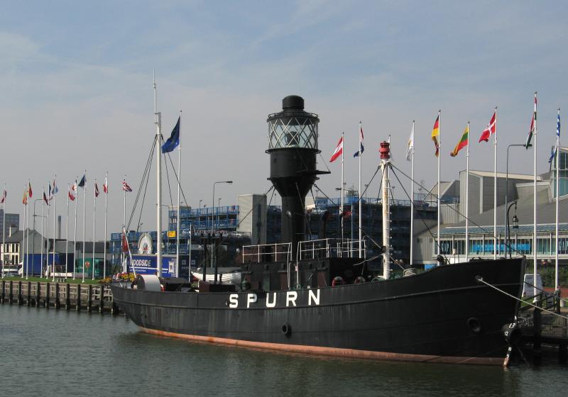
Spurn lightship
Web: http://www.ukstudentlife.com/Travel/Tours/England/Hull.htm
