
England's Historic Seascapes: Withernsea to Skegness
Museum of London Archaeology, 2010. https://doi.org/10.5284/1000104. How to cite using this DOI
Data copyright © Historic England unless otherwise stated
This work is licensed under the ADS Terms of Use and Access.


Primary contact
David
Bowsher
Director of Research
Museum of London Archaeology
Mortimer Wheeler House
46 Eagle Wharf Road
London
N1 7ED
UK
Tel: 020 7410 2285
Resource identifiers
- ADS Collection: 935
- ALSF Project Number: 4730
- DOI:https://doi.org/10.5284/1000104
- How to cite using this DOI
Sunk Island Coast Character Area
Present Day Form
The Sunk Island coast character area is situated in the north-western extent of the study area, on the north bank of the Inner Humber Estuary in the parish of East Riding of Yorkshire. The area is entirely land based and is an essential part of the surrounding seascape. The Geology of the area is glacial moraine, chalk and boulder clay overlain by thick deposits of alluvium.
The form of the present day coastline has been influenced by the dynamic actions of the Estuary, particularly over the past 400 years. Prior to this time this area of land was submerged and part of the Humber Estuary, which was much wider prior to the 17th century (Hull University 1994).
Sea Use: Present
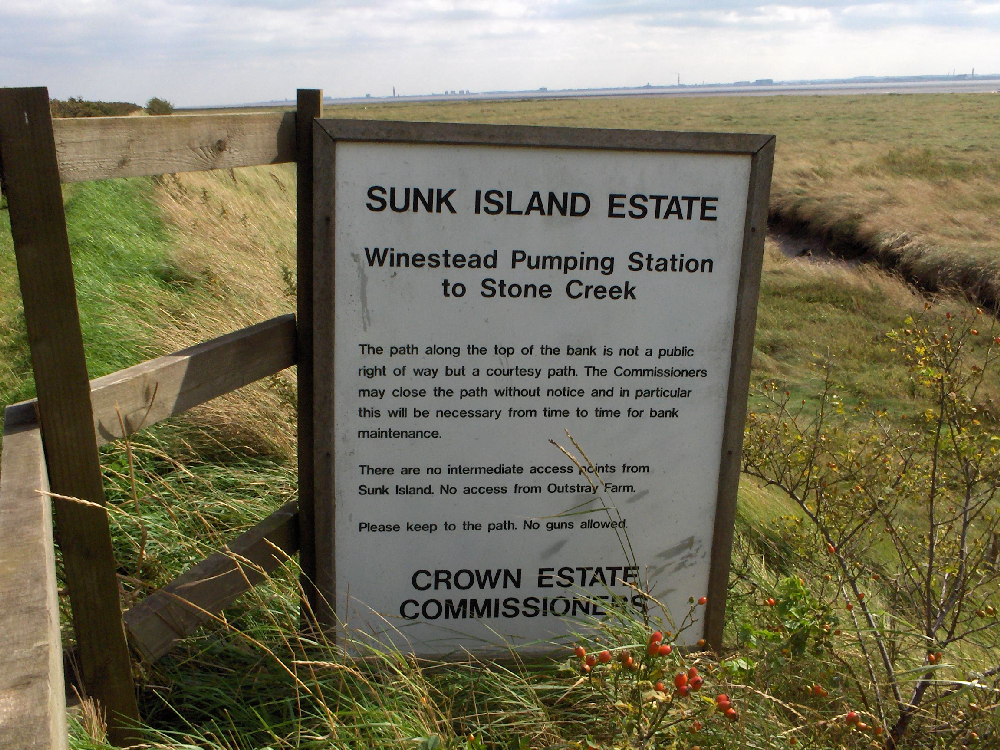
The area is located almost entirely on post-medieval reclaimed land and falls within the local flood risk zone. The land/sea line is actively managed. The area is a mixture of being highly industrial in the western part and rural and agricultural in the east.
A large BP oil terminal and works is located at Saltend. The dock receives tankers bringing oil in from offshore contexts (the oil is not piped in). A number of settlements with maritime character fall within the character area and most of these are now associated with agriculture rather than fishing.
For instance, the village of Keyingham is an important centre for horticulture. The villages of Patrington and Patrington Haven are agricultural but also house RAF Patrington. The village of Paull was until recently a centre for fishing, particularly shrimping.
The Sunk Island coast area falls partially within the Humber Estuary SSSI.
Sea Use: Past
Sunk Island coast is formed almost entirely from land deliberately reclaimed form the sea from the early 17th century onwards. The Humber Estaury was originally much wider than it is todays and then in the late 1600s a sandbank began to form in what used to be the centre and by 1675 it was high enough to be reclaimed. This was the original Sunk Island (University of Hull 1994). At this time many of the villages, some of which are now quite a distance inland, were situated on the banks of the Estuary. For instance, Paull, Hedon, Thorngumbald, Keyingham, Ottringham, Partrington, Welwick and Weeton. After 1675 the land around the newly formed island was systematically reclaimed and by the end of the 1800s reclamation of the area was complete (ibid).
All the settlements in the character area have ancient origins strongly and many of these are associated with maritime activities. The settlement at Paull contains an old WWII decoy for Hull City and anti aircraft batteries. Until relatively recently Paull was a centre for fishing but was also known for shipbuilding. In 1812 HMS Anson, a 74-gun warship of 1,741 tons, was built at Paull. The stocks used can still be seen at low tide on the beach and the adjacent cottages are known as Anson Villas.
The historic centre of Hedon town is thought to have been created by the Normans as a port. Hedon was at its most prosperous in the 12th and 13th centuries and at one time was the 11th largest port in England. The decline of the port came with the development of the port of Hull and the building of larger ships which were unable to get down the small river to Hedon.
During World War II the village of Ottringham had a transmitting station, named BBC Ottringham or OSE5, which was built to counter German jamming signals and broadcast propaganda into Germany.
The villages of Patrington and Patrington Haven were previously situated on the Estuary banks and until relatively recently the Patrington Haven channel used to connect the settlements to the sea. RAF Patrington was built during the Second World War and the new base at Holmpton was renamed RAF Patrington.
Archaeological Potential
The Humber Estuary was formed 10,000 years ago during the last ice age when the advancing glaciers buried the old coastline beneath a blanket of boulder clay (Hull University Press 1994). Prior to this the estuary mouth was much further to the west, where the Humber Bridge currently stands.
The Estuary has been used as a transport route and fishing area since the prehistoric period, for example some of the earliest known wooden boats in Europe were discovered on the foreshore at North Ferriby (Van de Noort 2000, 167). Many of the surrounding ancient settlements on the Estuary banks accessed the Estuary and grew up because of the opportunities it offered for transport and fishing.
Much of the Sunk Island coast area was only reclaimed from the Estuary between 1675 and 1900 (Hull University 1994) and so the area will contain archaeological evidence relating to previous uses as a channel of the Estuary and evidence of land reclamation and settlement during the post-medieval period.
Character Perceptions
Sunk Island is perceived as a rural settlement area with elements of industry.
References
Skeggs, G. S. (1990). Thorngumbald: That Village Yon Side of Hedon. Highgate Publications (Beverley) Ltd.
University of Hull, 1994, Humber Estuary and Coast, Institute of Estuarine and Coastal Studies, University of Hull, November 1994
Images
View over sunk island towards estuary
Web: http://www.johndavies.org/pic-sunk-island-1.jpg
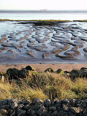
Sunk Island sands
Web: http://upload.wikimedia.org/wikipedia/commons/thumb/4/4a/Humber_Estuary_at_Sunk_Island.jpg/350px-Humber_Estuary_at_Sunk_Island.jpg
