An Imperial Frontier and its Landscape: the Gorgan and Tammisheh Walls in North-East Iran

Roger Ainslie, Jebrael Nokandeh, Hamid Omrani Rekavandi, Eberhard Sauer, Tony Wilkinson, Chris Oatley, Mohammad Ershadi, 2014. https://doi.org/10.5284/1000163. How to cite using this DOI

Digital Object Identifiers

Digital Object Identifiers (DOIs) are persistent identifiers which can be used to consistently and accurately reference digital objects and/or content. The DOIs provide a way for the ADS resources to be cited in a similar fashion to traditional scholarly materials. More information on DOIs at the ADS can be found on our help page.

Citing this DOI

The updated Crossref DOI Display guidelines recommend that DOIs should be displayed in the following format:

https://doi.org/10.5284/1000163
Sample Citation for this DOI

Roger Ainslie, Jebrael Nokandeh, Hamid Omrani Rekavandi, Eberhard Sauer, Tony Wilkinson, Chris Oatley, Mohammad Ershadi (2014) An Imperial Frontier and its Landscape: the Gorgan and Tammisheh Walls in North-East Iran [data-set]. York: Archaeology Data Service [distributor] https://doi.org/10.5284/1000163

Data copyright © Roger Ainslie unless otherwise stated

This work is licensed under the ADS Terms of Use and Access.
Creative Commons License


Arts and Humanities Research Council (AHRC) logo

Primary contact

Abingdon Archaeological Geophysics
4 Sutton Close
Abingdon
Oxfordshire
OX14 1ER
England

Send e-mail enquiry

Resource identifiers

Digital Object Identifiers

Digital Object Identifiers (DOIs) are persistent identifiers which can be used to consistently and accurately reference digital objects and/or content. The DOIs provide a way for the ADS resources to be cited in a similar fashion to traditional scholarly materials. More information on DOIs at the ADS can be found on our help page.

Citing this DOI

The updated Crossref DOI Display guidelines recommend that DOIs should be displayed in the following format:

https://doi.org/10.5284/1000163
Sample Citation for this DOI

Roger Ainslie, Jebrael Nokandeh, Hamid Omrani Rekavandi, Eberhard Sauer, Tony Wilkinson, Chris Oatley, Mohammad Ershadi (2014) An Imperial Frontier and its Landscape: the Gorgan and Tammisheh Walls in North-East Iran [data-set]. York: Archaeology Data Service [distributor] https://doi.org/10.5284/1000163

University of Edinburgh logo
Durham University logo

Downloads

2006

The geophysical surveys were part of the work on this wall being carried out by the Gorgan Wall Research Project in 2006. In the previous year brick kilns along the wall had been located and excavated to produce samples for scientific dating. See Iran 44 (2006).

The 2006 season included geophysical surveys of part of Fort 5 and of Fort 4, along with further work on kilns found along the walls and excavation of features indicated by the magnetometery in Fort 4.

Report
Gorgan Wall, IRAN, Forts 4 and 5. Geophysical Survey using Magnetometery. Abingdon Archaeological Geophysics (2006). Gorgan Wall, IRAN, Forts 4 and 5. Geophysical Survey using Magnetometery. Abingdon Archaeological Geophysics: Abingdon. PDF 4 Mb

Fort 4

Metadata
Data
Fort 4. Geophysics data. ZIP 351 Kb
Thumbnail of Fort 4. Black and white, with grid lines.
Fort 4. Black and white, with grid lines.
b_and_w_grid_lines.jpg
[DOWNLOAD] (Full Resolution) right-click and save link
Fort 4. Black and white, with grid lines. JPG
Fort 4. Black and white, with grid lines.
b_and_w_grid_lines.jpg
[DOWNLOAD] (Full Resolution) right-click and save link
979 Kb
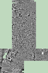
Thumbnail of Fort 4. Black and white, with no grid lines.
Fort 4. Black and white, with no grid lines.
b_and_w_no_grid_lines.jpg
[DOWNLOAD] (Full Resolution) right-click and save link
Fort 4. Black and white, with no grid lines. JPG
Fort 4. Black and white, with no grid lines.
b_and_w_no_grid_lines.jpg
[DOWNLOAD] (Full Resolution) right-click and save link
871 Kb
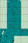
Thumbnail of Fort 4. Colour, with grid lines.
Fort 4. Colour, with grid lines.
colour_grid_lines.jpg
[DOWNLOAD] (Full Resolution) right-click and save link
Fort 4. Colour, with grid lines. JPG
Fort 4. Colour, with grid lines.
colour_grid_lines.jpg
[DOWNLOAD] (Full Resolution) right-click and save link
1.26 Mb
Thumbnail of Fort 4. Interpretation.
Fort 4. Interpretation.
interpretation.jpg
[DOWNLOAD] (Full Resolution) right-click and save link
Fort 4. Interpretation. JPG
Fort 4. Interpretation.
interpretation.jpg
[DOWNLOAD] (Full Resolution) right-click and save link
1.07 Mb

Fort 5

Metadata
Data
Fort 5. Geophysics data. ZIP 71 Kb
Thumbnail of Fort 5. Black and white, with no grid lines.
Fort 5. Black and white, with no grid lines.
b_and_w_no_grid_lines.jpg
[DOWNLOAD] (Full Resolution) right-click and save link
Fort 5. Black and white, with no grid lines. JPG
Fort 5. Black and white, with no grid lines.
b_and_w_no_grid_lines.jpg
[DOWNLOAD] (Full Resolution) right-click and save link
172 Kb
Thumbnail of Fort 5. Colour, with grid lines.
Fort 5. Colour, with grid lines.
colour_grid_lines.jpg
[DOWNLOAD] (Full Resolution) right-click and save link
Fort 5. Colour, with grid lines. JPG
Fort 5. Colour, with grid lines.
colour_grid_lines.jpg
[DOWNLOAD] (Full Resolution) right-click and save link
247 Kb
Thumbnail of Fort 5. Interpretation.
Fort 5. Interpretation.
interpretation.jpg
[DOWNLOAD] (Full Resolution) right-click and save link
Fort 5. Interpretation. JPG
Fort 5. Interpretation.
interpretation.jpg
[DOWNLOAD] (Full Resolution) right-click and save link
627 Kb
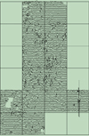
Thumbnail of Fort 5. Trace.
Fort 5. Trace.
trace.jpg
[DOWNLOAD] (Full Resolution) right-click and save link
Fort 5. Trace. JPG
Fort 5. Trace.
trace.jpg
[DOWNLOAD] (Full Resolution) right-click and save link
366 Kb

ADS logo
Data Org logo
University of York logo