
Home Front Legacy 1914-18
Claire Corkill, Chris Kolonko, 2020. https://doi.org/10.5284/1059297. How to cite using this DOI
Data copyright © Council for British Archaeology unless otherwise stated
This work is licensed under a Creative Commons Attribution 4.0 International License.

Primary contact
Council for British Archaeology
92 Micklegate
York
YO1 6JX
UK
Tel: 01904 671417
Resource identifiers
- ADS Collection: 3366
- DOI:https://doi.org/10.5284/1059297
- How to cite using this DOI

Full Record - Brushes Rifle Range (PRN: 11426)
| PRN | 11426 | ||||
|---|---|---|---|---|---|
| Site or location name | Brushes Rifle Range | ||||
| Summary | |||||
| Description | Overall runs East West. Earlier site (19th C) updated with mainly brick built structures. 9 sites and associated trenching site to south. Two brick built commnd centres/target stores. Latrine. 3 mantlets. Hand gun gallery & markers shelter. One rifle range & markers gallery. One possible vickers range with possible water coolant source and mantlet and gallery and command/ store room. Two possible earlier rifle/musket target areas associated with large bore bullet tips. Terracing associated with corrugated metal sheet remanents. Large linear bank. Gulley and further terracing/revetments possible billets to west of main site. One very large embankment for main rifle range. Resues of proable prehistory cairns for lon distance cut stone supports for targets and association with large bore bullet tips. Resused iron boiler as sentry box on Easterly perimeter of site. Most of brick work extant with minor vandalism. Gallerys suffering from iron corrosion within concrete or supports, some collapsed already.' | ||||
| Monument Type | RIFLE RANGE;TRAINING AREA;RIFLE RANGE | ||||
| Desgination | None | ||||
| Material | BRICK, CONCRETE | ||||
| Location | |||||
| Country | ENGLAND | ||||
|---|---|---|---|---|---|
| County | Stalybridge | ||||
| Site Location | Brushes Rifle Range | ||||
| Postcode | SK15 3EH | ||||
| Map Reference | NGR: SJ98389859 (398380, 398590) | ||||
| Condition/Threat | |||||
| Condition (Date) | Very Poor (20-07-2018) | ||||
| Threat | Delapidation | ||||
| Signif | Low | ||||
| Related Sites | |||||
| trenching directly to south | |||||
| Source | |||||
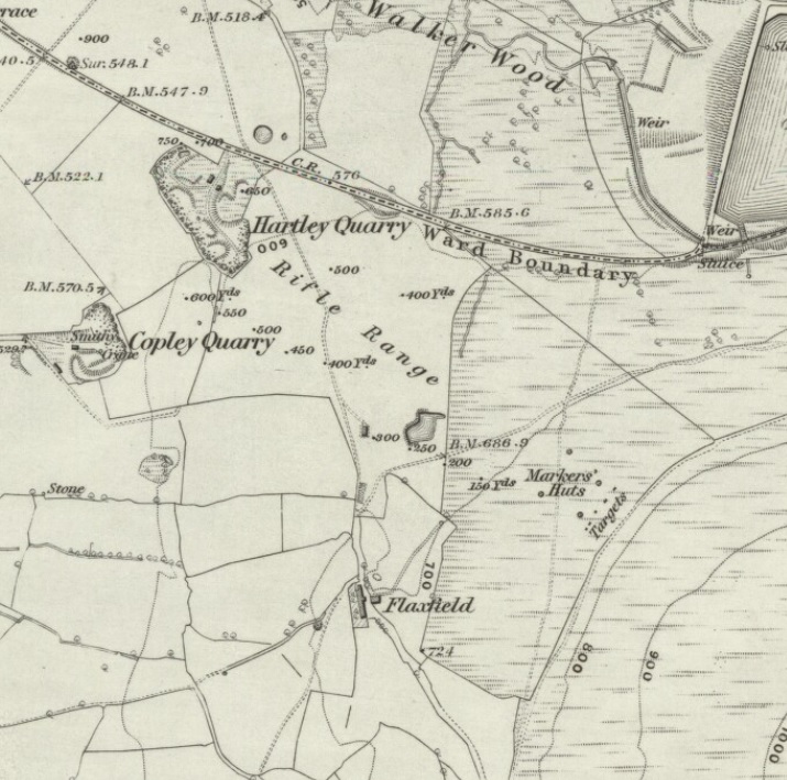
| Ordnance Survey (1882) Cheshire III (includes: Dukinfield; Mossley; Stalybridge.). National Library of Scotland . Edinburgh. https://maps.nls.uk/view/102340957 | |||||
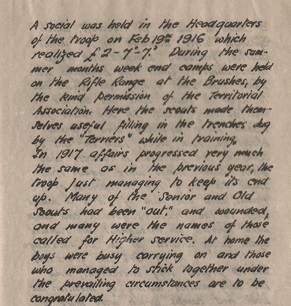
| (1921) History of 1st ashton under lyne scout group. | |||||
| (1938) Lancashire CV (includes: Ashton Under Lyne; Audenshaw; Denton; Dukinfield; Hurst; Hyde.) Six-inch England and Wales, 1842-1952. . Ordnance Survey/National Library of Scotland. https://maps.nls.uk/os/6inch-england-and-wales/lancashire.html | |||||
| TAS (2016) Lidar of rifle range . | |||||
| Administration | |||||
| Recorded By (Date) | Kevin Wright - Tameside Archaeological Society Ltd | ||||
| Copiled On | 20-07-2018 | ||||
| Last Updated | 20-07-2018 | ||||
| Associated data |
|---|
Documentation
| Image metadata | CSV | 590 Kb |
| Image metadata (scanned documents) | CSV | 36 Kb |
Data
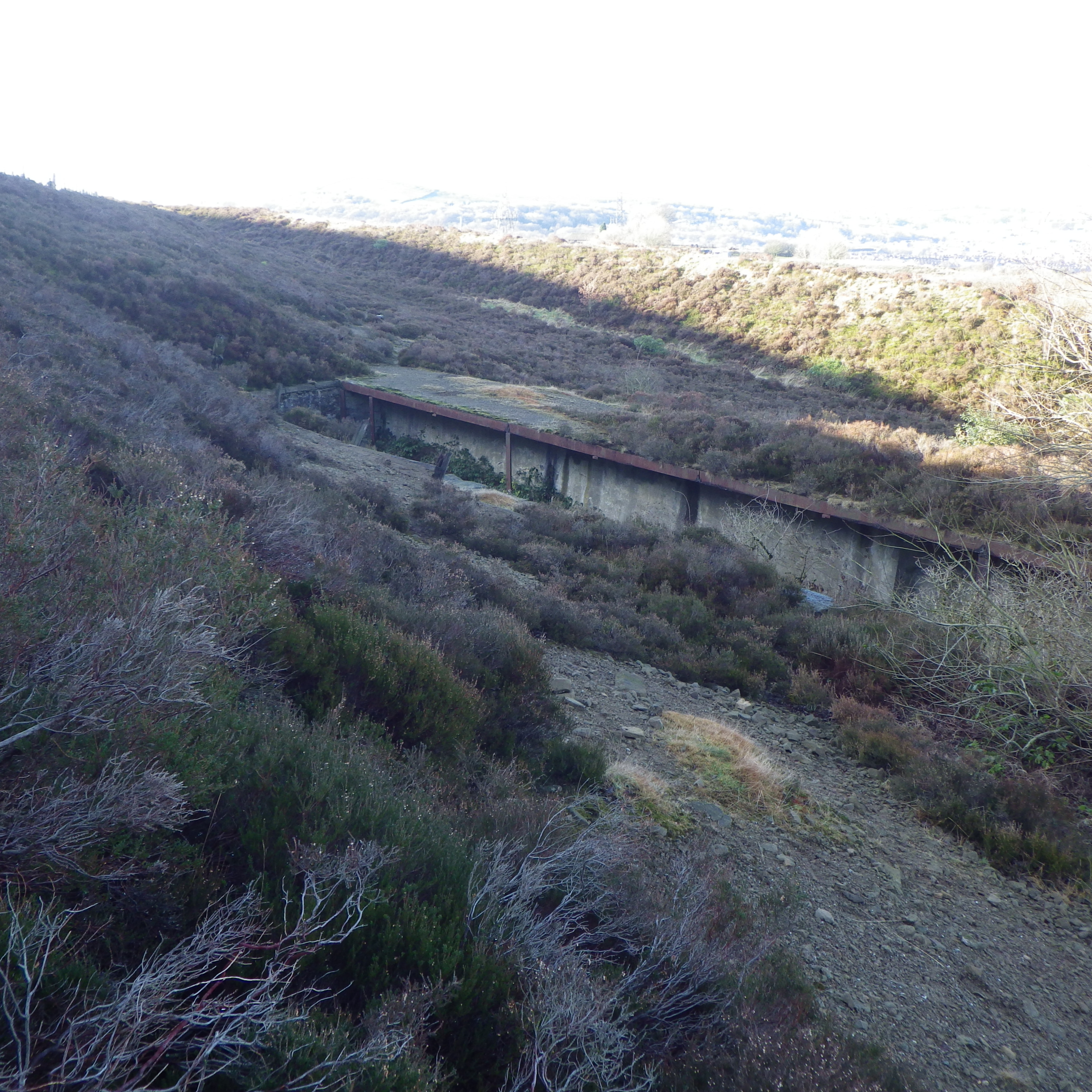
. Rifle range gallery, command/store room and possible prone lying bank. as a JPG image")
|
Former Brushes Rifle Range (Brushes Road, Stalybridge, Tameside, Greater Manchester). Rifle range gallery, command/store room and possible prone lying bank. (File name: 11426_1237.jpg) |
JPG | 156 Kb |
. End of rifle range gallery, destroyed markers box, possible prone lying banking on right, facing North. as a JPG image")
|
Former Brushes Rifle Range (Brushes Road, Stalybridge, Tameside, Greater Manchester). End of rifle range gallery, destroyed markers box, possible prone lying banking on right, facing North. (File name: 11426_1236.jpg) |
JPG | 3.67 Mb |
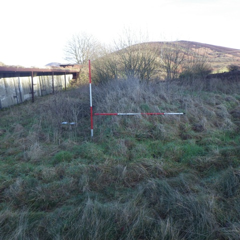
. Hand gun range in foreground, rear of banking eartyhwork for rifle range, facing South West. as a JPG image")
|
Former Brushes Rifle Range (Brushes Road, Stalybridge, Tameside, Greater Manchester). Hand gun range in foreground, rear of banking eartyhwork for rifle range, facing South West. (File name: 11426_1235.jpg) |
JPG | 3.54 Mb |
. History of 1st Ashton under Lyne Scout group. as a JPG image")
|
Former Brushes Rifle Range (Brushes Road, Stalybridge, Tameside, Greater Manchester). History of 1st Ashton under Lyne Scout group. (File name: 11426_2944.jpg) |
JPG | 215 Kb |
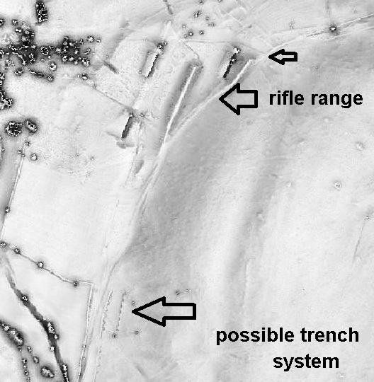
. Lidar of rifle range. as a JPG image")
|
Former Brushes Rifle Range (Brushes Road, Stalybridge, Tameside, Greater Manchester). Lidar of rifle range. (File name: 11426_2943.jpg) |
JPG | 95 Kb |
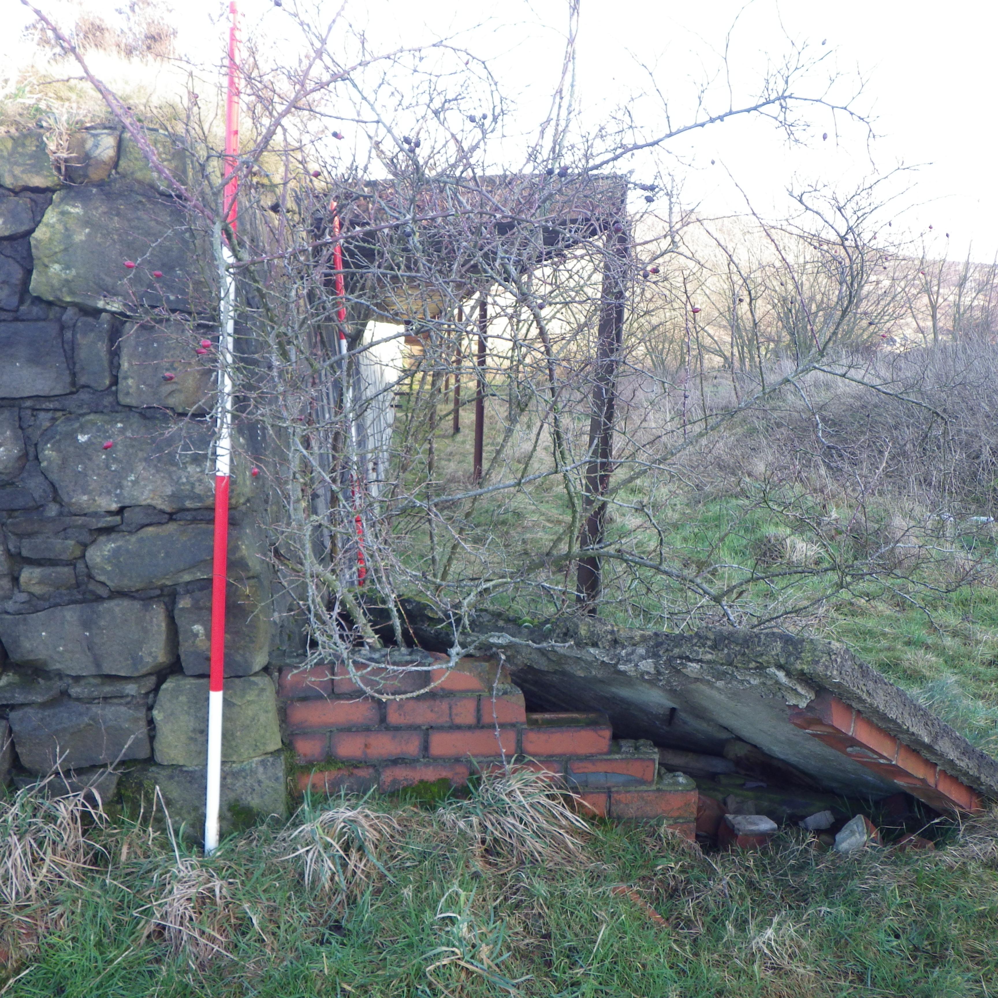
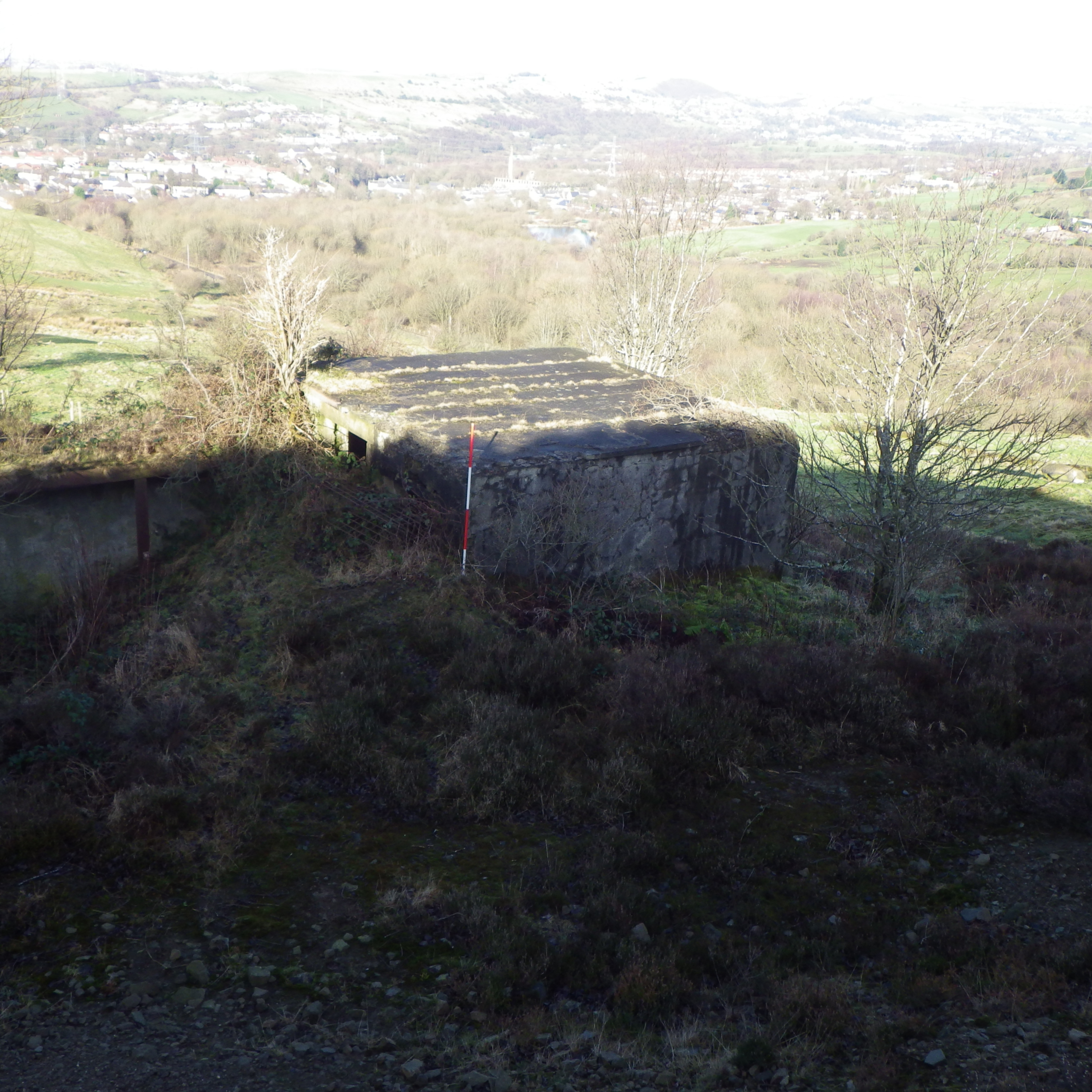
. Rifle range command/store room, facing west. as a JPG image")
|
Former Brushes Rifle Range (Brushes Road, Stalybridge, Tameside, Greater Manchester). Rifle range command/store room, facing west. (File name: 11426_1238.jpg) |
JPG | 3.55 Mb |
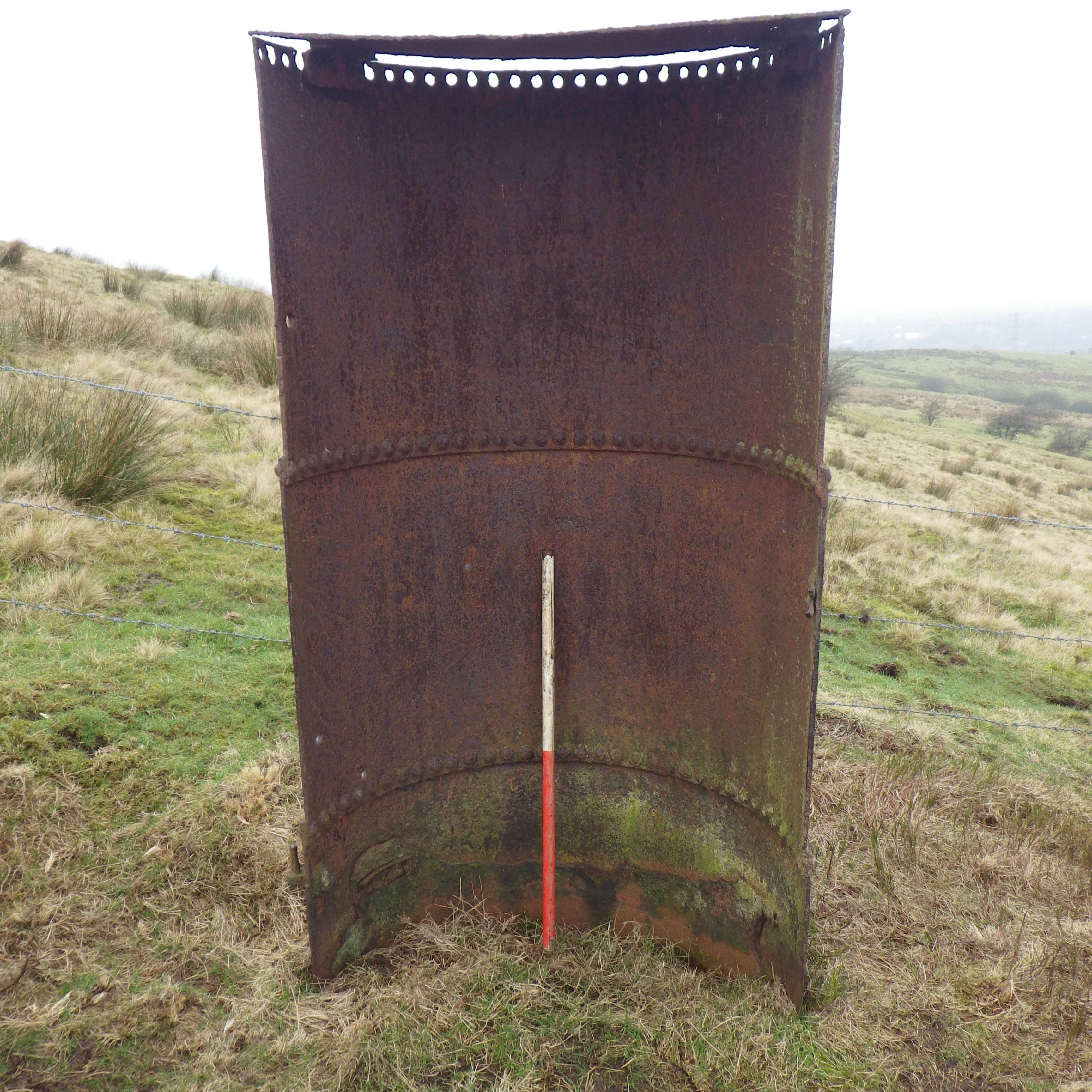
. Sentry box, North west facing. as a JPG image")
|
Former Brushes Rifle Range (Brushes Road, Stalybridge, Tameside, Greater Manchester). Sentry box, North west facing. (File name: 11426_1234.jpg) |
JPG | 3.73 Mb |
. Six-inch England and Wales, 1842-1952 Lancashire CV.NE. as a JPG image")
|
Former Brushes Rifle Range (Brushes Road, Stalybridge, Tameside, Greater Manchester). Six-inch England and Wales, 1842-1952 Lancashire CV.NE. (File name: 11426_2942.jpg) |
JPG | 187 Kb |
. Six-inch England and Wales, 1842-1952, Cheshire III. as a JPG image")
|
Former Brushes Rifle Range (Brushes Road, Stalybridge, Tameside, Greater Manchester). Six-inch England and Wales, 1842-1952, Cheshire III. (File name: 11426_2941.jpg) |
JPG | 174 Kb |
