
Home Front Legacy 1914-18
Claire Corkill, Chris Kolonko, 2020. https://doi.org/10.5284/1059297. How to cite using this DOI
Data copyright © Council for British Archaeology unless otherwise stated
This work is licensed under a Creative Commons Attribution 4.0 International License.

Primary contact
Council for British Archaeology
92 Micklegate
York
YO1 6JX
UK
Tel: 01904 671417
Resource identifiers
- ADS Collection: 3366
- DOI:https://doi.org/10.5284/1059297
- How to cite using this DOI

Full Record - Ashton Armoury (PRN: 178)
| PRN | 178 | ||||
|---|---|---|---|---|---|
| Site or location name | Ashton Armoury | ||||
| Summary | |||||
| Description | Ashton Armoury | ||||
| Monument Type | DRILL HALL;DRILL HALL | ||||
| Desgination | None | ||||
| Material | BRICK | ||||
| Location | |||||
| Country | ENGLAND | ||||
|---|---|---|---|---|---|
| County | Ashton | ||||
| Site Location | North side of Old Street at junction with Wellington Street. | ||||
| Postcode | |||||
| Map Reference | NGR: SJ9356898905 (393568, 398905) | ||||
| Condition/Threat | |||||
| Condition (Date) | Good (03-07-2015) | ||||
| Threat | Closure as TA Centre. Redevelopmment threat. | ||||
| Signif | High | ||||
| Source | |||||
| Osborne, Mike (2006) Always Ready: The Drill Halls of Britain's Volunteer Forces. Partizan Press. Leigh-on-Sea. | |||||
| Administration | |||||
| Recorded By (Date) | John M - Geograph (02-07-2014) | ||||
| Copiled On | 03-07-2015 | ||||
| Last Updated | 03-07-2015 | ||||
| Associated data |
|---|
Documentation
| Image metadata | CSV | 590 Kb |
Data
. Front and side elevation. as a JPG image")
|
Ashton Armour (Wellington Street, Hurst, Tameside, Greater Manchester). Front and side elevation. (File name: 178_288.jpg) |
JPG | 59 Kb |
. Front elevation, Old Street. as a JPG image")
|
Ashton Armour (Wellington Street, Hurst, Tameside, Greater Manchester). Front elevation, Old Street. (File name: 178_287.jpg) |
JPG | 75 Kb |
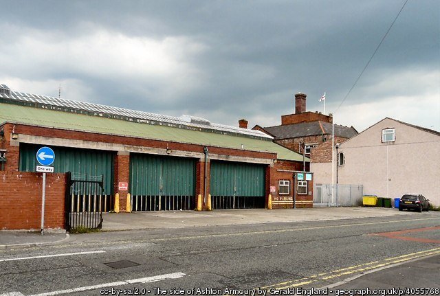
. Side elevation, Cavendish Street. as a JPG image")
|
Ashton Armour (Wellington Street, Hurst, Tameside, Greater Manchester). Side elevation, Cavendish Street. (File name: 178_289.jpg) |
JPG | 69 Kb |
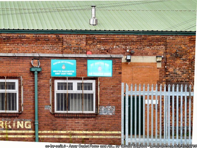
. Side elevation, detail. as a JPG image")
|
Ashton Armour (Wellington Street, Hurst, Tameside, Greater Manchester). Side elevation, detail. (File name: 178_290.jpg) |
JPG | 116 Kb |
