
Home Front Legacy 1914-18
Claire Corkill, Chris Kolonko, 2020. https://doi.org/10.5284/1059297. How to cite using this DOI
Data copyright © Council for British Archaeology unless otherwise stated
This work is licensed under a Creative Commons Attribution 4.0 International License.

Primary contact
Council for British Archaeology
92 Micklegate
York
YO1 6JX
UK
Tel: 01904 671417
Resource identifiers
- ADS Collection: 3366
- DOI:https://doi.org/10.5284/1059297
- How to cite using this DOI

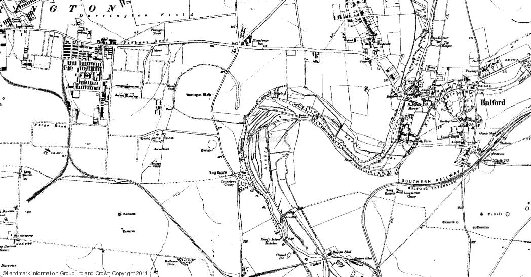
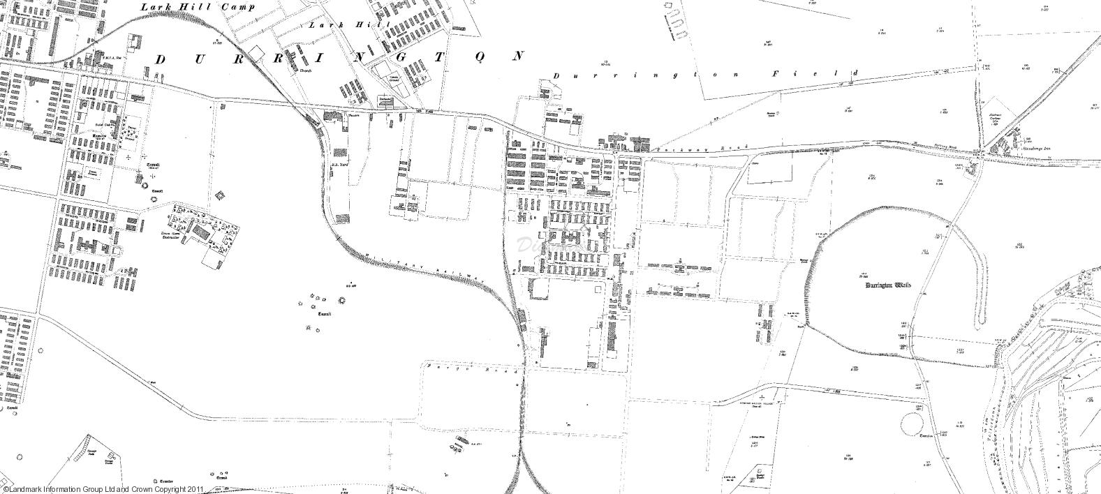
Full Record - Durrignton Camp (PRN: 310)
| PRN | 310 | ||||
|---|---|---|---|---|---|
| Site or location name | Durrignton Camp | ||||
| Summary | |||||
| Description | Trainig Camp | ||||
| Monument Type | ARMY CAMP;TRAINING CAMP;ARMY CAMP | ||||
| Desgination | None | ||||
| Material | |||||
| Location | |||||
| Country | ENGLAND | ||||
|---|---|---|---|---|---|
| County | |||||
| Site Location | Adjacent to Durrington Walls. SIte not vsited | ||||
| Postcode | |||||
| Map Reference | NGR: SU14604386 (414600, 143860) | ||||
| Condition/Threat | |||||
| Condition (Date) | Uncertain (06-09-2015) | ||||
| Administration | |||||
| Recorded By (Date) | McVey - No Mans Land (05-09-2015) | ||||
| Copiled On | 06-09-2015 | ||||
| Last Updated | 06-09-2015 | ||||
| Associated data |
|---|
Documentation
| Image metadata | CSV | 590 Kb |
Data
. 1920s map. as a JPG image")
|
Durrignton Camp (Pownall Road, Durrington, Wiltshire). 1920s map. (File name: 310_481.jpg) |
JPG | 124 Kb |
. 1920s map. as a JPG image")
|
Durrignton Camp (Pownall Road, Durrington, Wiltshire). 1920s map. (File name: 310_482.jpg) |
JPG | 145 Kb |
