
Home Front Legacy 1914-18
Claire Corkill, Chris Kolonko, 2020. https://doi.org/10.5284/1059297. How to cite using this DOI
Data copyright © Council for British Archaeology unless otherwise stated
This work is licensed under a Creative Commons Attribution 4.0 International License.

Primary contact
Council for British Archaeology
92 Micklegate
York
YO1 6JX
UK
Tel: 01904 671417
Resource identifiers
- ADS Collection: 3366
- DOI:https://doi.org/10.5284/1059297
- How to cite using this DOI

Full Record - Briggate (02) (PRN: 8190)
| PRN | 8190 | ||||
|---|---|---|---|---|---|
| Site or location name | Briggate (02) | ||||
| Summary | |||||
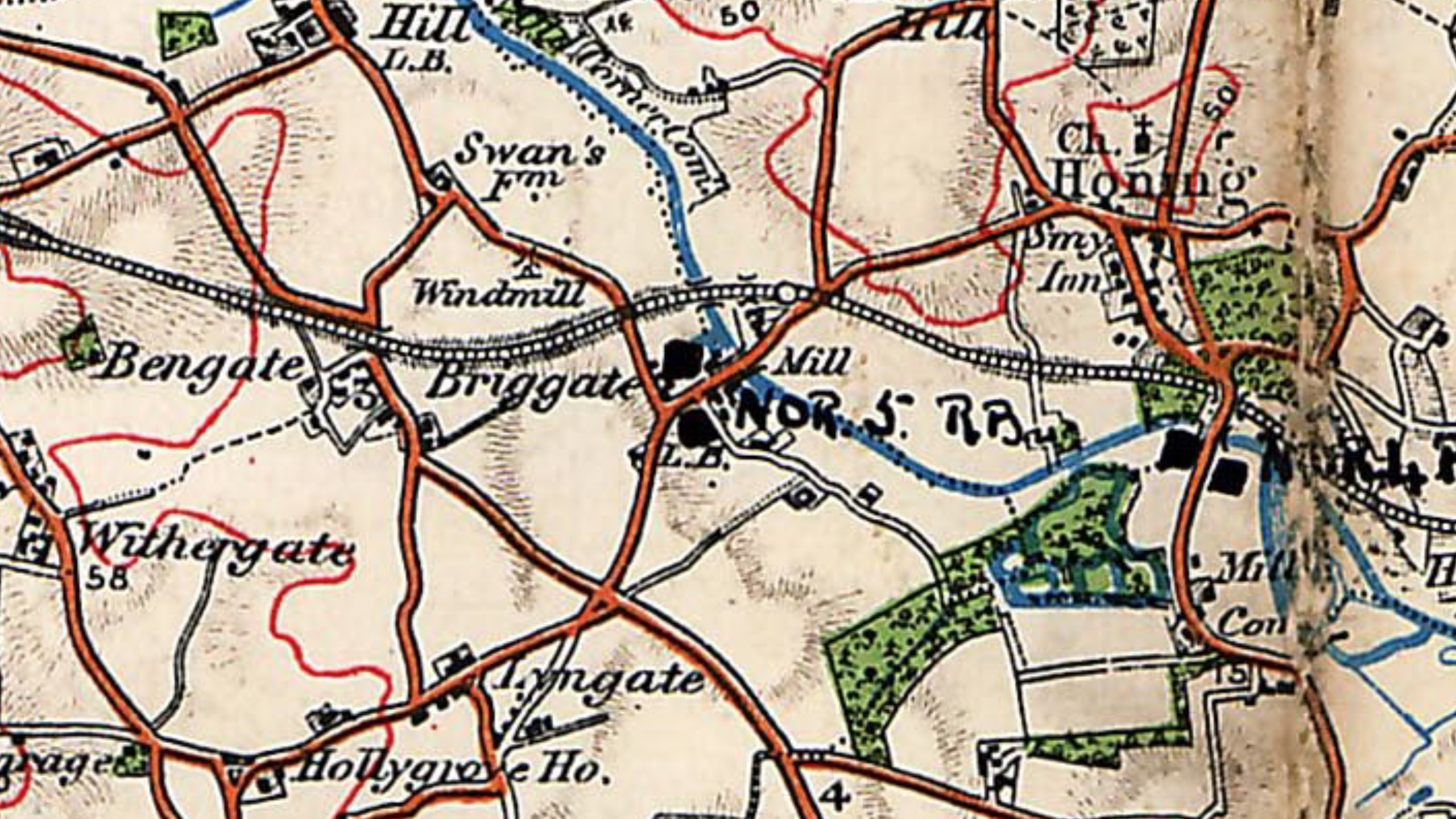
| Description | WW1 pillbox, almost certainly circular of concrete block construction. One of a pair, part of the River Ant stop line. The only source for this site is a 1918 military map of First World War defences in North Norfolk. Map reproduced by kind permission of the map's owner, Mr. J. Hall. The map shows NOR 5 RB marked by this pillbox. | ||||
| Monument Type | PILLBOX;PILLBOX | ||||
| Desgination | None | ||||
| Material | CONCRETE | ||||
| Location | |||||
| Country | ENGLAND | ||||
|---|---|---|---|---|---|
| County | |||||
| Site Location | To W of watermill | ||||
| Postcode | |||||
| Map Reference | NGR: TG31432727 (631430, 327270) | ||||
| Condition/Threat | |||||
| Condition (Date) | Destroyed (27-07-2016) | ||||
| Source | |||||
| Hall, J (1918) Map of North Norfolk Defences from WW1. | |||||
| Administration | |||||
| Recorded By (Date) | Christopher Bird - Norfolk's WW1 pillboxes | ||||
| Copiled On | 27-07-2016 | ||||
| Last Updated | 27-07-2016 | ||||
| Associated data |
|---|
Documentation
| Image metadata (scanned documents) | CSV | 36 Kb |
Data
, WW1 pillbox, almost certainly circular of concrete block construction (Briggate, Worstead, North Norfolk, Norfolk). Map of North Norfolk Defences from WW1. (c) J Hall as a PNG image")
|
Briggate (02), WW1 pillbox, almost certainly circular of concrete block construction (Briggate, Worstead, North Norfolk, Norfolk). Map of North Norfolk Defences from WW1. (c) J Hall (File name: 8190_655.png) |
PNG | 6.10 Mb |
