Land at Boulton Moor, east of Chellaston Lane (Phases 3 and 4), Derby: Evaluation and Excavation
Oxford Archaeology (South), 2019. https://doi.org/10.5284/1058967. How to cite using this DOI
Data copyright © Oxford Archaeology (South) unless otherwise stated
This work is licensed under a Creative Commons Attribution 4.0 International License.
Primary contact
Oxford Archaeology (South)
Janus House
Osney Mead
Oxford
OX2 0ES
UK
Tel: 01865 263800
Fax: 01865 793496
Resource identifiers
- ADS Collection: 3642
- DOI:https://doi.org/10.5284/1058967
- How to cite using this DOI
Introduction

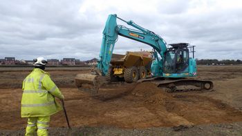
Oxford Archaeology (OA) evaluated a site at Boulton Moor (NGR 440025 331550) by trenching in 2017 and excavated two areas, A and B, in 2018 in advance of housing development by Persimmon Homes.
A Phase 1 evaluation was commissioned by CgMs Consulting for an area of land of c 14.5 hectares between Chellaston Road and the A6, Derby. Eighty-one trenches were opened in November and December 2017, representing a 3.6% sample of the two fields. Pottery dating to both the earlier and later Iron Age was discovered, primarily from ditches concentrated in the central southern part of the site. Roman pottery, principally of later 2nd or 3rd century date, and worked stone were recovered from ditches and pits over a more extensive area, although concentrated in the south-eastern part of the site. A large feature of uncertain date and function containing a waterlogged deposit was found to the north. The nature of the Iron Age and Roman activity remains uncertain, although it appears that a system of land divisions and/or enclosures were present on the site. Settlement activity is also suggested for the Roman period by the variety of finds. A large number of north-south aligned ditches and furrows were also discovered. These followed the prevailing orientation of the modern fields, and post-medieval finds were recovered in a number of these features. They appear to have been post-medieval sub-divisions of the field and related to agricultural activity.
Phase 2 open area excavations revealed a system of ditches in the western half of Area A, surrounding a penannular ditched enclosure with an entrance on its eastern side which may well represent a small pastoral settlement managed by a single family or individual. In Area B, Roman pottery principally of later 2nd-3rd century date, was found within the fills of an enclosure ditch only part of the Roman enclosure lay within the site, so it is difficult to establish its overall character with confidence.
Results of Phase 3/4 can be found within the archive.


