Beneath the Surface of Roman Republican Cities

Martin Millett, Lieven Verdonck, Ninetta Leone, Alessandro Launaro, 2019. https://doi.org/10.5284/1052663. How to cite using this DOI

Digital Object Identifiers

Digital Object Identifiers (DOIs) are persistent identifiers which can be used to consistently and accurately reference digital objects and/or content. The DOIs provide a way for the ADS resources to be cited in a similar fashion to traditional scholarly materials. More information on DOIs at the ADS can be found on our help page.

Citing this DOI

The updated Crossref DOI Display guidelines recommend that DOIs should be displayed in the following format:

https://doi.org/10.5284/1052663
Sample Citation for this DOI

Martin Millett, Lieven Verdonck, Ninetta Leone, Alessandro Launaro (2019) Beneath the Surface of Roman Republican Cities [data-set]. York: Archaeology Data Service [distributor] https://doi.org/10.5284/1052663

Data copyright © Lieven Verdonck, Prof Martin Millett unless otherwise stated

This work is licensed under the ADS Terms of Use and Access.
Creative Commons License


Arts and Humanities Research Council (AHRC) logo

Primary contact

Prof Martin Millett
Faculty of Classics
University of Cambridge
Sidgwick Avenue
Cambridge
CB3 9DA
England
Tel: 01223 337733

Send e-mail enquiry

Resource identifiers

Digital Object Identifiers

Digital Object Identifiers (DOIs) are persistent identifiers which can be used to consistently and accurately reference digital objects and/or content. The DOIs provide a way for the ADS resources to be cited in a similar fashion to traditional scholarly materials. More information on DOIs at the ADS can be found on our help page.

Citing this DOI

The updated Crossref DOI Display guidelines recommend that DOIs should be displayed in the following format:

https://doi.org/10.5284/1052663
Sample Citation for this DOI

Martin Millett, Lieven Verdonck, Ninetta Leone, Alessandro Launaro (2019) Beneath the Surface of Roman Republican Cities [data-set]. York: Archaeology Data Service [distributor] https://doi.org/10.5284/1052663

Overview

Beneath the Surface of Roman Republican Cities

This collection contains:

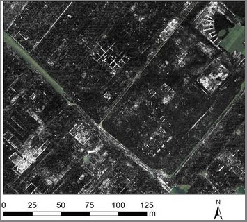
  • Ground penetrating radar (GPR) data acquired at two Roman Republican Cities in Lazio (Italy): Falerii Novi and Interamna Lirenas, between April 2015 and August 2017. The area surveyed was approximately 27 ha (Falerii Novi) and 23 ha (Interamna Lirenas). Data were collected with a pulse GPR and an RTK-GNSS instrument or robotic total station. The traverse separation was between 0.06 m and 0.12 m, the reading interval was approximately 0.05 m. The GPR data in the collection consist of raw and processed GPR profiles in SEG-Y format, as well as georeferenced time-slices (GeoTIFFs).
  • Lists of finds from:
    1. Excavations carried out by the Italian Soprintendenza at Falerii Novi (Fabrica di Roma, VT - Italy) in 1969-1975 and
    2. Systematic survey collection carried out by our team at Interamna Lirenas (Pignataro interamna, FR - Italy) in 2015-16.


ADS logo
Data Org logo
University of York logo