England's Historic Seascapes: HSC Method Consolidation
Cornwall Council, 2008. https://doi.org/10.5284/1000033. How to cite using this DOI
Data copyright © Historic England unless otherwise stated
This work is licensed under the ADS Terms of Use and Access.
Primary contact
Charlie
Johns
Cornwall Council
Kennall Building, Old County Hall
Station Road
Truro
TR1 3AY
UK
Tel: 01872 322056
Resource identifiers
- ADS Collection: 466
- ALSF Project Number: 5254
- DOI:https://doi.org/10.5284/1000033
- How to cite using this DOI
England's Historic Seascapes: HSC Method Consolidation
ALSF Project Number 5254
Cornwall County Council Historic Environment Service, 2008
Introduction
To finalise the development of a nationally-applicable method for characterising the historic dimension of England's coastal and marine environment, Historic Seascape Characterisation (HSC), Cornwall Historic Environment Service consolidated a national HSC methodology from the lessons and the experience gained during the five pilot projects of the England's Historic Seascapes Programme undertaken in 2004-07.

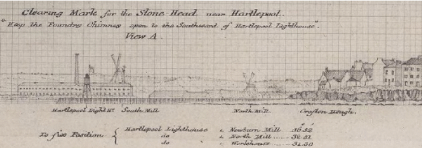
The 'view from sea'. Coast profile for guiding sailors safely into Hartlepool (© UKHO)
Funded by the Marine Aggregates Levy Sustainability Fund as distributed by English Heritage (EH), the method-consolidation was undertaken in close consultation with EH and other interested parties to ensure that the selected elements from the pilot methodologies function together in a practicable and fit-for-purpose manner to meet the needs of the method's anticipated end-users both within and beyond English Heritage. Detailed guidance on the content and implementation of the resulting methodology is provided in the project's 'National HSC Method Statement'.
Consolidation of this national HSC method substantially realises the Seascapes Programme's over-arching aim of seeking a robust method for extending the principles of historic landscape characterisation (HLC), already applied over 75% of England's land area, to England's coastal and marine zones and to the limits of UK Controlled Waters. As for HLC, a key role for this HSC methodology is expected to be the provision of effective, area-based, historic environment inputs to spatial planning, inter-operable with analogous natural environment inputs, of particular relevance given the forthcoming introduction of the system of marine spatial planning signalled by the Marine Bill White Paper, A Sea Change (Defra 2007).


