The Sutton Hoo Research Project 1983-2001
Martin Carver, 2004. https://doi.org/10.5284/1000266. How to cite using this DOI
Data copyright © Prof Martin Carver unless otherwise stated
This work is licensed under the ADS Terms of Use and Access.

Primary contact
Prof
Martin
Carver
Department of Archaeology
University of York
King's Manor
Exhibition Square
York
YO1 7EP
England
Resource identifiers
- ADS Collection: 404
- DOI:https://doi.org/10.5284/1000266
- How to cite using this DOI
Downloads
Site Atlas
(Details of the property rights relating to data accessible via this archive can be found on the Overview page)
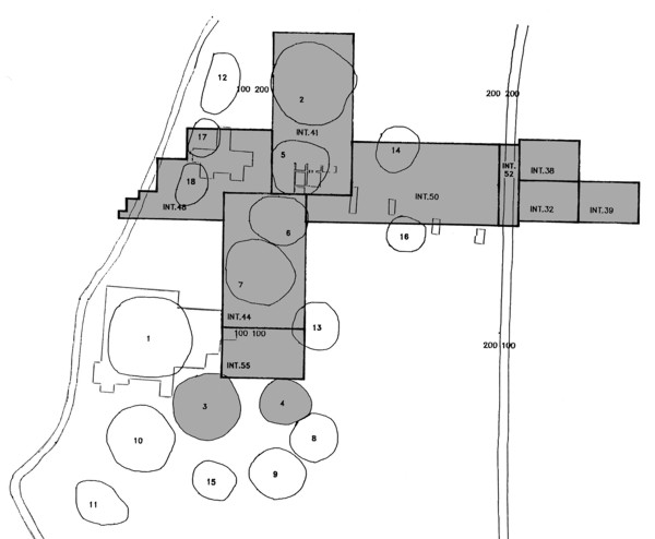
The Site Atlas is a diagrammatic map of the area excavated at Sutton Hoo showing the location of the mounds and of interventions made between 1983 and 1993. Detailed plans of mounds and interventions can be accessed by clicking on the site map at the appropriate location. The Detailed plans are working drawings, extracted from the field records and labelled by hand. These formed the basis for the summary plans that were published in the RESEARCH REPORT. Detailed plans are presented at their original scale but can be previewed at a reduced scale using the 'preview image' link. Please use your local software to reduce (to obtain an overview) or enlarge (to read labels) as required.
Alternatively you can view the full list of files by intervention.