
West Yorkshire Archaeological Service Geophysical Survey Archive
Archaeological Services WYAS, 2002. https://doi.org/10.5284/1000335. How to cite using this DOI
Data copyright © Archaeological Services WYAS unless otherwise stated
This work is licensed under the ADS Terms of Use and Access.

Primary contact
Ian
Sanderson
Archaeological Services WYAS
Nepshaw Lane South
Morley
Leeds
LS27 7JQ
UK
Tel: 01924 306798
Fax: 01924 306810
Resource identifiers
- ADS Collection: 320
- DOI:https://doi.org/10.5284/1000335
- How to cite using this DOI
Downloads
Vector Graphic files
Vector Graphic files for Royd Edge and Oldfield Hill Earthworks, Meltham, West Yorkshire (2000). The Figures and 1:500 Geophysical Data Plots for the survey are archived as AutoCAD 2000 files. Some of these contain embedded Ordnance Survey data and, for reasons of copyright, can not be made available for downloading. The figures are available as GIF files with the OS backdrop removed which should print at approximately the original size on a 300 dpi printer. The size of the original plots is included for guidance - note that many printers may be unable to plot these files at a 1:1 scale.
Files
|
Title: Figure 1. Site location Filename: gtr_fig1.gif (165 kB) Description: A4 portrait, colour |
GIF |
Info
Download |
|
|
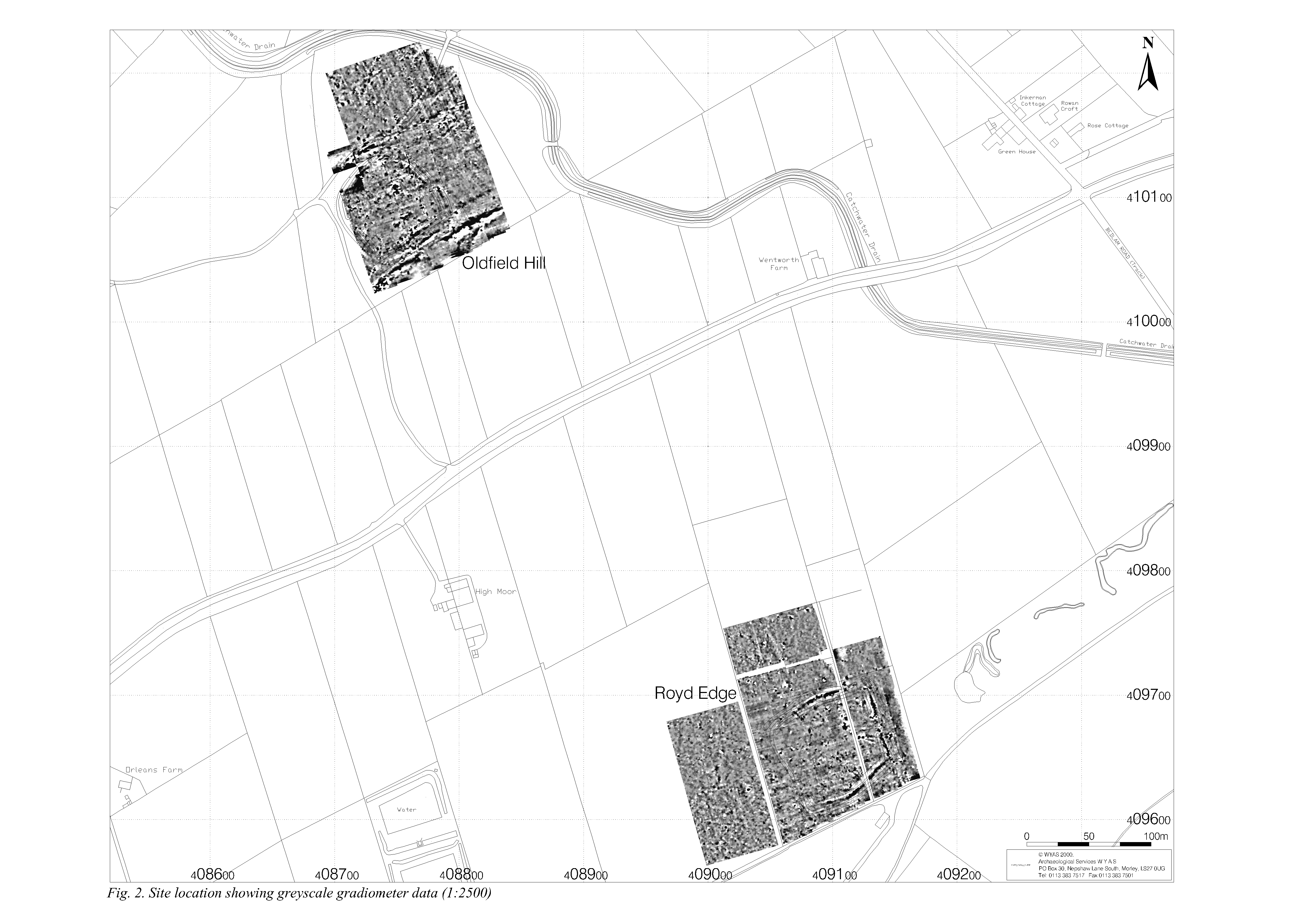
Title: Figure 2. Site location showing greyscale gradiometer data (1:2500) Filename: gtr_fig2.gif (595 kB) Description: A3 landscape |
GIF |
Info
Download |
|
|
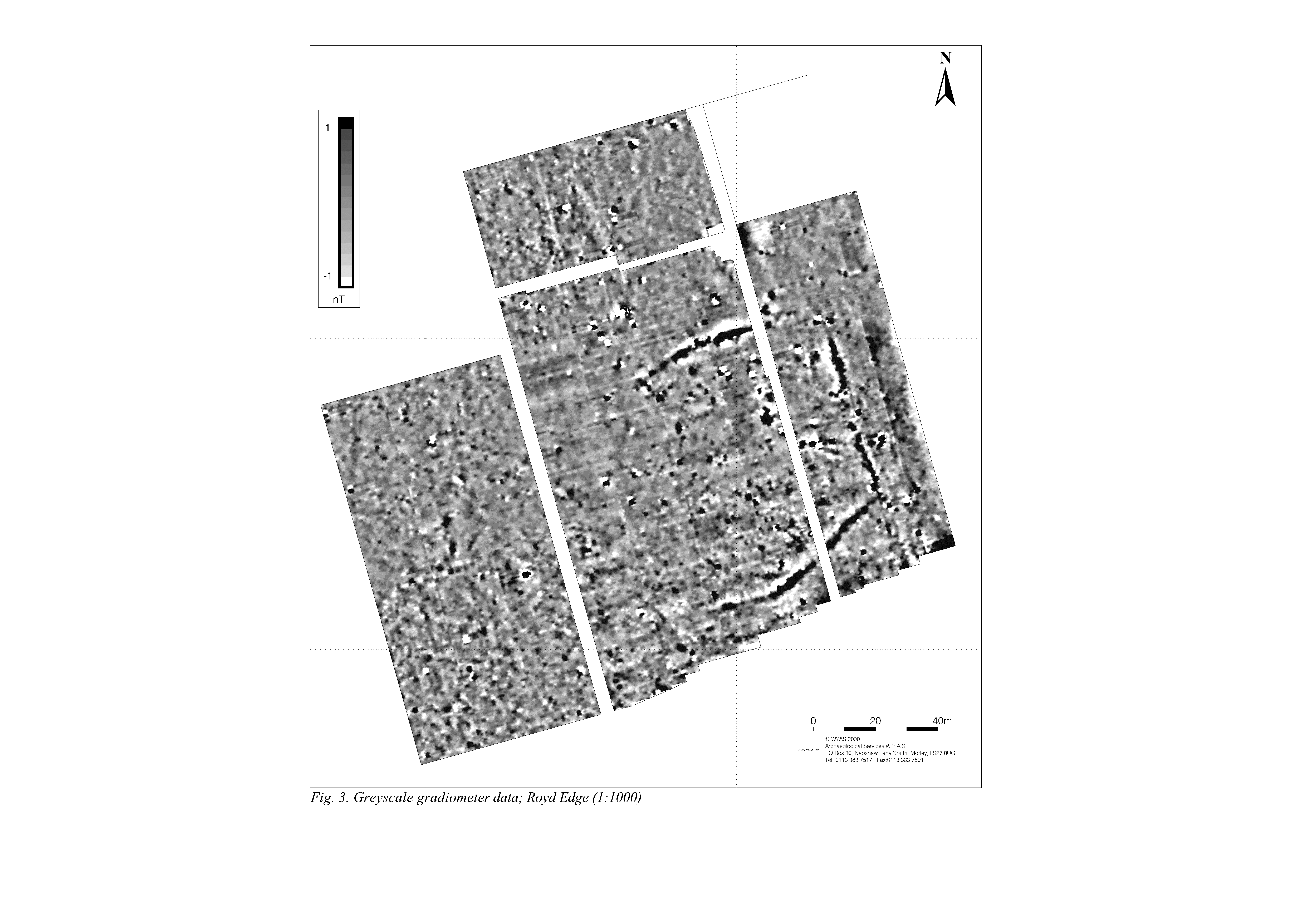
Title: Figure 3. Greyscale gradiometer data; Royd Edge (1:1000) Filename: gtr_grey-roydedge.gif (1 MB) Description: A3 landscape |
GIF |
Info
Download |
|
|
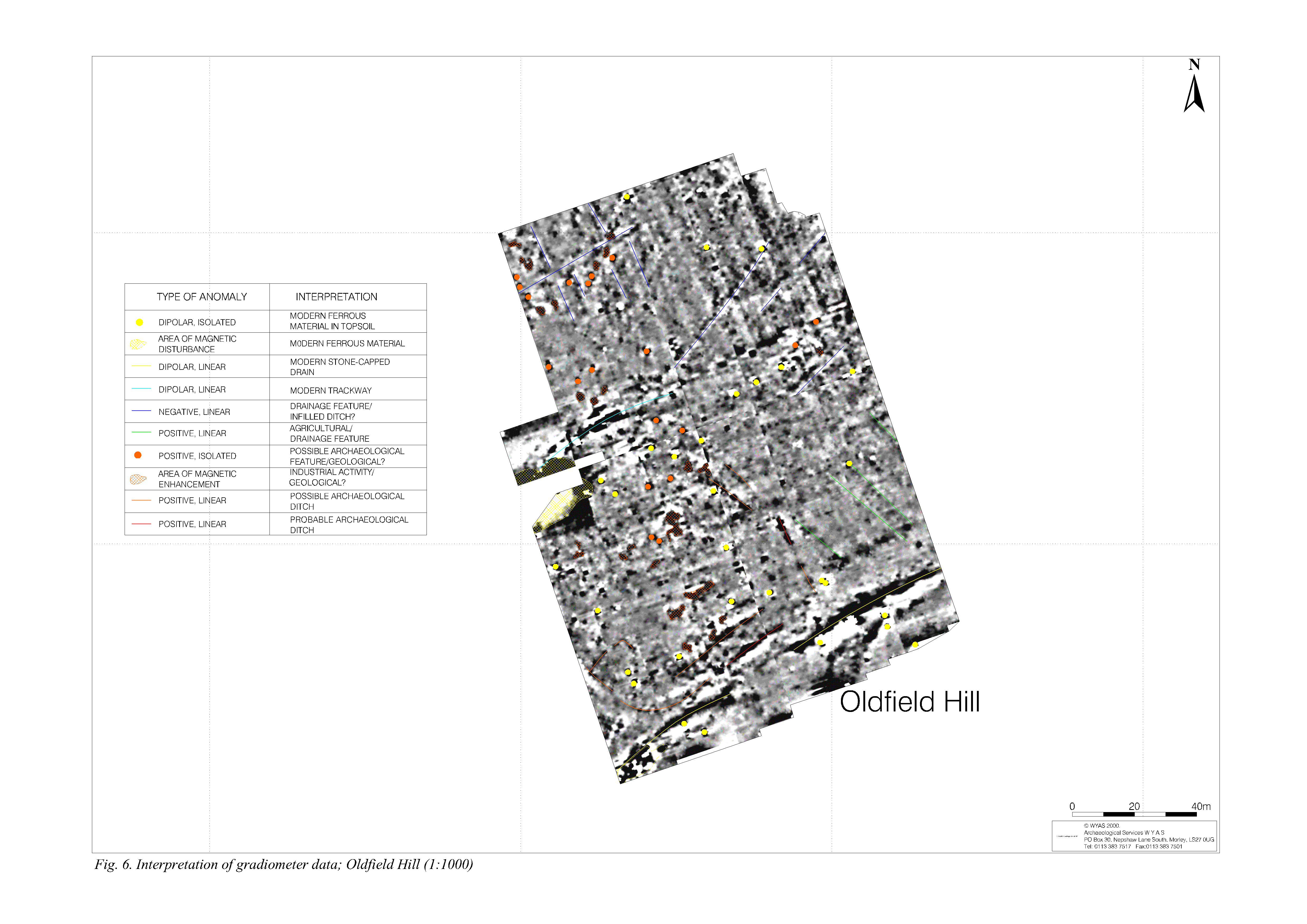
Title: Figure 4 and 6. Interpretation of gradiometer data; Royd Edge and Oldfield Hill (1:1000) Filename: gtr_int-oldfieldhill.gif (1 MB) Description: A3 landscape, colour |
GIF |
Info
Download |
|
|
Title: Figure 4. Interpretation of gradiometer data; Royd Edge (1:1000) Filename: gtr_int-roydedge.gif (1 MB) Description: A3 landscape, colour |
GIF |
Info
Download |
|
|
Title: Figure 5. Greyscale gradiometer data; Oldfield Hill (1:1000) Filename: gtr_grey-oldfieldhill.gif (1 MB) Description: A3 landscape |
GIF |
Info
Download |
|
|
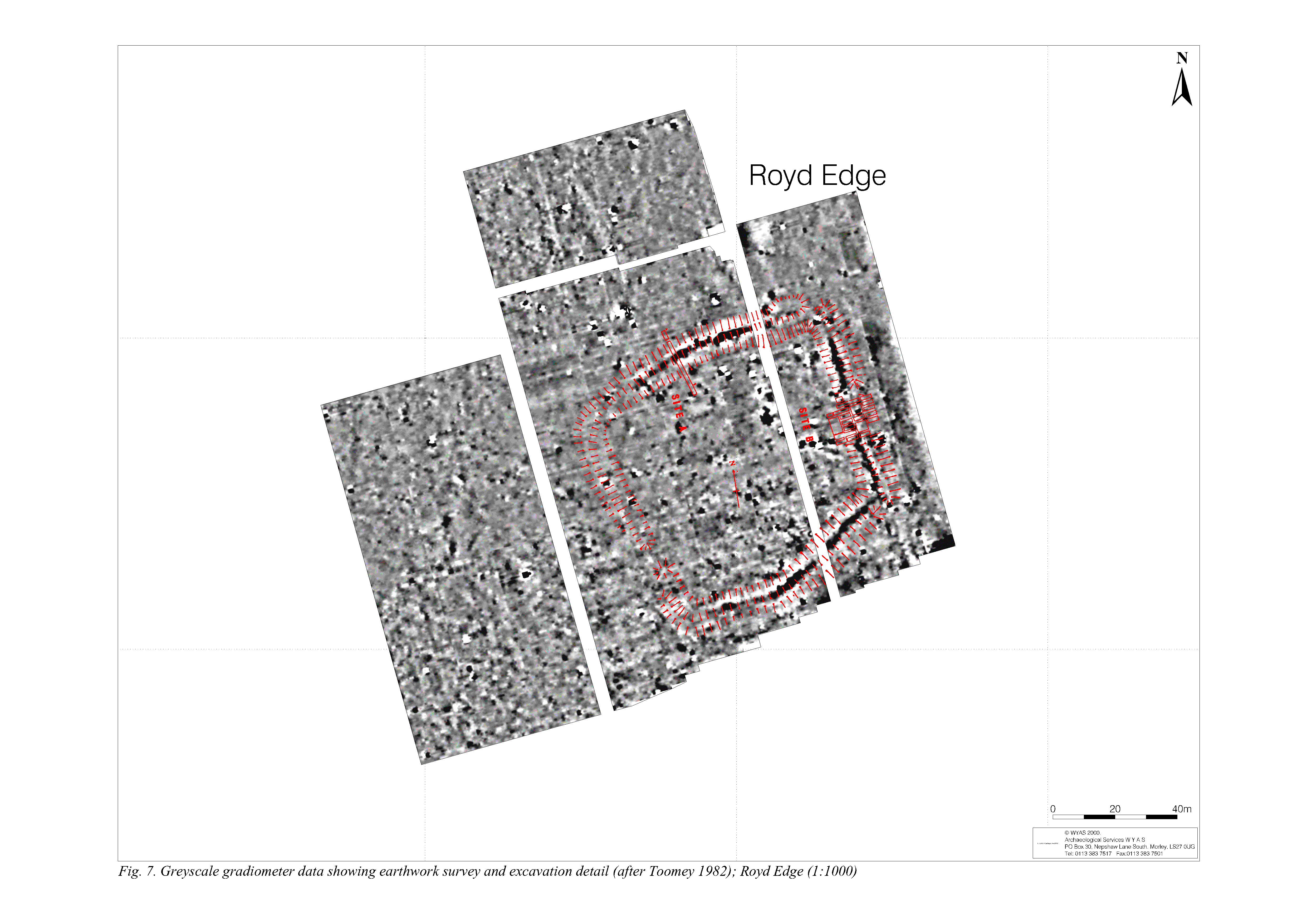
Title: Figure 7. Greyscale gradiometer data showing earthwork survey and excavation detail (after Toomey 1982); Royd Edge (1:1000) Filename: gtr_exc-roydedge.gif (1 MB) Description: A3 landscape, colour |
GIF |
Info
Download |
|
|
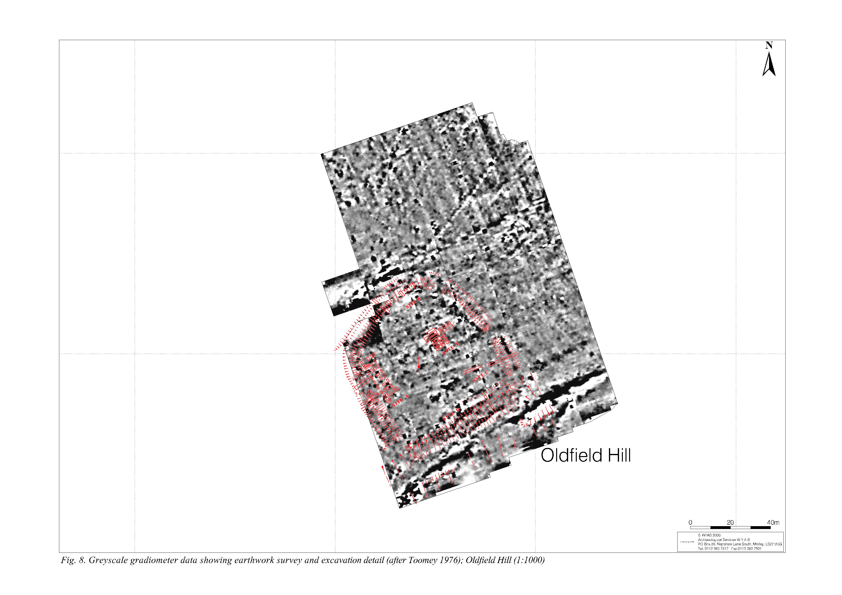
Title: Figure 8. Greyscale gradiometer data showing earthwork survey and excavation detail (after Toomey 1976); Oldfield Hill (1:1000) Filename: gtr_exc-oldfieldhill.gif (662 kB) Description: A3 landscape, colour |
GIF |
Info
Download |
|
